Fetlar
| Gaelic name | Unknown |
|---|---|
| Norse name | Fætilar[1] |
| Meaning of name | Unclear |
| Location | |
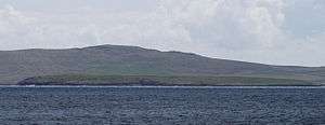
 Fetlar Fetlar shown within Shetland | |
| OS grid reference | HU620919 |
| Physical geography | |
| Island group | Shetland |
| Area | 4,078 hectares (15.75 sq mi) |
| Area rank | 25 [2] |
| Highest elevation | Vord Hill 158 metres (518 ft) |
| Administration | |
| Sovereign state | United Kingdom |
| Country | Scotland |
| Council area | Shetland Islands |
| Demographics | |
| Population | 61[3] |
| Population rank | 52 [2] |
| Pop. density | 1.5 people/km2[3][4] |
| Largest settlement | Houbie |
| References | [4][5] |

Fetlar is one of the North Isles of Shetland, Scotland, with a usually resident population of 61 at the time of the 2011 census.[3] Its main settlement is Houbie on the south coast, home to the Fetlar Interpretive Centre. Fetlar is the fourth largest island of Shetland and has an area of just over 4,000 hectares (15 sq mi).
History
One of the strange features of Fetlar is a huge wall that goes across the island known as the Funzie Girt or Finnigirt Dyke.[6] It is thought to date from the Mesolithic period. So sharp was the division between the two halves of the island, that the Norse talked of East and West Isle separately.[4]
Another attraction on the island is the Gothic Brough Lodge, built by Arthur Nicolson in about 1820, and which is undergoing restoration by the Brough Lodge Trust.[7] The Fetlar sheepdog trials take place annually, normally in July. The Fetlar Foy was once very popular with Shetlanders and tourists alike. It took place at midsummer on the Links at Tresta where folk were entertained with music, food and drink.[8]
Its most famous son was Sir William Watson Cheyne Bt FRS FRCS, a close associate of Lord Lister and one of the pioneers of antiseptics. He was professor of surgery at King's College London, President of the Royal College of Surgeons of England and wrote many books on medical treatments. He was made a baronet for services to medicine in 1908, was an MP first for the Universities of Edinburgh and St Andrews and then the Combined Scottish Universities in 1917 and 1918. He was Lord Lieutenant of the Shetland Islands from 1919 to 1930. Cheyne died on Fetlar on 19 April 1932.
Fishing and shipwrecks
Fetlar has a long tradition of fishing. According to Guinness World Records, in August 2012 what was then the oldest message in a bottle, released in June 1914, was found by Andrew Leaper, skipper of the Copious, coincidentally the same fishing vessel involved in a previous record recovery in 2006. The bottle, and Mr Leaper's World Record certificate, have been donated to the Fetlar Interpretative Centre.[9] Fetlar also has an international selection of shipwrecks including Danish, Dutch, German, English and Soviet vessels.[4]
Geography and geology
Fetlar has a very complex geology, including gneiss in the west, metamorphosed gabbro and phyllite, and kaolin. There is also antigorite and steatite here. Talc was mined here.[4]
Fetlar is surrounded by a number of small islands, particularly in the sound between it and Unst. These include to the north: Daaey; Haaf Gruney; Sound Gruney; Urie Lingey and Uyea and to the west: Hascosay and Linga
It is separated from Hascosay and Yell by Colgrave Sound. Much further to the south are the Out Skerries and Whalsay.
Etymology
There are three island names in Shetland of unknown and possibly pre-Celtic origin: Fetlar, Unst and Yell. The earliest recorded forms of these three names do carry Norse meanings: Fetlar is the plural of fetill and means "shoulder-straps" Omstr is "corn-stack" and í Ála is from ál meaning "deep furrow". However these descriptions are hardly obvious ones as island names and are probably adaptations of a pre-Norse language.[10][11] This may have been Pictish but there is no clear evidence for this.[12][13] Haswell-Smith suggests a meaning of "prosperous land"[4] and that the island's name may mean "two islands strapped together" by the Funzie Girt. It was recorded as "Fötilør" in 1490.[14]
Wildlife
Fetlar's wildlife is as varied as its geology. For example, over two hundred species of wild flower have been identified here.[4]
The northern part of Fetlar is a RSPB reserve, home to several important breeding species including Arctic skuas and whimbrels. The Lamb Hoga peninsula and nearby Haaf Gruney have some of the largest colonies of storm petrel.[4] Of greatest importance though are red-necked phalaropes, for which the Loch of Funzie is the most important breeding site in the United Kingdom, and for a while during the 1990s was the only breeding site in the country. A pair of snowy owls famously bred here in the 1960s and early 1970s,[15] they lasted until the 1980s but are no longer present. The island is known as "The Garden of Shetland," due to its highly fertile soil.[14]
Infrastructure
Ferries sail daily from Hamars Ness on Fetlar to Gutcher on Yell and Belmont on Unst. A new breakwater and berthing facility was added at Hamars Ness and was officially opened on 1 December 2012.[16]
There is a communications tower on Fetlar at: 60°36'5.39"N, 0°55'35.44"W. Fetlar is "Under Evaluation" for superfast broadband according to Digital Scotland.[17]
Community development
Fetlar Developments Ltd (FDL), a company limited by guarantee and a registered charity, was set up by the community to counter the depopulation of the island, which had fallen to just 48 in early 2009, when the 2001 total had been 86.[18] The development company continue to work towards securing a sustainable future for the island both socially and economically.
Work to install three wind turbines in a Community wind energy project began in December 2015.[19]
School
Currently there are 7 primary pupils and 2 nursery pupils at Fetlar primary school, situated at Baela near Houbie.[20]
Notes
- ↑ Anderson (1873) preface
- 1 2 Area and population ranks: there are c. 300 islands over 20 ha in extent and 93 permanently inhabited islands were listed in the 2011 census.
- 1 2 3 National Records of Scotland (15 August 2013) (pdf) Statistical Bulletin: 2011 Census: First Results on Population and Household Estimates for Scotland - Release 1C (Part Two). "Appendix 2: Population and households on Scotland’s inhabited islands". Retrieved 17 August 2013.
- 1 2 3 4 5 6 7 8 Haswell-Smith (2004) pp. 471-74
- ↑ Ordnance Survey. Get-a-map (Map). 1:25,000. Leisure. Ordinance Survey. Retrieved 21 August 2013.
- ↑ "Finnigirt Dyke" fetlar.com. Retrieved 1 May 2008
- ↑ "Brough Lodge Trust" fetlar.com. Retrieved 30 April 2008.
- ↑ "10th Anniversary Fetlar Foy" johnsmasfoy.com. Retrieved 2 June 2008.
- ↑ "World record as message in bottle found after 98 years near Shetland" BBC News. Retrieved 30 August 2012.
- ↑ Gammeltoft (2010) p. 17
- ↑ Gammeltoft (2010) pp. 19-20
- ↑ Gammeltoft (2010) p. 9
- ↑ "Norn" Shetlopedia. Retrieved 23 Jan 2011.
- 1 2 Haswell-Smith (2004) p. 473
- ↑ "Fetlar Museum" fetlar.com. Retrieved 1 May 2008.
- ↑ "New pier frees Fetlar to fish at last". stenews.co.uk. 3 December 2012. Retrieved 21 December 2015.
- ↑ http://www.digitalscotland.org/superfast-broadband/the-programme/
- ↑ General Register Office for Scotland (28 November 2003) Scotland's Census 2001 – Occasional Paper No 10: Statistics for Inhabited Islands. Retrieved 26 February 2012.
- ↑ "Fetlar Wind Ltd". Retrieved 21 December 2015.
- ↑ Fetlar Primary School. "News Page". Retrieved 28 November 2009.
References
- Anderson, Joseph (ed.) (1873) The Orkneyinga Saga. Translated by Jón A. Hjaltalin & Gilbert Goudie. Edinburgh. Edmonston and Douglas. The Internet Archive. Retrieved 26 August 2013.
- Haswell-Smith, Hamish (2004). The Scottish Islands. Edinburgh: Canongate. ISBN 978-1-84195-454-7.
- Gammeltoft, Peder (2010) "Shetland and Orkney Island-Names – A Dynamic Group". Northern Lights, Northern Words. Selected Papers from the FRLSU Conference, Kirkwall 2009, edited by Robert McColl Millar.
External links
| Inhabited islands | ||
|---|---|---|
| Other islands | ||
| Towns and villages | ||
| Points of interest |
| |
| Inhabited islands | ||
|---|---|---|
| Other islands | ||
| Towns and villages | ||
| Mainland Parishes | ||
| Maritime features | ||
Extreme points
| ||
| Topics | ||
|  | ||||||||||||||||||||||||||||
|
| |||||||||||||||||||||||||||||
| |||||||||||||||||||||||||||||
| |||||||||||||||||||||||||||||
| |||||||||||||||||||||||||||||
| |||||||||||||||||||||||||||||
| |||||||||||||||||||||||||||||
| |||||||||||||||||||||||||||||
Coordinates: 60°37′N 0°52′W / 60.617°N 0.867°W