Ferland-et-Boilleau, Quebec
| Ferland-et-Boilleau | |
|---|---|
| Municipality | |
|
Lake Ha!Ha! in Ferland-et-Boilleau | |
 | |
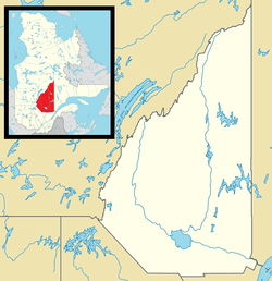 Ferland-et-Boilleau Location in Saguenay–Lac-Saint-Jean Quebec. | |
| Coordinates: 48°06′N 70°50′W / 48.100°N 70.833°WCoordinates: 48°06′N 70°50′W / 48.100°N 70.833°W[1] | |
| Country |
|
| Province |
|
| Region | Saguenay–Lac-Saint-Jean |
| RCM | Le Fjord-du-Saguenay |
| Constituted | January 1, 1978 |
| Government[2] | |
| • Mayor | Carmen Simard |
| • Federal riding | Chicoutimi—Le Fjord |
| • Prov. riding | Dubuc |
| Area[2][3] | |
| • Total | 407.30 km2 (157.26 sq mi) |
| • Land | 385.67 km2 (148.91 sq mi) |
| Population (2011)[3] | |
| • Total | 583 |
| • Density | 1.5/km2 (4/sq mi) |
| • Pop (2006–11) |
|
| • Dwellings | 283 |
| Time zone | EST (UTC−5) |
| • Summer (DST) | EDT (UTC−4) |
| Postal code(s) | G0V 1H0 |
| Area code(s) | 418 and 581 |
| Climate | Dfb |
| Website |
www |

Ferland-et-Boilleau is a municipality in the Canadian province of Quebec, located in Le Fjord-du-Saguenay Regional County Municipality. This municipality is located on Route 381 relatively near Saguenay.
Climate
| Climate data for Ferland-et-Boilleau | |||||||||||||
|---|---|---|---|---|---|---|---|---|---|---|---|---|---|
| Month | Jan | Feb | Mar | Apr | May | Jun | Jul | Aug | Sep | Oct | Nov | Dec | Year |
| Record high °C (°F) | 16 (61) |
15 (59) |
24 (75) |
28.5 (83.3) |
33.9 (93) |
37 (99) |
36 (97) |
35 (95) |
32.2 (90) |
26 (79) |
20.6 (69.1) |
14 (57) |
37 (99) |
| Average high °C (°F) | −9.7 (14.5) |
−7.2 (19) |
−0.1 (31.8) |
7.6 (45.7) |
16.5 (61.7) |
21.9 (71.4) |
24.2 (75.6) |
22.7 (72.9) |
16.8 (62.2) |
9.6 (49.3) |
1.7 (35.1) |
−5.9 (21.4) |
8.2 (46.8) |
| Daily mean °C (°F) | −17.3 (0.9) |
−14.7 (5.5) |
−7 (19) |
1.5 (34.7) |
9.3 (48.7) |
14.6 (58.3) |
17.2 (63) |
15.8 (60.4) |
10.6 (51.1) |
4.4 (39.9) |
−3.1 (26.4) |
−12.1 (10.2) |
1.6 (34.9) |
| Average low °C (°F) | −24.7 (−12.5) |
−22.1 (−7.8) |
−13.8 (7.2) |
−4.6 (23.7) |
2 (36) |
7.4 (45.3) |
10.2 (50.4) |
9 (48) |
4.3 (39.7) |
−0.9 (30.4) |
−7.9 (17.8) |
−18.4 (−1.1) |
−5 (23) |
| Record low °C (°F) | −46.7 (−52.1) |
−43.9 (−47) |
−38.5 (−37.3) |
−30.5 (−22.9) |
−11.1 (12) |
−5 (23) |
0 (32) |
−2 (28) |
−7.8 (18) |
−13.9 (7) |
−27.8 (−18) |
−42.5 (−44.5) |
−46.7 (−52.1) |
| Average precipitation mm (inches) | 52.8 (2.079) |
48.5 (1.909) |
46.7 (1.839) |
50.8 (2) |
83.7 (3.295) |
92.3 (3.634) |
109.2 (4.299) |
98.2 (3.866) |
89.9 (3.539) |
73.9 (2.909) |
72 (2.83) |
75.5 (2.972) |
893.5 (35.177) |
| Source: Environment Canada[4] | |||||||||||||
References
- ↑ Reference number 92774 of the Commission de toponymie du Québec (French)
- 1 2 Ministère des Affaires municipales, des Régions et de l'Occupation du territoire - Répertoire des municipalités: Ferland-et-Boilleau
- 1 2 "Ferland-et-Boilleau census profile". 2011 Census data. Statistics Canada. Retrieved 2010-10-26.
- ↑ Environment Canada Canadian Climate Normals 1971–2000, accessed 14 May 2010
External links
![]() Media related to Ferland-et-Boilleau at Wikimedia Commons
Media related to Ferland-et-Boilleau at Wikimedia Commons
 |
Saguenay | Saint-Félix-d'Otis | | |
| Lac-Ministuk | |
Rivière-Éternité Lalemant | ||
| ||||
| | ||||
| Lac-Pikauba |
This article is issued from Wikipedia - version of the 8/8/2016. The text is available under the Creative Commons Attribution/Share Alike but additional terms may apply for the media files.