Fengning Manchu Autonomous County
| Fengning County 丰宁县 ᡶᡝᠩᠨᡳᠩ ᠰᡳᠶᠠᠨ | |
|---|---|
| Autonomous county | |
丰宁满族自治县 ᡶᡝᠩᠨᡳᠩ ᠮᠠᠨᠵᡠ ᠪᡝᠶᡝ ᡩᠠᠰᠠᠩᡤᠠ ᠰᡳᠶᠠᠨ | |
|
The former temporary palace of Genghis Khan on north grassland of the county. | |
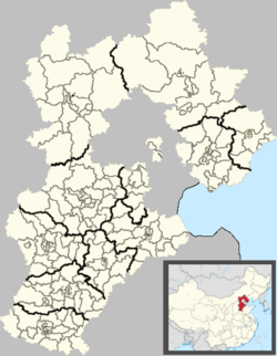 Fengning Location in Hebei | |
| Coordinates: 41°12′N 116°39′E / 41.200°N 116.650°ECoordinates: 41°12′N 116°39′E / 41.200°N 116.650°E | |
| Country | People's Republic of China |
| Province | Hebei |
| Prefecture-level city | Chengde |
| Township-level divisions |
9 towns 16 townships 1 ethnic township |
| County seat | Dage (大阁镇) |
| Area | |
| • Total | 8,765 km2 (3,384 sq mi) |
| Elevation | 662 m (2,172 ft) |
| Population (2004) | |
| • Total | 380,000 |
| • Density | 43/km2 (110/sq mi) |
| Time zone | China StandardChina Standard (UTC+8+8) |
| Postal code | 068300 |
| Area code(s) | 0314 |
| Website |
fn |

Fengning Manchu Autonomous County (simplified Chinese: 丰宁满族自治县; traditional Chinese: 豐寧滿族自治縣; pinyin: Fēngníng Mǎnzú Zìzhìxiàn; Manchu: ᡶᡝᠩᠨᡳᠩ ᠮᠠᠨᠵᡠ ᠪᡝᠶᡝ ᡩᠠᠰᠠᠩᡤᠠ ᠰᡳᠶᠠᠨ) is a Manchu autonomous county of northern Hebei province, bordering Beijing to the southwest and Inner Mongolia to the north, and lying under the administration of Chengde City. As of 2004, it had a population of 380,000 residing in an area of 8,765 square kilometres (3,384 sq mi), making it the second-largest county of Hebei in terms of area, after the neighbouring Weichang Manchu and Mongol Autonomous County.
Here, fossil-bearing rocks of the Mesozoic Huajiying Formation and/or Yixian Formation occur on the surface. The prehistoric bird Paraprotopteryx was found in such a deposit.
Administrative divisions
The county has 9 towns, 16 townships, and one ethnic township under its administration.:[1]
|
Towns:
|
Townships:
|
Climate
Fengning has a rather dry, monsoon-influenced humid continental climate (Köppen Dwa), with long, very cold and dry winters, and hot, humid summers, and the elevation depresses temperatures. The monthly 24-hour mean temperature in January is −11.2 °C (11.8 °F), and in July it is 22.4 °C (72.3 °F), while the annual mean is 6.83 °C (44.3 °F). More than half of the annual precipitation occurs in July and August alone.
| Climate data for Fengning County (1971−2000) | |||||||||||||
|---|---|---|---|---|---|---|---|---|---|---|---|---|---|
| Month | Jan | Feb | Mar | Apr | May | Jun | Jul | Aug | Sep | Oct | Nov | Dec | Year |
| Record high °C (°F) | 9.2 (48.6) |
17.8 (64) |
22.4 (72.3) |
32.6 (90.7) |
35.9 (96.6) |
37.6 (99.7) |
40.5 (104.9) |
36.8 (98.2) |
33.4 (92.1) |
26.2 (79.2) |
19.8 (67.6) |
13.7 (56.7) |
40.5 (104.9) |
| Average high °C (°F) | −3 (27) |
0.7 (33.3) |
7.6 (45.7) |
17.0 (62.6) |
23.5 (74.3) |
27.1 (80.8) |
28.2 (82.8) |
26.8 (80.2) |
22.3 (72.1) |
15.6 (60.1) |
5.7 (42.3) |
−1.1 (30) |
14.2 (57.6) |
| Daily mean °C (°F) | −11.2 (11.8) |
−7.3 (18.9) |
0.1 (32.2) |
9.3 (48.7) |
16.1 (61) |
20.4 (68.7) |
22.4 (72.3) |
20.6 (69.1) |
14.7 (58.5) |
7.6 (45.7) |
−1.8 (28.8) |
−8.9 (16) |
6.8 (44.2) |
| Average low °C (°F) | −17.5 (0.5) |
−14.2 (6.4) |
−7.2 (19) |
1.2 (34.2) |
8.2 (46.8) |
13.5 (56.3) |
17.1 (62.8) |
15.2 (59.4) |
8.0 (46.4) |
0.9 (33.6) |
−7.7 (18.1) |
−14.9 (5.2) |
0.2 (32.4) |
| Record low °C (°F) | −27.4 (−17.3) |
−28.5 (−19.3) |
−26 (−15) |
−11.9 (10.6) |
−3.7 (25.3) |
4.0 (39.2) |
8.8 (47.8) |
0.5 (32.9) |
−3.3 (26.1) |
−10.5 (13.1) |
−23.6 (−10.5) |
−26.8 (−16.2) |
−28.5 (−19.3) |
| Average precipitation mm (inches) | 1.5 (0.059) |
3.7 (0.146) |
6.4 (0.252) |
15.6 (0.614) |
36.8 (1.449) |
72.5 (2.854) |
134.2 (5.283) |
108.3 (4.264) |
51.8 (2.039) |
18.8 (0.74) |
5.8 (0.228) |
1.6 (0.063) |
457.0 (17.992) |
| Average precipitation days (≥ 0.1 mm) | 1.2 | 2.3 | 3.6 | 4.6 | 8.0 | 11.7 | 15.1 | 13.2 | 8.9 | 4.8 | 2.1 | 1.1 | 76.6 |
| Source: Weather China | |||||||||||||
Transport
Both China National Highway 111 and 112 pass through the county, with the former providing direct access to Beijing.
References
- ↑ 2011年统计用区划代码和城乡划分代码:丰宁满族自治县 (in Chinese). National Bureau of Statistics of the People's Republic of China. Retrieved 2012-12-26.
External links
| Counties |
|    | ||||||||||
|---|---|---|---|---|---|---|---|---|---|---|---|---|
Ethnic minority autonomous areas: Dong · Hui · Korean · Manchu · Miao · Mongol · Tibetan · Tujia · Uyghur · Yao · Yi · Zhuang · Other | ||||||||||||