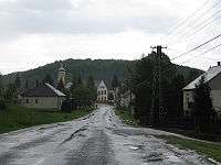
Felsőszölnök
| Felsőszölnök Gornji Senik · Oberzemming | |
|---|---|
 Felsőszölnök Location of Felsőszölnök | |
| Coordinates: 46°52′14″N 16°09′35″E / 46.87059°N 16.15973°ECoordinates: 46°52′14″N 16°09′35″E / 46.87059°N 16.15973°E | |
| Country |
|
| County | Vas |
| Area | |
| • Total | 23.56 km2 (9.10 sq mi) |
| Population (2004) | |
| • Total | 683 |
| • Density | 29/km2 (80/sq mi) |
| Time zone | CET (UTC+1) |
| • Summer (DST) | CEST (UTC+2) |
| Postal code | 9985 |
| Area code(s) | 94 |
Felsőszölnök
Felsőszölnök (Slovene: Gornji Senik, German: Oberzemming. Latin: Zelnuk Superior) is a village in Vas County, Hungary. It is the westernmost point of Hungary, and lies on the borders with Slovenia and Austria.
Location
The nearest settlements are Oberdrosen in Jennersdorf, Burgenland to the northwest, and Neradnovci in the Municipality of Gornji Petrovci, Slovenia to the south.
Culture
The Alliance of Hungarian Slovenes has its seat in Felsőszölnök, there is a preschool with education in Slovene, and Slovene is taught in the primary school.[1]
The Martinje-Felsőszölnök border crossing between Hungary and Slovenia was opened in 1992, resulting in more frequent contacts between the districts in the neighbouring countries.[2]
Twin cities
.jpg)
People
- András Horváth worked in Felsőszölnök.
- József Kossics died in Felsőszölnök.
References
- ↑ "The Slovenes of Vas County". LOGO. Retrieved 2009-04-21.
- ↑ Hirnök, Katalin Munda (July 2003). "Slovenes in the Raba Region in Hungary". Slovene Ethnic Minorities - Hungary. Government Communication Office. Retrieved 2013-06-24.
External links
| Wikimedia Commons has media related to Felsőszölnök. |
- Felsőszölnök (in Hungarian)
This article is issued from Wikipedia - version of the 11/9/2016. The text is available under the Creative Commons Attribution/Share Alike but additional terms may apply for the media files.