Fairoaks Airport
| Fairoaks Airport | |||||||||||
|---|---|---|---|---|---|---|---|---|---|---|---|
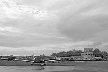 Fairoaks Control Tower in 2006 | |||||||||||
| IATA: none – ICAO: EGTF | |||||||||||
| Summary | |||||||||||
| Airport type | Private-owned, Public-use | ||||||||||
| Owner | Albermarle Fairoaks Airport Ltd. | ||||||||||
| Operator | Fairoaks Operations Ltd. | ||||||||||
| Serves | Woking | ||||||||||
| Location | Chobham, Surrey | ||||||||||
| Elevation AMSL | 80 ft / 24 m | ||||||||||
| Coordinates | 51°20′53″N 000°33′31″W / 51.34806°N 0.55861°WCoordinates: 51°20′53″N 000°33′31″W / 51.34806°N 0.55861°W | ||||||||||
| Map | |||||||||||
 EGTF Location in Surrey | |||||||||||
| Runways | |||||||||||
| |||||||||||
Fairoaks Airport (ICAO: EGTF) is an operational general aviation airport by the A319 between Chobham and Ottershaw in Surrey, England. It is 2 NM (3.7 km; 2.3 mi) north of the major town of Woking and for passengers is 2.8 miles (4.5 km) from Junction 11 of the M25 motorway which is between the M3 and A3 junctions.
The airport is operated by Fairoaks Operations Ltd, owned by Albermarle Fairoaks Airport Ltd.
Fairoaks Aerodrome has a CAA Ordinary Licence (number P560) that allows flights for the public transport of passengers or for flying instruction as authorised by the licensee (Fairoaks Operations Ltd).[4]
The facility is used as by light aircraft, some of which are operated by its two resident training schools - Synergy Aviation [5] and London Transport Flying Club,[6] and as a maintenance airfield. Its business centre is substantially dedicated to aviation-related enterprises, including the headquarters of the European Regions Airline Association and the British Helicopter Advisory Board.
Fairoaks is equipped with navigational aids: coverage is provided by local beacons at Ockham, Midhurst and London Heathrow. There is a small on-site fire and rescue service, comprising two 4WD rescue vehicles.
From 1994 until 2009 one of three South East Regional Air Support Unit (Metropolitan and Surrey Police Forces) helicopters (and for a period of this time one for the latter force alone) were at Fairoaks. In June 2009, the remaining police helicopter was transferred to RAF Odiham in Hampshire on security grounds.[7]
There are no restrictions on the number of helicopter movements, although there is a ban on training with the Robinson R22.[3] Fixed wing movements are limited to 120,000 per annum.
History
Fairoaks opened as a private airstrip in 1931, but was signed up for military use in 1936 and became RAF Fairoaks during World War II. It was used as a training airfield, with No. 18 Elementary & Reserve Flying School being formed on 1 October 1937 equipped with De Havilland Tiger Moths. 6,000 pilots were trained at the airfield, mostly in Tiger Moths. The unit was re-designated No. 18 Reserve Flying School on 14 May 1947 and was managed by Universal Flying Services. The Tiger Moths were replaced by De Havilland Canada Chipmunks in 1951 but the school was disbanded on 31 July 1953.[8]
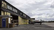
In the early postwar years, the airfield was managed by Universal Flying Services, which operated a flying training school and provided aircraft maintenance services. The airfield was sold by auction in 1967. Alan Mann Helicopters began operations there in 1968 after which The Alan Mann Group became the operator. The hard runway was constructed in 1979. The Alan Mann Group sold its interests in 2008 to Albermarle Fairoaks Airport Ltd which owns Fairoaks Operations Ltd, the operator. The landside buildings were owned by West Register Property until they sold their interest on the 8th December 2015 to TEREF ADP Fairoaks Limited, a company registered in Jersey number 120101 which was formed on the 27th November 2015.[9]
On 25th November 2016 the airport owners announced plans to close the airport, and build a 1500 unit housing development to be known as "Fairoaks Garden Village". [10]
Flying information
Lat N51 20.88
Long W000 33.52
VHF 123.42 AFIS "Fairoaks Information", A/G "Fairoaks Radio"
NDB 348.0 'FOS' (on aerodrome)
DME 109.85 'FRK' (on aerodrome)
VORs: 'OCK' 115.3 bearing 304 4.9 nm; 'LON' 113.60 bearing 205 9.0 nm[2]
A majority of the Fairoaks Aerodrome Traffic Zone (ATZ) is within the London Control Zone (CTR), therefore special procedures are in place to enable flights to depart and arrive at Fairoaks without the need to contact Heathrow Radar.[11]
NOTE: All circuit joins must be made from the south, usually overhead the Ockham Visual Reporting Point. This can require pilots to cross the airfield first, if arriving from the north.
References
- ↑ "Fairoaks - EGTF". NATS Holdings.
- 1 2 Pooley's Flight Guide. 2011. pp. 276–277.
- 1 2 Bloom, Nick (May 2011). "Sleeping beauty". Pilot: 44.
- ↑ "Ordinary licences and boundary maps (F to J)". UK Civil Aviation Authority. Retrieved 20 November 2016.
- ↑ "Synergy Aviation". synergyaviation.com.
- ↑ "London Transport Flying Club". ltfc.org.uk.
- ↑ "Surrey police helicopter may be scrapped". BBC News. 26 May 2010. Retrieved 20 November 2016.
- ↑ Sturtivant (1997), p. 263.
- ↑ "Fairoaks Airport". fairoaksairport.com.
- ↑ http://www.getsurrey.co.uk/news/surrey-news/fairoaks-garden-village-plans-revealed-12229687
- ↑ "Fairoaks Airport Pilots' Information" (PDF). Fly Synergy. 17 September 2011. Retrieved 20 November 2016.
Bibliography
- Sturtivant, R. C. (1997). Royal Air Force Flying Training and Support Units. Air-Britain (Historians) Ltd. ISBN 0-85130-252-1.
External links
| Wikimedia Commons has media related to Fairoaks Airport. |
- "Aerodrome chart in the Civil Aviation Authority UK AIP" (PDF). European AIS Database.