Fairfield East
| Fairfield East Sydney, New South Wales | |||||||||||||
|---|---|---|---|---|---|---|---|---|---|---|---|---|---|
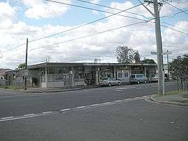 Shops in Tangerine Street | |||||||||||||
| Population | 5,074 (2011 census)[1] | ||||||||||||
| Established | 1876 | ||||||||||||
| Postcode(s) | 2165 | ||||||||||||
| Location | 28 km (17 mi) west of Sydney CBD | ||||||||||||
| LGA(s) | City of Fairfield | ||||||||||||
| State electorate(s) | Fairfield | ||||||||||||
| Federal Division(s) | Fowler | ||||||||||||
| |||||||||||||
Fairfield East is a suburb of Sydney, in the state of New South Wales, Australia. Fairfield East is located 28 kilometres (17 mi) west of the Sydney central business district in the local government area of the City of Fairfield. Fairfield East is part of the Greater Western Sydney region.
Fairfield East shares the postcode of 2165 with nearby suburbs of Fairfield, Fairfield Heights and Fairfield West.
History
Fairfield East gets its name from its neighbour Fairfield which in turn was named after the family estate of Captain John Horsley, an early settler. Prior to colonisation, the Cabrogal clan of the Dharug people inhabited the area around what is now known as Fairfield East. British settlers moved into the area in the early 19th century and used the land for farming.[2]
By the 1870s, the area now known as Fairfield East was part of two large properties: Orchardleigh in the north which extended towards Guildford and Mark Lodge in the south which also included Villawood, Carramar and parts of the Fairfield town centre.[3]
In 1876, Orchardleigh was subdivided for housing and when Mark Lodge followed suit in 1885, the area completed its transformation from farmland to suburbia. The name Mark Lodge was still used in the area for some time after although by the 1950s it had officially become Fairfield East.
Population
According to the 2011 census, Fairfield East had a population of 5,074 people, including a substantial Vietnamese community with 18.7% of residents born in Vietnam and 24.6% speaking Vietnamese. The majority of people were born outside of Australia, and after Vietnam, the next most common countries of birth were Iraq, China and Lebanon. Almost a quarter of the population were Buddhists, just behind Catholicism as the leading religion in the suburb. The most common occupations were technicians and tradespeople (16.6%), labourers (16.1%) and professionals (14.8%). Speaking languages other than English was common with just 22.1% of people speaking English only at home. Other languages spoken at home included Vietnamese 24.6%, Arabic 14.8%, Cantonese 6.0%, Mandarin 3.6% and Spanish 3.2%.[1]
References
- 1 2 Australian Bureau of Statistics (31 October 2012). "Fairfield East (State Suburb)". 2011 Census QuickStats. Retrieved 4 May 2013.
- ↑ "Fairfield". Fairfield City Council. Retrieved 2008-08-29.
- ↑ "Fairfield East". Fairfield City Council. Retrieved 2008-08-29.
Coordinates: 33°52′18″S 150°58′24″E / 33.87177°S 150.97346°E