Fairburn, South Dakota
| Fairburn, South Dakota | |
|---|---|
| Town | |
 Location in Custer County and the state of South Dakota | |
| Coordinates: 43°41′12″N 103°12′39″W / 43.68667°N 103.21083°WCoordinates: 43°41′12″N 103°12′39″W / 43.68667°N 103.21083°W | |
| Country | United States |
| State | South Dakota |
| County | Custer |
| Incorporated | 1919[1] |
| Area[2] | |
| • Total | 0.33 sq mi (0.85 km2) |
| • Land | 0.33 sq mi (0.85 km2) |
| • Water | 0 sq mi (0 km2) |
| Elevation | 3,301 ft (1,006 m) |
| Population (2010)[3] | |
| • Total | 85 |
| • Estimate (2012[4]) | 85 |
| • Density | 257.6/sq mi (99.5/km2) |
| Time zone | MST (UTC-7) |
| • Summer (DST) | MDT (UTC-6) |
| Zip Code | 57738 |
| Area code(s) | 605 |
| FIPS code | 46-20340[5] |
| GNIS feature ID | 1261656[6] |
Fairburn (/ˈfɛrˌbɜ:rn/) is a town in Custer County, South Dakota, United States. The population was 85 at the 2010 census.
History
Fairburn was platted in 1886.[7] The town was named from its location on a stream, burn being a Scottish word meaning "creek".[7] A post office has been in operation in Fairburn since 1887.[8]
Geography
Fairburn is located at 43°41′12″N 103°12′39″W / 43.68667°N 103.21083°W (43.686613, -103.210797).[9]
According to the United States Census Bureau, the town has a total area of 0.33 square miles (0.85 km2), all of it land.[2]
Fairburn has been assigned the ZIP code 57738.
Demographics
| Historical population | |||
|---|---|---|---|
| Census | Pop. | %± | |
| 1930 | 91 | — | |
| 1940 | 120 | 31.9% | |
| 1950 | 80 | −33.3% | |
| 1960 | 47 | −41.2% | |
| 1970 | 50 | 6.4% | |
| 1980 | 41 | −18.0% | |
| 1990 | 62 | 51.2% | |
| 2000 | 80 | 29.0% | |
| 2010 | 85 | 6.3% | |
| Est. 2015 | 82 | [10] | −3.5% |
2010 census
As of the census[3] of 2010, there were 85 people, 39 households, and 23 families residing in the town. The population density was 257.6 inhabitants per square mile (99.5/km2). There were 47 housing units at an average density of 142.4 per square mile (55.0/km2). The racial makeup of the town was 91.8% White, 2.4% African American, 1.2% Native American, and 4.7% from two or more races. Hispanic or Latino of any race were 1.2% of the population.
There were 39 households of which 20.5% had children under the age of 18 living with them, 48.7% were married couples living together, 5.1% had a female householder with no husband present, 5.1% had a male householder with no wife present, and 41.0% were non-families. 33.3% of all households were made up of individuals and 5.1% had someone living alone who was 65 years of age or older. The average household size was 2.18 and the average family size was 2.87.
The median age in the town was 45.1 years. 23.5% of residents were under the age of 18; 5.9% were between the ages of 18 and 24; 20% were from 25 to 44; 36.5% were from 45 to 64; and 14.1% were 65 years of age or older. The gender makeup of the town was 50.6% male and 49.4% female.
2000 census
As of the census[5] of 2000, there were 80 people, 34 households, and 22 families residing in the town. The population density was 242.9 people per square mile (93.6/km²). There were 41 housing units at an average density of 124.5 per square mile (48.0/km²). The racial makeup of the town was 98.75% White and 1.25% African American.
There were 34 households out of which 32.4% had children under the age of 18 living with them, 55.9% were married couples living together, 5.9% had a female householder with no husband present, and 32.4% were non-families. 29.4% of all households were made up of individuals and 17.6% had someone living alone who was 65 years of age or older. The average household size was 2.35 and the average family size was 2.96.
In the town the population was spread out with 23.8% under the age of 18, 7.5% from 18 to 24, 28.8% from 25 to 44, 22.5% from 45 to 64, and 17.5% who were 65 years of age or older. The median age was 39 years. For every 100 females there were 116.2 males. For every 100 females age 18 and over, there were 117.9 males.
The median income for a household in the town was $23,750, and the median income for a family was $33,125. Males had a median income of $23,125 versus $33,750 for females. The per capita income for the town was $20,832. There were 9.5% of families and 10.0% of the population living below the poverty line, including no under eighteens and none of those over 64.
References
- ↑ "SD Towns" (PDF). South Dakota State Historical Society. Retrieved 2010-02-12.
- 1 2 "US Gazetteer files 2010". United States Census Bureau. Retrieved 2012-06-21.
- 1 2 "American FactFinder". United States Census Bureau. Retrieved 2012-06-21.
- ↑ "Population Estimates". United States Census Bureau. Retrieved 2013-05-29.
- 1 2 "American FactFinder". United States Census Bureau. Retrieved 2008-01-31.
- ↑ "US Board on Geographic Names". United States Geological Survey. 2007-10-25. Retrieved 2008-01-31.
- 1 2 Chicago and North Western Railway Company (1908). A History of the Origin of the Place Names Connected with the Chicago & North Western and Chicago, St. Paul, Minneapolis & Omaha Railways. p. 70.
- ↑ "Custer County". Jim Forte Postal History. Retrieved 17 March 2015.
- ↑ "US Gazetteer files: 2010, 2000, and 1990". United States Census Bureau. 2011-02-12. Retrieved 2011-04-23.
- ↑ "Annual Estimates of the Resident Population for Incorporated Places: April 1, 2010 to July 1, 2015". Retrieved July 2, 2016.
- ↑ "Census of Population and Housing". Census.gov. Retrieved June 4, 2015.
Municipalities and communities of Custer County, South Dakota, United States | ||
|---|---|---|
| City | 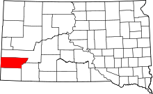 | |
| Towns | ||
| Unincorporated communities | ||
| Ghost towns | ||