Excelsior District, San Francisco
Coordinates: 37°43′14″N 122°25′58″W / 37.72058°N 122.43276°W
| Excelsior District | |
|---|---|
| Neighborhood of San Francisco | |
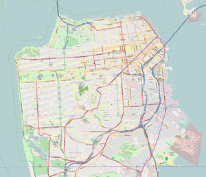 Excelsior District Location within San Francisco | |
| Coordinates: 37°43′14″N 122°25′58″W / 37.72058°N 122.43276°W | |
| Government | |
| • Supervisor | John Avalos |
| • Assemblymember | Phil Ting (D)[1] |
| • State Senator | Scott Wiener (D)[1] |
| • United States Representatives | Nancy Pelosi (D)[2] and Jackie Speier (D)[2] |
| Area[3] | |
| • Total | 3.50 km2 (1.350 sq mi) |
| • Land | 3.50 km2 (1.350 sq mi) |
| Population (2008) | |
| • Total | 23,823 |
| • Density | 6,810/km2 (17,640/sq mi) |
| [3] | |
| ZIP Code | 94112, 94134 |
| Area codes | 415/628 |
The Excelsior District is a neighborhood in San Francisco, California.
Location
The Excelsior District is located along Mission Street, east of San Jose Ave, south of Interstate 280 Southern Fwy, west of John McLaren Park, and somewhat north of Geneva Avenue.
Neighborhoods within the Excelsior District include the Excelsior Neighborhood itself, Mission Terrace, Outer Mission neighborhood, Portola, & Crocker Amazon.
History
On April 15, 1869, the Excelsior Homestead was filed at city hall. The record is in books “C” and “D” and in the book of city maps on page 129. This map section showing the area called the Excelsior can be found in Bancroft's Official Guide Map of City and County of San Francisco.[4] This map indicates that the Excelsior area was previously part of the Rancho Rincon de las Salinas y Potrero Viejo.[5]
Rancho Rincon de las Salinas y Potrero Viejo later became known as Southern San Francisco on city maps, not to be confused with the town of South San Francisco. The Southern San Francisco area referred to everything south and central along with the eastern bent of Mission Street and District. The neighborhood extends to its end at the county line. Over the years, as the southern end of San Francisco was developed, the city created Major neighborhoods & Districts within the area, and these were given names that appeared on city maps. These are: Bernal Heights, Ingleside, The Excelsior District, Visitacion Valley & The Bay View District. As the city grew, The Excelsior District was developed further, and it was split into even smaller sub-neighborhoods useful for Real Estate. Some of these given names are: the Excelsior neighborhood itself, Mission Terrace, the Outer Mission neighborhood, Portola, and Crocker Amazon. Despite this division into smaller sub-neighborhoods, most of these areas are still referred to as being the Excelsior District today.
Many of the area's streets, those named for the capitals of countries, and its avenues, those that are named for the countries themselves, were done so by Emanuel Lewis and his daughter Jeannette. Emanuel built 200 houses which sold as a result of the 1906 earthquake. On the west side of the district, which is also known as the Mission Terrace, many of the streets were named after American Indian tribes (Mohawk Ave became Seneca Ave for example), and Onondaga, Navajo, Modoc, Ottawa, Oneida, Seminole, and Cayuga are named among the rest. It is evident that many names have been retained, and from the various neighborhoods' inceptions, while some have changed to accommodate changes in political climate. As an example, Excelsior Avenue itself was originally named "China". Due to anti-Asian feelings that led to the Chinese Exclusion Act of 1882, India, Japan and China Streets were changed to Peru, Avalon, and Excelsior Streets.[6]
In the 1980s, the neighborhood became predominantly Latino when it was settled by refugees of Central American wars and temporary workers from Mexico.[7]
Characteristics
In its earlier days, the Excelsior District was predominantly Italian, Irish, and Swiss.[8] During the late 1970s, 80s, and 90s, the Excelsior District, like the Mission District, became predominantly Latino. The Excelsior District also has a large Filipino community. For the past two decades the Excelsior District along with neighboring neighborhoods Ingleside, Ocean View, and Visitacion Valley, which were predominantly African American neighborhoods, have become predominantly Asian, mostly of Chinese descent. Today it is one of the most ethnically diverse districts in San Francisco.[9]
Noteworthy residents
- Grateful Dead singer/guitarist Jerry Garcia
- Boston Red Sox Hall of Fame shortstop Joe Cronin
- Industrial-rock band Orgy frontman Jay Gordon
- Turntablist and composer DJ Qbert
- Former heavyweight contender Pat Valentino
- San Francisco supervisor and political assassin Dan White
- Surrealist poet Philip Lamantia
There are several events associated with the Excelsior District.
The biggest one is Jerry Day, which celebrates Jerry Garcia (frontman of the Grateful Dead) and typically draws thousands of residents, former residents, Deadheads, and other revelers to John McLaren Park and the Jerry Garcia Amphitheater, which is bordered by the Excelsior, Visitacion Valley, and Portola districts. This annual event typically occurs in August.
The Excelsior Festival draws hundreds to Mission Street to celebrate the neighborhood's assets such as its cultural diversity, food and to draw people together in a family-friendly environment for music, shopping and fun. The Excelsior Festival is typically held on the first Sunday in October.
The Excelsior District Annual Car Show, which takes place in Excelsior Park each year and typically in October brings together hundreds of locals residents to celebrate the Chicano Cholo culture & Irish, Italian roots of the Excelsior District. Displays of low riders and Muscle cars line the street of Madrid, food, vendors, live local rap artist performances all take place within Excelsior Park.
Central to the neighborhood for quite some time was the landmark Granada Theater, at the intersection of Mission and Ocean. In 1922 it opened with the name "Excelsior" but, was replaced with the name "Granada" in 1931 after the downtown Granada Theater changed its name to the Paramount, freeing up the name. Both the name and a vertical "Granada" sign were deployed in the Excelsior. However, the theater closed in 1982.
Among the various schools in the district is the San Francisco Community Alternative School, a public grade school with a unique 'project-based' curriculum,[10] and the School of the Epiphany.
References
- 1 2 "Statewide Database". UC Regents. Retrieved December 29, 2014.
- 1 2 "California's 12th Congressional District - Representatives & District Map". Civic Impulse, LLC.
- 1 2 Excelsior neighborhood in San Francisco, California (CA), 94112, 94134 subdivision profile - real estate, apartments, condos, homes, community, population, jobs, income, stree...
- ↑ Bancroft, A.L. (1881). Bancroft's Official Guide Map of City and County of San Fan Francisco.
- ↑ Rancho Rincon de las Salinas y Potrero Viejo
- ↑ "In the Neighborhood - Greg Pabst and the Excelsior Stroll". San Francisco Public Library - Excelsior Branch. Retrieved January 1, 2014.
- ↑ Tong, Candice (23 September 2011). "Under the Same Sky: The Excelsior District: The Latino American community". KTSF. Archived from the original on 27 December 2014. Retrieved 26 August 2012.
- ↑ Jebe Sr., Walter G. (8 December 2004). San Francisco's Excelsior District. Arcadia Publishing. p. 11. ISBN 978-1-4396-3075-4. Retrieved 14 February 2016.
- ↑ Nakao, Annie (October 1, 2002). "Excelsior district takes care of its own". San Francisco Chronicle. Retrieved 25 November 2008.
- ↑ San Francisco Community School - Welcome
External links
- http://www.jerryday.org
- Excelsior District Improvement Association
- Excelsior Action Group
- http://www.excelsiorfestival.org
- Excelsior District Improvement Association (EDIA) website
| Downtown | .svg.png) | |
|---|---|---|
| North of Downtown | ||
| Outside Lands | ||
| Western Addition | ||
| Southern | ||
| ||