Evenes
| Evenes kommune Evenášši | |||
|---|---|---|---|
| Municipality | |||
 | |||
| |||
 Evenes within Nordland | |||
| Coordinates: 68°32′11″N 16°55′55″E / 68.53639°N 16.93194°ECoordinates: 68°32′11″N 16°55′55″E / 68.53639°N 16.93194°E | |||
| Country | Norway | ||
| County | Nordland | ||
| District | Ofoten | ||
| Administrative centre | Bogen i Ofoten | ||
| Government | |||
| • Mayor (2003) | Jardar Jensen (H) | ||
| Area | |||
| • Total | 252.31 km2 (97.42 sq mi) | ||
| • Land | 241.23 km2 (93.14 sq mi) | ||
| • Water | 11.08 km2 (4.28 sq mi) | ||
| Area rank | 300 in Norway | ||
| Population (2012) | |||
| • Total | 1,359 | ||
| • Rank | 374 in Norway | ||
| • Density | 5.6/km2 (15/sq mi) | ||
| • Change (10 years) | -9.9 % | ||
| Demonym(s) | Evenesværing[1] | ||
| Time zone | CET (UTC+1) | ||
| • Summer (DST) | CEST (UTC+2) | ||
| ISO 3166 code | NO-1853 | ||
| Official language form |
Bokmål Sami (semi-official) | ||
| Website |
www | ||
|
| |||


Evenes (Northern Sami: Evenášši) is a village and municipality in Nordland county, Norway. It is part of the traditional district of Ofoten. The administrative centre of the municipality is the village of Bogen. Other villages in Evenes include Liland, Tårstad, and Dragvik.
The village of Evenes is located along the northern shore of the Ofotfjorden, about 3 kilometres (1.9 mi) south of Harstad/Narvik Airport, Evenes and the European route E10 highway. The village is the location of the historic Evenes Church.
General information

The municipality of Evindnæs was established on 1 January 1884 when the old municipality of Ofoten was split into Evindnæs and Ankenes. Initially, Evindnæs had 2,397 residents. The spelling was later changed from Evindnæs to Evenes. On 1 January 1912, the southern part of Trondenes municipality in Troms county (population: 291) was transferred to Evenes (and Nordland county).
On 1 July 1925, the southern district of Evenes (population: 3,270) was separated to become the new municipality of Ballangen. This left Evenes with 2,323 residents. On 1 January 1964, the unpopulated Ramnes area in western Evenes was transferred to Tjeldsund. On 1 January 1999, a small area of Narvik (population: 9) was transferred to Evenes.[2][3]
Name
The municipality (originally the parish) is named after the old Evenes farm (Old Norse: Øyvindarnes), since the first church was built there (Evenes Church). The first element is (probably) the genitive case of the male name Øyvindr and the last element is nes meaning "headland". Historically, the name was spelled Evindnæs.[4]
Churches

The Church of Norway has one parish (sokn) within the municipality of Evenes. It is part of the Ofoten deanery in the Diocese of Sør-Hålogaland.
| Parish (Sokn) | Church Name | Location of the Church | Year Built |
|---|---|---|---|
| Evenes | Evenes Church | Evenes | 1800 |
| Bogen Chapel | Bogen | 1920 |
Coat-of-arms
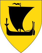
The coat-of-arms is from modern times; they were granted on 12 January 1990. The arms show an old wheel on a red background. The wheel was chosen as a symbol for Evenes as a center of communication and transportation.[5]
Geography
.jpg)
Evenes is located on the northern shore of the Ofotfjord, and borders Skånland municipality (in Troms county) to the north, Narvik municipality to the east, and Tjeldsund to the west.
There are lowlands in the western part of the municipality (Liland and Evenes area), while in the eastern part (Bogen), the mountains go almost straight up from the fjord. The highest mountain is Lilletinden (1,137 metres or 3,730 feet), which can be climbed without climbing equipment, even with skis in the winter and early spring. The view is stunning.
The most noticeable mountain when driving on European route E10, which crosses through Evenes, is perhaps the steep Niingen (1,090 metres or 3,580 feet) just east of Bogen. Strandvatnet lake next to Bogen village is surrounded by mountains and is a relatively rare Meromictic lake. There is trout in most lakes in Evenes, and Arctic char spawns in Østervikvatnet (lake) a few kilometres east of Bogen. Niingsvatnet is partly located in Evenes.
The large cave Trollkirka (the Troll Church) is located in the western part of the municipality (near Tårstad). German fortifications from World War II can be seen at Evenestangen, which is also a good place for fishing in the fjord.
Evenestangen is also the site of the sculpture Stone House by Danish artist Bjørn Nørgaard. The sculpture is part of the Artscape Nordland project.[6]
Climate
| Climate data for Harstad/Narvik Airport, Evenes | |||||||||||||
|---|---|---|---|---|---|---|---|---|---|---|---|---|---|
| Month | Jan | Feb | Mar | Apr | May | Jun | Jul | Aug | Sep | Oct | Nov | Dec | Year |
| Daily mean °C (°F) | −4.9 (23.2) |
−4.5 (23.9) |
−3.0 (26.6) |
1.0 (33.8) |
6.1 (43) |
9.9 (49.8) |
12.2 (54) |
11.6 (52.9) |
7.5 (45.5) |
3.4 (38.1) |
−1.3 (29.7) |
−4.1 (24.6) |
2.8 (37) |
| Average precipitation mm (inches) | 108 (4.25) |
100 (3.94) |
74 (2.91) |
68 (2.68) |
53 (2.09) |
65 (2.56) |
75 (2.95) |
89 (3.5) |
106 (4.17) |
155 (6.1) |
107 (4.21) |
120 (4.72) |
1,120 (44.09) |
| Source: Norwegian Meteorological Institute[7] | |||||||||||||
Government
All municipalities in Norway, including Evenes, are responsible for primary education (through 10th grade), outpatient health services, senior citizen services, unemployment and other social services, zoning, economic development, and municipal roads. The municipality is governed by a municipal council of elected representatives, which in turn elect a mayor.
Municipal council
The municipal council (Kommunestyre) of Evenes is made up of 17 representatives that are elected to every four years. Currently, the party breakdown is as follows:[8]
| Party Name | Name in Norwegian | Number of representatives | |
|---|---|---|---|
| Labour Party | Arbeiderpartiet | 4 | |
| Progress Party | Fremskrittspartiet | 1 | |
| Conservative Party | Høyre | 7 | |
| Centre Party | Senterpartiet | 3 | |
| Socialist Left Party | Sosialistisk Venstreparti | 1 | |
| Liberal Party | Venstre | 1 | |
| Total number of members: | 17 | ||
Economy

Most people work in public services and there is also some small-scale agriculture. Harstad/Narvik Airport, Evenes is located in the western part of the municipality, with daily flights to Oslo, Trondheim, Bodø, and Tromsø, as well as charter flights to southern Europe filled with sun-hungry tourists. The Royal Norwegian Air Force has a substantial infrastructure at Evenes, but the base was closed following the end of the Cold War, though it is often used by other NATO allies during their winter training. The large C-5 Galaxy from the United States Air Force has made several landings at the airport. A mobile hospital was built inside a small mountain at Osmarka, 5 kilometres (3.1 mi) east of the airport, using NATO infrastructure funds. The United States Navy moved the hospital to Kuwait before the Gulf War started in 1991. To achieve this, a large transport ship used the deep water harbour near Bogen, 13 kilometres (8.1 mi) east of the airport. This harbour was also built with funds from NATO, to enable heavy equipment to be moved north to Troms by road.
History

The Evenes Church was the first church in Ofoten, built about the year 1250. The original church and a subsequent church has been lost in fires; the present church is a wooden church (built in 1800) inspired by Danish Biedermeier mansion building style. Some relics from the original churches remain in the church today, most notably a stone baptismal font from the 13th century.
Liland used to be the commercial centre of the entire Ofotfjord area right up until the emergence of Narvik as a commerce/industry centre in the early 20th century.
During World War II, the Germans found the wide and fairly deep Bogen bay, with its mostly hard rock bottom well suited for anchoring, to be perfect for a naval base. Narvik is only 10 nautical miles (19 km) to the east (further into the fjord). The German battleship Tirpitz and cruiser Admiral Hipper were stationed in Bogen during part of the war (8 July - 23 October 1942, returned 11 March 1943). The battleships Scharnhorst and Lützow were based in Bogen for a shorter time. Additionally, several destroyers and submarines used Bogen as a base for shorter periods. Thus, this bay was one of Germany's most powerful naval bases during parts of the war and constituted a very real threat to Allied Arctic Convoys. The Allies had an obvious need for intelligence about these powerful German warships, and the British provided a radio set to the local resistance group. This radio was set up at Liland, 9 km west of Bogen, and codenamed Lyra.
References
- ↑ "Navn på steder og personer: Innbyggjarnamn" (in Norwegian). Språkrådet. Retrieved 2015-12-01.
- ↑ Statistisk sentralbyrå (2012). "1853 Evenes. Population 1 January and population changes during the year. 1951-" (in Norwegian).
- ↑ Jukvam, Dag (1999). "Historisk oversikt over endringer i kommune- og fylkesinndelingen" (PDF) (in Norwegian). Statistisk sentralbyrå.
- ↑ Rygh, Oluf (1905). Norske gaardnavne: Nordlands amt (in Norwegian) (16 ed.). Kristiania, Norge: W. C. Fabritius & sønners bogtrikkeri. pp. 289–290.
- ↑ Norske Kommunevåpen (1990). "Nye kommunevåbener i Norden". Retrieved 2008-11-20.
- ↑ "Steinhuset" (in Norwegian). Retrieved 2008-11-20.
- ↑ "eKlima Web Portal". Norwegian Meteorological Institute.
- ↑ "Table: 04813: Members of the local councils, by party/electoral list at the Municipal Council election (M)" (in Norwegian). Statistics Norway. 2015.
External links
| Wikimedia Commons has media related to Evenes. |
 Nordland travel guide from Wikivoyage
- Municipal fact sheet from Statistics Norway
- Gallery with old pictures from Evenes
- Pictures and information from Evenes (Norwegian)
- Pictures of Tirpitz and Admiral Hipper in Bogen
- Pictures from a kayak trip in Evenes
- Nautå nature reserve (Norwegian)
- Veggen nature reserve (Norwegian)