Uinta County, Wyoming
| Uinta County, Wyoming | |
|---|---|
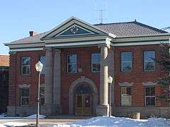 Uinta County Courthouse | |
 Location in the U.S. state of Wyoming | |
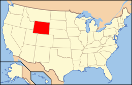 Wyoming's location in the U.S. | |
| Founded | 1869 |
| Named for | Uintah Mountains |
| Seat | Evanston |
| Largest city | Evanston |
| Area | |
| • Total | 2,088 sq mi (5,408 km2) |
| • Land | 2,081 sq mi (5,390 km2) |
| • Water | 6.3 sq mi (16 km2), 0.3% |
| Population (est.) | |
| • (2015) | 20,822 |
| • Density | 10/sq mi (4/km²) |
| Congressional district | At-large |
| Time zone | Mountain: UTC-7/-6 |
| Website |
www |
Uinta County /juːˈɪntə/ is a county located in the U.S. state of Wyoming. As of the 2010 census, the population was 21,118.[1] Its county seat is Evanston.[2] It is northeast from the Utah state line.
Uinta County comprises the Evanston, WY Micropolitan Statistical Area.
History
Uinta County was created on December 1, 1869 by the legislature of the Wyoming Territory.[3][4] Originally, it ran along the entire western border of Wyoming, including Yellowstone National Park.[5] The county was named for Utah's Uinta Mountains, which are visible from many places in the county.[6] The county was given its present boundaries in 1911 when Lincoln County was carved out of the northern part of Uinta County.[3]
Geography
According to the U.S. Census Bureau, the county has a total area of 2,088 square miles (5,410 km2), of which 2,081 square miles (5,390 km2) is land and 6.3 square miles (16 km2) (0.3%) is water.[7] It is the second-smallest county in Wyoming by area.
Geology
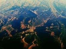
The 161 km wide western North American Fold and thrust belt extends from Alaska to Mexico, forming several northerly trending thrust faults in southwest Wyoming, including the Crawford, Absaroka and Hogsback (Darby), which formed from the Late Jurassic through the early Eocene.[8] The Painter Reservoir Field was discovered in 1977 from the 407 m thick Nuggest Sandstone which forms an anticline structural trap in the hanging wall of the Absaroka thrust plate, at a depth of about 3 km.[8]
National protected area
- Wasatch National Forest (part)
State protected areas
Major highways
Adjacent counties
- Lincoln County - north
- Rich County, Utah - northwest
- Summit County, Utah - south
- Sweetwater County - east
Demographics
| Historical population | |||
|---|---|---|---|
| Census | Pop. | %± | |
| 1870 | 856 | — | |
| 1880 | 2,879 | 236.3% | |
| 1890 | 7,414 | 157.5% | |
| 1900 | 12,223 | 64.9% | |
| 1910 | 16,982 | 38.9% | |
| 1920 | 6,611 | −61.1% | |
| 1930 | 6,572 | −0.6% | |
| 1940 | 7,223 | 9.9% | |
| 1950 | 7,331 | 1.5% | |
| 1960 | 7,484 | 2.1% | |
| 1970 | 7,100 | −5.1% | |
| 1980 | 13,021 | 83.4% | |
| 1990 | 18,705 | 43.7% | |
| 2000 | 19,742 | 5.5% | |
| 2010 | 21,118 | 7.0% | |
| Est. 2015 | 20,822 | [9] | −1.4% |
| U.S. Decennial Census[10] 1870–2000[11] 2010–2015[1] | |||
2000 census
As of the census[12] of 2000, there were 19,742 people, 6,823 households, and 5,144 families residing in the county. The population density was 10 people per square mile (4/km²). There were 8,011 housing units at an average density of 4 per square mile (1/km²). The racial makeup of the county was 94.32% White, 0.11% Black or African American, 0.87% Native American, 0.27% Asian, 0.07% Pacific Islander, 2.86% from other races, and 1.50% from two or more races. 5.34% of the population were Hispanic or Latino of any race. 27.7% were of English, 14.8% German, 8.3% American and 6.9% Irish ancestry.
There were 6,823 households out of which 44.70% had children under the age of 18 living with them, 61.20% were married couples living together, 9.90% had a female householder with no husband present, and 24.60% were non-families. 20.90% of all households were made up of individuals and 5.60% had someone living alone who was 65 years of age or older. The average household size was 2.84 and the average family size was 3.31.
In the county the population was spread out with 33.50% under the age of 18, 9.00% from 18 to 24, 29.20% from 25 to 44, 21.40% from 45 to 64, and 7.00% who were 65 years of age or older. The median age was 31 years. For every 100 females there were 103.80 males. For every 100 females age 18 and over, there were 100.30 males.
The median income for a household in the county was $44,544, and the median income for a family was $49,520. Males had a median income of $37,500 versus $21,450 for females. The per capita income for the county was $16,994. About 7.80% of families and 9.90% of the population were below the poverty line, including 11.90% of those under age 18 and 7.30% of those age 65 or over.
2010 census
As of the 2010 United States Census, there were 21,118 people, 7,668 households, and 5,577 families residing in the county.[13] The population density was 10.1 inhabitants per square mile (3.9/km2). There were 8,713 housing units at an average density of 4.2 per square mile (1.6/km2).[14] The racial makeup of the county was 92.4% white, 0.8% American Indian, 0.3% black or African American, 0.3% Asian, 0.2% Pacific islander, 4.1% from other races, and 2.0% from two or more races. Those of Hispanic or Latino origin made up 8.8% of the population.[13] In terms of ancestry, 33.4% were English, 23.0% were German, 12.0% were Irish, 6.5% were Scottish, 5.1% were Scotch-Irish, and 3.3% were American.[15]
Of the 7,668 households, 39.8% had children under the age of 18 living with them, 58.3% were married couples living together, 9.7% had a female householder with no husband present, 27.3% were non-families, and 22.6% of all households were made up of individuals. The average household size was 2.72 and the average family size was 3.19. The median age was 33.9 years.[13]
The median income for a household in the county was $58,346 and the median income for a family was $68,949. Males had a median income of $54,766 versus $30,561 for females. The per capita income for the county was $24,460. About 8.2% of families and 12.1% of the population were below the poverty line, including 14.6% of those under age 18 and 7.7% of those age 65 or over.[16]
Government and infrastructure
The Wyoming Department of Health Wyoming State Hospital, a psychiatric facility,[17] is located in Evanston.[18][19] The facility was operated by the Wyoming Board of Charities and Reform until that agency was dissolved as a result of a state constitutional amendment passed in November 1990.[20]
Communities
City
- Evanston (county seat)
Towns
Census-designated places
Ghost towns
See also
- National Register of Historic Places listings in Uinta County, Wyoming
- Uintatherium, a namesake fossil mammal discovered there
References
- 1 2 "State & County QuickFacts". United States Census Bureau. Retrieved January 25, 2014.
- ↑ "Find a County". National Association of Counties. Retrieved 2011-06-07.
- 1 2 Bartlett, ed., I.S. "chapter 31". History of Wyoming. S.J. Clarke Publishing Co.
- ↑ Long, John H., ed. (2004). "Wyoming: Individual County Chronologies". Wyoming Atlas of Historical County Boundaries. The Newberry Library. Retrieved August 19, 2015.
- ↑ "Uinta County Map". Atlas of the World 1888. Rand McNally and Company. Retrieved 2 August 2011.
- ↑ Urbanek, Mae (1988). Wyoming Place Names. Missoula, MT: Mountain Press Publishing Company. ISBN 0-87842-204-8.
- ↑ "2010 Census Gazetteer Files". United States Census Bureau. August 22, 2012. Retrieved August 18, 2015.
- 1 2 Lamb, C.F., 1980, Painter Reservoir Field-Giant in the Wyoming Thrust Belt, in Giant Oil and Gas Fields of the Decade: 1968-1978, AAPG Memoir 30, Halbouty, M.T., Tulsa: American Association of Petroleum Geologists, ISBN 0891813063, pp. 281-288
- ↑ "County Totals Dataset: Population, Population Change and Estimated Components of Population Change: April 1, 2010 to July 1, 2015". Retrieved July 2, 2016.
- ↑ "U.S. Decennial Census". United States Census Bureau. Retrieved August 18, 2015.
- ↑ "Historical Decennial Census Population for Wyoming Counties, Cities, and Towns". Wyoming Department of Administration & Information, Division of Economic Analysis. Retrieved January 25, 2014.
- ↑ "American FactFinder". United States Census Bureau. Retrieved 2011-05-14.
- 1 2 3 "DP-1 Profile of General Population and Housing Characteristics: 2010 Demographic Profile Data". United States Census Bureau. Retrieved 2016-01-12.
- ↑ "Population, Housing Units, Area, and Density: 2010 - County". United States Census Bureau. Retrieved 2016-01-12.
- ↑ "DP02 SELECTED SOCIAL CHARACTERISTICS IN THE UNITED STATES – 2006-2010 American Community Survey 5-Year Estimates". United States Census Bureau. Retrieved 2016-01-12.
- ↑ "DP03 SELECTED ECONOMIC CHARACTERISTICS – 2006-2010 American Community Survey 5-Year Estimates". United States Census Bureau. Retrieved 2016-01-12.
- ↑ "WDH Who We Are - Wyoming State Hospital." Wyoming Department of Health. Retrieved on December 12, 2010.
- ↑ "WDH Directory." Wyoming Department of Health. Retrieved on December 12, 2010. "Physical Address: 831 Hwy 150 S Evanston WY 82931-0177" (State Hospital)
- ↑ "Evanston city, Wyoming." U.S. Census Bureau. Retrieved on December 12, 2010.
- ↑ "About the Department of Corrections." Wyoming Department of Corrections. Retrieved on August 22, 2010.
| Wikimedia Commons has media related to Uinta County, Wyoming. |
 |
Rich County, Utah | Lincoln County | | |
| |
Sweetwater County | |||
| ||||
| | ||||
| Summit County, Utah |
Municipalities and communities of Uinta County, Wyoming, United States | ||
|---|---|---|
| City | | |
| Towns | ||
| CDPs | ||
| Ghost towns | ||
Cheyenne (capital) | |
| Topics |
|
| Society |
|
| Regions | |
| Cities | |
| Counties | |
Coordinates: 41°17′N 110°33′W / 41.29°N 110.55°W