Erdal, Hordaland
| Erdal | |
|---|---|
| Village | |
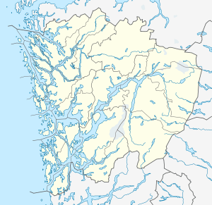 Erdal  Erdal Location in Hordaland county | |
| Coordinates: 60°26′33″N 05°13′37″E / 60.44250°N 5.22694°ECoordinates: 60°26′33″N 05°13′37″E / 60.44250°N 5.22694°E | |
| Country | Norway |
| Region | Western Norway |
| County | Hordaland |
| District | Midhordland |
| Municipality | Askøy |
| Elevation[1] | 20 m (70 ft) |
| Time zone | CET (UTC+01:00) |
| • Summer (DST) | CEST (UTC+02:00) |
| Post Code | 5306 Erdal |
Erdal is a village in Askøy municipality in Hordaland county, Norway. The village is located along the Byfjorden on the southeastern coast of the island of Askøy. The village lies in a valley just north of the mountain Kolbeinsvarden, the tallest mountain on the island. The villages of Florvåg and Kleppestø lie just to the south of Erdal. In 2006, Erdal Church was built in the village, serving the southeastern part of the island. There are also two schools in Erdal: a municipal pre-school and an elementary school.
References
- ↑ "Erdal, Askøy (Hordaland)" (in Norwegian). yr.no. Retrieved 2014-11-13.
This article is issued from Wikipedia - version of the 8/4/2016. The text is available under the Creative Commons Attribution/Share Alike but additional terms may apply for the media files.