Erciş
| Erciş | |
|---|---|
|
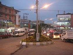
A view from Erciş city center | |
 Erciş | |
| Coordinates: 39°01′52″N 43°21′35″E / 39.03111°N 43.35972°ECoordinates: 39°01′52″N 43°21′35″E / 39.03111°N 43.35972°E | |
| Country | Turkey |
| Province | Van |
| Government | |
| • Mayor | Diba Keskin (BDP) |
| • Kaymakam | Barboros Baran |
| Area[1] | |
| • District | 1,876.38 km2 (724.47 sq mi) |
| Population (2012)[2] | |
| • Urban | 81,212 |
| • District | 165,953 |
| • District density | 88/km2 (230/sq mi) |
| Post code | 65400 |
| Website |
www |
Erciş (pronounced [eɾˈdʒiʃ]; Armenian: Ականց, Akants; historically Արճեշ, Artchesh, Kurdish: Erdîş) is a town and its surrounding district located in the Van Province, Turkey. The mayor is Diba Keskin (BDP).
In Classical Antiquity, it was known as Arsissa, and as Arjish in Arabic and Western Armenian during the Middle Ages.[3] The Byzantines knew it as Arzes (Ἂρζες or Ἀρζές) and the 10th-century emperor Constantine VII Porphyrogennetos records in his De administrando imperio (Chapter XLIV) that it was under the rule of the Kaysite emirate of Manzikert.
This small district several times was the capital city of some ruling states. It was a main center of the province of Turuberan as part of the ancient Kingdom of Armenia. The city changed hands on several occasions between the Arabs and the Byzantines, in the early Middle Ages. In 1054, while under Byzantine administration, it was captured and sacked by the Seljuk Turks after an eight-day siege. It was fortified in the early 14th century by the Ilkhanid vizier Ali Shah. Erciş was part of the Karakoyunlu state and later became a part of the Ottoman Empire. It was moved to a new location called Alada in 1841, due to floods. After the Armenian Genocide in 1915, the Russian forces captured the city as part of the Caucasus Campaign. They were replaced by Russian Armenian troops after December 1917. These were eventually driven out by the Ottomans on April 1, 1918.
The city suffered a major earthquake on October 23, 2011.
The district has total of 2,115 km² area and is surrounded by Muradiye on the east, Bitlis on the west, Ağrı on the north and the Lake Van on the south. There are 143 settlement areas, including 3 municipalities, 14 districts, 2 subdistricts, 85 villages and 39 other entities.
It is one of the most developed cities in eastern Turkey and it is the place where the folk songs are still alive. Many kinds of fruits and vegetables are raised. Planting of poplar trees is widely seen in the city and surroundings.
The total population of the district is 145,229 and spread among the capital city and villages. The rural population is 66,832, while the urban population is 78,397. Population density is 47/km². The population of the city of Erciş is 77,065 inhabitants.
Historical Artchesh
From 18th century, because of the increase of level of Lake Van the old town (called Artchesh) slowly disappeared. And in the second half of the 19th century the buildings, churches and dwelling houses were not seen. After old Erciş was covered by water, the city was moved to north to much higher place called Alada in 1841, were the new town was built called Akants (Նոր Արճեշ (Armenian pronunciation: [ɑɾtʃɛʃ], New Artchesh in Armenian and Erciş (Turkish pronunciation: [eɾdʒiʃ]) in Turkish).[4] In 1890 64% of the population of the city was Armenian.
See also
References
- ↑ "Area of regions (including lakes), km²". Regional Statistics Database. Turkish Statistical Institute. 2002. Retrieved 2013-03-05.
- ↑ "Population of province/district centers and towns/villages by districts - 2012". Address Based Population Registration System (ABPRS) Database. Turkish Statistical Institute. Retrieved 2013-02-27.
- ↑ Baldwin, M.W., ed. (1969), A History of the Crusades, Volume I: The first hundred years, University of Wisconsin Press, p. 630
- ↑ Tadevos Hakobyan, ՊԱՏՄԱԿԱՆ ՀԱՅԱՍՏԱՆԻ ՔԱՂԱՔՆԵՐԸ - ԱՐՃԵՇ (The cities of Historical Armenia - Artchesh), Yerevan, 1987
External links
| Wikimedia Commons has media related to Erciş. |
- Erciş
- Video About Ercis
-
 "Arjish, or Akhlat. A small town of Turkish Armenia". New International Encyclopedia. 1905.
