Ensign Peak
| Ensign Peak | |
|---|---|
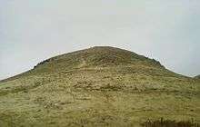
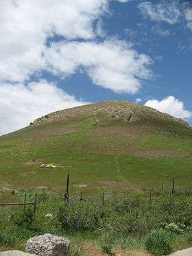 Ensign Peak, as seen from hiking trail below. | |
| Highest point | |
| Elevation | 5,417 ft (1,651 m) NAVD 88[1] |
| Prominence | 64 ft (20 m) [1] |
| Coordinates | 40°47′40″N 111°53′26″W / 40.7943902°N 111.8904922°WCoordinates: 40°47′40″N 111°53′26″W / 40.7943902°N 111.8904922°W [2] |
| Geography | |
| Location | Salt Lake County, Utah, U.S. |
| Parent range | Wasatch Range |
| Topo map | USGS Salt Lake City North |
| Climbing | |
| Easiest route | 0.47 mile (0.75 km) hike on Ensign Peak Trail |
For the Deseret Book imprint, see Ensign Peak (imprint).
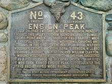
Ensign Peak is a peak in the foothills near downtown Salt Lake City, Utah. It is approximately one mile north of the Utah State Capitol and sits almost directly behind it. On July 26, 1847, Brigham Young and other early members of The Church of Jesus Christ of Latter-day Saints (LDS Church) climbed this hill and gave it its present name. The hill has religious significance in LDS Church history and in its symbolism.[3][4]
See also
Notes
- 1 2 "Ensign Peak, Utah". Peakbagger.com. Retrieved 2016-04-18.
- ↑ "Ensign Peak". Geographic Names Information System. United States Geological Survey. Retrieved 2016-04-18.
- ↑ Walker, Ronald W. "A Banner is Unfurled: Mormonisms Ensign Peak" Dialogue: A Journal of Mormon Thought Volume 26 Number 4, Winter 1993, pages 71-91.
- ↑ "Ensign Peak: A Historical Review", Dennis A. Wright and Rebekah E. Westrup. BYU Religious Studies Center. Retrieved 2012-12-11.
Further reading
- Packer, Boyd K. (November 2006), "A Defense and a Refuge", Ensign. An address giving some background information on Ensign Peak.
 |
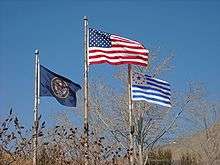 The Flag of the United States, Flag of Utah, and Mormon Flag at Ensign Peak. |
 |
External links
| Wikimedia Commons has media related to Ensign Peak. |
This article is issued from Wikipedia - version of the 4/18/2016. The text is available under the Creative Commons Attribution/Share Alike but additional terms may apply for the media files.