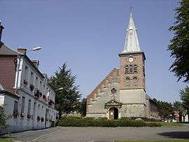
Englefontaine
| Englefontaine | ||
|---|---|---|
 | ||
| ||
 Englefontaine | ||
|
Location within Hauts-de-France region  Englefontaine | ||
| Coordinates: 50°11′32″N 3°38′37″E / 50.1922°N 3.6436°ECoordinates: 50°11′32″N 3°38′37″E / 50.1922°N 3.6436°E | ||
| Country | France | |
| Region | Hauts-de-France | |
| Department | Nord | |
| Arrondissement | Avesnes-sur-Helpe | |
| Canton | Le Quesnoy-Est | |
| Intercommunality | Quercitain | |
| Government | ||
| • Mayor (2008–2014) | Michel Manesse | |
| Area1 | 4.62 km2 (1.78 sq mi) | |
| Population (1999)2 | 1,327 | |
| • Density | 290/km2 (740/sq mi) | |
| Time zone | CET (UTC+1) | |
| • Summer (DST) | CEST (UTC+2) | |
| INSEE/Postal code | 59194 / 59530 | |
| Elevation |
128–152 m (420–499 ft) (avg. 135 m or 443 ft) | |
|
1 French Land Register data, which excludes lakes, ponds, glaciers > 1 km² (0.386 sq mi or 247 acres) and river estuaries. 2 Population without double counting: residents of multiple communes (e.g., students and military personnel) only counted once. | ||
Englefontaine is a commune in the Nord department in northern France.
Heraldry
.svg.png) |
The arms of Englefontaine are blazoned : Vair, 3 pales gules. (Englefontaine, Louvignies-Quesnoy, Poix-du-Nord and Saint-Waast-la-Vallée use the same arms.) |
See also
References
| Wikimedia Commons has media related to Englefontaine. |
This article is issued from Wikipedia - version of the 11/25/2014. The text is available under the Creative Commons Attribution/Share Alike but additional terms may apply for the media files.