Endicott River
| Endicott River | |
| Country | United States |
|---|---|
| State | Alaska |
| Borough | Haines |
| Source | unnamed glacier 2 miles (3 km) south of Mount Young |
| - location | Chilkat Range, Tongass National Forest, Endicott River Wilderness |
| - elevation | 2,394 ft (730 m) [1] |
| - coordinates | 58°49′58″N 135°35′23″W / 58.83278°N 135.58972°W [2] |
| Mouth | Lynn Canal |
| - location | 25 miles (40 km) northwest of Juneau |
| - elevation | 0 ft (0 m) [2] |
| - coordinates | 58°46′41″N 135°14′38″W / 58.77806°N 135.24389°WCoordinates: 58°46′41″N 135°14′38″W / 58.77806°N 135.24389°W [2] |
| Length | 25 mi (40 km) [2] |
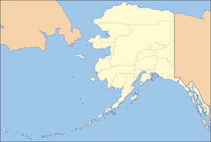 Location of the mouth of the Endicott River in Alaska
| |
The Endicott River is a stream, 25 miles (40 km) long, in Haines Borough in the U.S. state of Alaska.[2] Beginning at the base of an unnamed glacier near Mount Young in the Chilkat Range, it flows generally eastward into the Lynn Canal.[3] Most of the river's course lies within the Endicott River Wilderness of the Tongass National Forest.[3] The river mouth is about 25 miles (40 km) northwest of Juneau.[2]
See also
References
- ↑ Derived by entering source coordinates in Google Earth.
- 1 2 3 4 5 6 "Endicott River". Geographic Names Information System. United States Geological Survey. January 1, 2000. Retrieved December 23, 2013.
- 1 2 Alaska Atlas & Gazetteer (7th ed.). Yarmouth, Maine: DeLorme. 2010. p. 32. ISBN 978-0-89933-289-5.
This article is issued from Wikipedia - version of the 9/10/2016. The text is available under the Creative Commons Attribution/Share Alike but additional terms may apply for the media files.