Emba Soira
| Emba Soira | |
|---|---|
| Sowera | |
 Emba Soira Eritrea | |
| Highest point | |
| Elevation | 3,018 m (9,902 ft) [1] |
| Listing | Country high point |
| Coordinates | 14°45′N 39°32′E / 14.750°N 39.533°ECoordinates: 14°45′N 39°32′E / 14.750°N 39.533°E |
| Geography | |
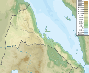
| Location | Debub Region, Eritrea |
| Parent range | Eritrean Highlands |
Emba Soira (also transliterated Sowera) is the highest mountain in Eritrea.[1] Rising 3,018 metres (9,902 ft) above sea level, it is part of the Eritrean Highlands, one side of the Great Rift Valley which cuts through Eritrea and joins the Red Sea. The mountain is situated in the southeastern part of the Debub (Southern) administrative region in central Eritrea.
Emba Soira is reached by a paved road from the city of Senafe, located 135 kilometres south of the national capital Asmara. From there, a very difficult and perilous dirt track heading east for almost 20 kilometres leads to the mountain. The last part must be trekked and takes at least a few hours of travel.
References
- 1 2 "Soira, Eritrea" on Peakbagger.com Retrieved 28 September 2011
This article is issued from Wikipedia - version of the 5/13/2016. The text is available under the Creative Commons Attribution/Share Alike but additional terms may apply for the media files.