Eltanin Fault System
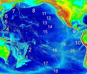
Pacific Ocean depth map showing the Heezen Fault and the Tharp Fault as #17.
The Eltanin Fault System (Eltanin Fracture Zone) is a series of six or seven dextral transform faults that offset the Pacific-Antarctic Ridge, a spreading zone between the Pacific Plate and the Antarctic Plate. The affected zone of the Pacific-Antarctic Ridge is about 800 km long, between 56° S, 145° W and 54.5° S, 118.5° W,[1] southwest of Easter Island, and about as far as one can get from land on planet Earth (48°52.6′S 123°23.6′W).[2] However, the total offset is about 1600 km.[1] The two major faults in the Eltanin Fracture Zone are the Heezen Fault and the Tharp Fault. Others related faults include the Vacquier Transform Fault, the Menard Transform Fault, and the Udintsev Fault.[3]
Notes
- 1 2 Lonsdale, Peter (1994). "Structural geomorphology of the Eltanin fault system and adjacent transform faults of the Pacific-Antarctic plate boundary". Marine geophysical researches. 16 (2): 105–143. Bibcode:1994MarGR..16..105L. doi:10.1007/BF01224756.
- ↑ Because of the generally remote character of the epicentral area (the Eltanin FZ is indeed close to the point at sea farthest away from any land shore) page 10.497, Stewart, Lisa M.; Okal, Emile A. (1983). "Seismicity and Aseismic Slip Along the Eltanin Fracture Zone" (PDF). Journal of Geophysical Research. 88 (B12): 10,495–10,507. Bibcode:1983JGR....8810495S. doi:10.1029/jb088ib12p10495.
- ↑ Dosso, L.; et al. (2005). "The Pacififi c-Antarctic Ridge between 41°15'S and 52°45'S: Survey and sampling during the PACANTARCTIC 2 cruise" (PDF). InterRidge News. 14: 1–4.
Further reading
- Beutel, Erin K.; Okal, Emile A. (2003). "Strength asperities along oceanic transform faults: a model for the origin of extensional earthquakes on the Eltanin transform system". Earth and Planetary Science Letters. 216 (1/2): 27–41. Bibcode:2003E&PSL.216...27B. doi:10.1016/S0012-821X(03)00484-9.
- Kashintsev, G.L.; Frikh-khar, D. (1978). "Structure of the oceanic crust in the Eltanin Fault Zone (Pacific Ocean) based on petrographic data". Oceanology. 18: 39–42.
- Lonsdale, Peter (1986). "Tectonic and magmatic ridges in the eltanin fault system, South Pacific". Marine geophysical researches. 8 (3): 203–242. Bibcode:1986MarGR...8..203L. doi:10.1007/BF00305484.
- Lonsdale, Peter (1994). "Structural geomorphology of the Eltanin fault system and adjacent transform faults of the Pacific-Antarctic plate boundary". Marine geophysical researches. 16 (2): 105–143. Bibcode:1994MarGR..16..105L. doi:10.1007/BF01224756.
- Okal, Emile A.; Langenhorst, Amy R. (2000). "Seismic properties of the Eltanin Transform System, South Pacific". Physics of The Earth and Planetary Interiors. 119 ((3/4): 185–208. Bibcode:2000PEPI..119..185O. doi:10.1016/S0031-9201(99)00169-7.
- Stewart, Lisa M.; Okal, Emile A. (1983). "Seismicity and Aseismic Slip Along the Eltanin Fracture Zone" (PDF). Journal of Geophysical Research. 88 (B12): 10,495–10,507. Bibcode:1983JGR....8810495S. doi:10.1029/jb088ib12p10495.
- Sykes, Lynn R.; Ekstörm, Göran (2011). "Earthquakes along Eltanin transform system, SE Pacific Ocean: fault segments characterized by strong and poor seismic coupling and implications for long-term earthquake prediction". Geophysical Journal International. 188 (2): 421–434. Bibcode:2012GeoJI.188..421S. doi:10.1111/j.1365-246X.2011.05284.x.
This article is issued from Wikipedia - version of the 5/29/2016. The text is available under the Creative Commons Attribution/Share Alike but additional terms may apply for the media files.