Elmwood, Berkeley, California
The Elmwood District is a neighborhood of the City of Berkeley, California. It is primarily residential, with a small commercial area. The district does not have set lines of demarcation, but is focused around College and Ashby Avenues. The most extreme definitions of the district's boundaries do not extend past Telegraph Avenue to the west, Dwight Way to the north, or the Oakland city limit to the south. Elmwood was a streetcar suburb that was developed in the 1900s housing boom following the 1906 earthquake.[1]
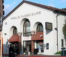
It has a small commercial corridor on College Avenue, centered on the intersection of Ashby and College Avenues, that spans College Avenue about one to two blocks in each direction. The commercial corridor consists of small shops and restaurants that cater to local residents. There is also a small movie theater and a bank near the intersection. There are also a handful of businesses near the intersection of College Avenue and Derby Street.
The housing stock in Elmwood is similar to surrounding areas of Berkeley and consists mostly of detached houses and small apartment buildings. The houses are generally moderate to large Brown Shingle, Arts and Crafts and Colonial Revival homes, sometimes one or two stories, that are usually landscaped with gardens and generally well-kept. The apartment buildings tend to be newer, usually built between the 1950s and 1970s, and become more numerous towards the adjacent Southside neighborhood.
Alta Bates Hospital is located in Elmwood near Ashby and Telegraph Avenues. Maybeck High School, Willard Middle School, The Julia Morgan Center for the Arts, Judah L. Magnes Museum, Claremont Branch of the Berkeley Public Library, and Willard Park are also located within a few blocks of the center of the neighborhood.
References
- ↑ Southworth, Michael and Eran Ben-Joseph. Streets and the Shaping of Towns and Cities. Washington,DC: Island Press, 2003. P. 110.
37°51′25″N 122°15′11″W / 37.85704°N 122.25304°W