El Quisco
| El Quisco | |||||
|---|---|---|---|---|---|
| Commune | |||||
| |||||
| Coordinates: 33°23′28.71″S 71°41′34.58″W / 33.3913083°S 71.6929389°WCoordinates: 33°23′28.71″S 71°41′34.58″W / 33.3913083°S 71.6929389°W | |||||
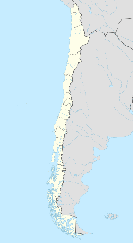
| Country | Chile | ||||
| Region | Valparaíso | ||||
| Province | San Antonio | ||||
| Government[1] | |||||
| • Type | Municipality | ||||
| • Alcalde | Natalia Carrasco Pizarro | ||||
| Area[2] | |||||
| • Total | 50.7 km2 (19.6 sq mi) | ||||
| Elevation | 13 m (43 ft) | ||||
| Population (2012 Census)[2] | |||||
| • Total | 11,329 | ||||
| • Density | 220/km2 (580/sq mi) | ||||
| • Urban | 8,931 | ||||
| • Rural | 536 | ||||
| Sex[2] | |||||
| • Men | 4,815 | ||||
| • Women | 4,652 | ||||
| Time zone | CLT [3] (UTC-4) | ||||
| • Summer (DST) | CLST [4] (UTC-3) | ||||
| Website |
www | ||||


El Quisco is a Chilean city and commune in San Antonio Province, Valparaíso Region. Located in the country's central coast, it serves as a popular summer resort for the population of Santiago and forms part of the Coast of Poets, a cultural space named for four Chilean poets of world renown: Pablo Neruda, Vicente Huidobro, Violeta Parra and Nicanor Parra. A place of interest is La Casa de Isla Negra, the former house of Chilean poet Pablo Neruda, now his burial place and a museum.
History

The Quisco has had a major development in the 20th century but few ones know his past.
Prehistory
A characteristic little known about this resort is that there have been important archaeological findings related to the Período agroalfarero temprano and Período agroalfarero tardío of the coastal zone, in the shape of conchales in the peninsulas, centre and north.
Inside the cultures that occupied El Quisco there were of El Bato and Llolleo[5] cultural areas, which they characterized to the Early period, coinciding your ates with those of the Molle culture.[6] In this Periodo agroalfarero temprano - or formative early-, coexistences of populations are distinguished yet of the Archaic Period, with other groups of entail ) northern - Bato tradition -, and others with geographic development more places - Llolleo cultural complex, but located more in the southern part.
Bato Tradition , that is established about them 300 BC and 400, sharing cultural guidelines with the Molle culture which was located more in the northern part. Typical of the above-mentioned culture it was the use of tembetá; in addition they found mortars which are elements of stone used in the grinding of vegetables and minerals. The evidence of the place of this group is in the ex-property in the country Trebulco and in La Manresa, located in the locality of Lonquén. His maximum development reaches towards 400 to 500 both on the coast and in the interior, and persists up to late moments in the Preandean zone towards 900.
Complex El Molle came to Chile in the year 300 approximately,[7] for big migrations to the country,[8] from Brazil, the tropical jungles of the Chaco, Argentine pampas and Peru, being established between(among) the transverse valleys of the river Copiapó and the Choapa river . The first accessions went to the interior of the country, in the Molle, where the first fingerprints were situated. They were mixed by the archaic populations adopting some cultural elements and physical features. They were the predecessors of the culture diaguita and at the arrival of the Spanish (1492), these already were extinguished. According to our political division - administrative current this culture would have been located between(among) the region III and IV.
The culture Aconcagua was spreading over the whole coastal zone included by the resorts of Algarrobo, El Quisco, Llolleo, El Tabo, Las Cruces, Rocas de Santo Domingo, Cartagena and the area of The Convent and Tejas Verdes , with many arcaheologic findings in the matter .
Report of your ceramics is called commonly Aconcagua Salmon Type for being of a well-known color orange with black painting in your decoration, and pertenence to the Late Agroalfarero period of the region, thereabouts for between 800 and 1470, producing principally pieces as pucos or bowls, in whose external face is frequent the decoration representing the figure of a "Trinaurio", or species of whirlpool of three arms.
Mapuche period

Later Picunche were located between( two important rivers: the Choapa river and Itata river. They were farmers and therefore, sedentary. Of this activity dads were obtaining, gourd, maize, beans and chili pepper. In the zone where they lived through the water was abundant and a hot climate. Also they raised animals, specially Llamas and Guanacos. Of them they extracted meat and wool to make your gowns. The picunches were establishing themselves in groups of approximately 300 persons, in small villages. Your houses were of mud and roof of totora. In each one approximately 30 persons were living, among the father, the wives, the children, and other direct relatives. Your custom was establishing that the men were giving the orders or directing; the maximum authority was the father and then the major son was coming. Only in case of emergency, especially if a war happened, there was a chief who was leading the others: the chief. Nevertheless, they shaped a pacific village.[9]
Inca period

This zone was a part of Inca Empire, specifically of Qullasuyu. In order to assure their domination and to introduce the Inca customs, the Inca sovereigns established numerous colonies of mitimaes, of farmers and pacific craftsmen brought of diverse parts of the empire: Aymara and Quechua people, atacameños, etc. These foreign settlers gave origin to numerous villages whose names remind those of their places of origin: Limache (people of Rímac or Lima), Collahue (place of the Qulla people or Aymara people), Pomaire and different people of atacameño origin.
This section was going between mitimaes of Quillota and Talagante. The zone of Casablanca and El Quisco was closely and was a step of the coastal route of them. In Casablanca, the section of the Inca road system that crosses the tideland in Las Dichas, has remained with the name of Way of the Chicken farmers (polleros) (name was derived that the inca soldiers took the Pulla as a uniform), which intersect the way Casablanca - Algarrobo, Chile in the current way to Lagunillas and Lo Abarca. 33°23′22.64″S 71°26′12.07″W / 33.3896222°S 71.4366861°W.
The clothes of the inca soldiers were done of Pulla Pulla (Zephyranthes párvula Killip). Annual plant of the family of Amaryllidaceae, proper of Highlands andean provinces, of beautiful flowers that they bloom in spring. It is considered to be like warning of the goodor bad one agricultural year. At [Lo Orozco] was passing the Way from Limache to Las Dichas, following to Portezuelo de Ibacache, finishing at Talagante where other Mitimae existed . In 1430, Túpac Inca Yupanqui, initiated a great military campaign that culminated with the establishment of a border in Maule river. Ilabe, one Incas nobles that commanded the invading forces, established in the valley Picunche of Llollehue, between the Maipo river and Mapocho river and decided to found a colony and a pucará, task that entrusted to his son Tala Canta Inca Ilabe.
He possessed authority to name kurakas or governors, simultaneously was depending on the Inca´s Cusco. His mandate was fruitful since there could establish the social, political and economic system typical of the Inca Empire, do distributions of land, of community property and initiate the constructions of works of common good, as ways, granaries to guard the fruits of the crops and the construction of the housings. The agricultural and cattle production achieved such a development that allowed to send food towards the pukaras of the north.
Spanish conquest

In 1541, the captain Pedro de Valdivia, his soldiers, yanakuna and Indians of service, entered to the basin of Mapocho river for the Inca way by the way that today occupies the Independence Avenue, Santiago de Chile of the city of Santiago de Chile, crossed Mapocho river, advanced five blocks and took possession of the principal buildings of this administrative center. Within one year, founded a Spanish city bigger than Inca that existed there with a Plaza de Armas initiating with this the Spanish Conquest. This Plaza de Armas was designed on a standard military fashion based on a grid pattern, taken from the Roman Castrum, of which one of the blocks would be left vacant to form the Plaza de Armas. It is often surrounded by governmental buildings, churches, and other structures of cultural or political significance. The name derives from the fact that this area would be a refuge in case of an attack upon the city, from which arms would be supplied to the defenders.
In times of Valdivia, were recorded the presence of Indian fishermen in the Central Zone.
" Aliamapu (Valparaíso) was inhabited ... for this special race of aborigines that preserves still your type, your name and up to his your humble exercise of the sea ... the former Changos " "— Benjamín Vicuña Mackenna, 1936
The term "chango" appears not only in the toponymy, but also in the documents of the colonial era alluding to the Indian fishermen. According to the historian Joaquín Santa Cruz (1926), they were living fundamentally of the fishing and compilation of seafood and marine mammals.
Towards 1562 a great number of Changos of the central coast had disappeared already be because they were moved, chased or exterminated.
"Vicuna Mackenna affirms that the colonists of Santiago had news of a ship that had smashed against the coasts of Topocalma and the scanty survivors, amongwhom one was counting a black, they were cruelly murdered for the Indians who there were living, for such a motive " .. they happened in avenging them killing hundred for one, as it was the eye for an eye rule in such cases"— Szmulewicz, 1984
The first precedents of Spanish settlement in the zone of El Quisco date back of 1570, when the Spanish family of Alonso de Córdoba agrees in the place. Before it was named Huallilemu (Mapudungun: forest of oakwood ), but then passed to call it El Totoral for the great quantity of totoras existing there.
Pirates

From 1578, together with the neighbor Algarrobo and El Canelo were a hiding place of pirates as the English men Francis Drake, Thomas Cavendish, Richard Hawkins and Dutches like Oliver Van Noort and Joris van Spilbergen. Francis Drake would have been with his galleon Golden Hind in its bay, in December 1578. He travels with two Japanese, that know themselves only for your Christian names, Cristhoper and Cosmas who were the first Japanese in circumnavigate the globe
Ginés de Lillo
The works of Ginés de Lillo allowed to have a finished record of the Chilean society of 17th century knew for diverse documents of the time that the peoples of the interior had fishermen in the coastal Cove s called ' " fishermen on the coast " Only in Ginés de Lillo's measures are mentioned three cases in the basin of the Maipo river:
- Melipilla's Indians have fishermen in Quebrada de Calbín together with it Alonso de Córdova's lagoon[10]
- Pico Indians have fishermen in Paico and extracts gold in Temumu[11]
- Huechún Indians (Melipilla) have relatives or fishermen in Duca Duca.[12][13]
Duca Duca ( mapudungun: " doka doka = Many Carpobrotus aequilaterus . Creeping beefy plant of the family of the aizoaceas called " berrir of sea " ") in the surroundings of the lagoon today known as El Peral that is located to the south of Las Cruces, Chile.
The ethnic center of Picones more eminent seems to have taken root in the payment of Pico, placed in the surroundings of Melipilla. Precisely, seventy aborigens picones were entrusted the bishop Rodrigo Gonzalez Marmolejo, for Valdivia.[14] He later the enjoyment of the commission, Antonio Gonzalez Montero, nephew of the ecclesiastic.[14] In the 18th century, [km] existed in the surroundings of Pomaire, the people of Pico, located in the estate of the same name, to approximately 8 km northwest from Melipilla (33°37′31.28″S 71°16′16.19″W / 33.6253556°S 71.2711639°W).[15]
Probably, Pico was very important, since a cacique with this name was appearing among the lofty "heads" of the Kingdom, in times of Valdivia.[16] In another order, the same conqueror donated to Juan Bautista Pastene a commission, in 1550, in that they were included:
The so called chiefs Antequilica and Chumavo or Catalogna with all your Indians ... that have his(her,your) land in the province of the picones and so called Poangui valley ... with more lands and seat that the above-mentioned chiefs have near the river Maipo, so called Beak(Peak), to sow the years that are of drought that for water does not have the Poangue's above-mentioned valley they are going to sow there and to have it for his last times— CDIHCh, la., XVIII: 445.
The use of the beaches in the Colony
The indigenous fishermen in the epoch of the Colonia had to cancel a rental to the owners of the stays for occupying the beaches and having a place to raise their huts. The breach of these dispositions provoked so many lawsuits that the governor Ambrosio O'Higgins abolished these hobbles
he declared of common use up to hundred rods of land from the line of the high tide towards the interior, with the unique condition of which in his huts, the fishermen were not sheltering people of evil to live they were not even causing prejudice to the ranchers— Ambrosio O'Higgins. In Smulewicz, 1984
The pirates and corsairs returns
At the end of the colonial stage already were numerous the foreign ships that were doing the illegal trade on the Chilean coasts. In addition to English, Dutch and French pirates of the past, already North American pirates had been added. They were operating generally with the support of the Chilean Creoles, who saw the Spanish attempts of the authorities of interfering as one more proof of the arrogance of the colonial Spanish system.
Chile Independence
The current way that El Totoral joins with Punta de Tralca , would have been the former route to valparaíso, route that Casimiro Marcó del Pont would have wanted to take in his flight after the defeat under patriots. This statement indicates that the last Governor of the Kingdom of Chile, would have sheltered in the sector of Punta deTralca Many of the Spanish soldiers would have found refuge in this Streams.
The roads in the 19th century
In general, and with exception of the villages founded expressly by the Spanish, the majority of the settlements that are located in our region, have origin in hamlets that were located in the boundaries of some of three roads that were crossing from north to south the country, in the colonial period.
The Royal Middle Road
The Royal road was planned by the hills of the coast, going of Santiago to Melipilla, from there to Colchagua was entering for Peumo, was still for Pichidegua and the people of Colchagua, today Santa Cruz. Lolol was continuing towards, Nilahue, Las Palmas and [El Coipo], coming to Peralillo and close to Mataquito river, was approaching to the jurisdiction of Maule. It as that of major use during the 16th and 17th centuries. Nowadays there are in use diverse sections of this route.
The Road of the Coast
The third way " the costino or of the salt's road ", was dividing from Valparaíso passing for Casablanca, Llolleo and Santo Domingo. To Colchagua was entering for Navidad and Rapel, until [Cáhuil] came to the Boyeruca lagoon and Bucalemu. Of the salt mines of this zone they were taking the salt to the capital and of there your name. followed it Route of Camino del Inca nearest to the Polleros Road. Had a lot of deviations that correspond to the current road Casablanca to Algarrobo that was parting with this one at a height of El Totoral and the road from El Totoral to Punta de Tralca .
Frontier road
The way of the Border was crossing the Central Valley and it corresponds to a great extent to the current Longitudinal one. Rancagua was passing for the villas of Rengo and San Fernando, already founded. Real backbone of the communications of the kingdom, it was used by ranchers and landowners to extract your products, which forced it continuous overhauling. Often these agricultural properties were in the habit of having a front towards this route, to bring houses, settlements and chapels over.
Today

Among the personalities of public service that took forward the idea of transforming to the Neighbors' Meeting of El Quisco, The illustrious municipality of Algarrobo, Isidoro Dubournais, Mayor of the illustrious municipality of Algarrobo and President of the Neighbors' Meeting of El Quisco. The principal avenue that constructs the road net of the commune takes today his name, as honoring to his management of service and development for the commune.
The commune of The Quisco is constituted as such on August 30, 1956 under the presidency of Don Carlos Ibáñez del Campo under Statutory order Nº 12110.
Demographics
According to the 2002 census of the National Statistics Institute, El Quisco spans an area of 50.7 km2 (20 sq mi) and has 9,467 inhabitants (4,815 men and 4,652 women). Of these, 8,931 (94.3%) lived in urban areas and 536 (5.7%) in rural areas. The population grew by 55.3% (3,370 persons) between the 1992 and 2002 censuses.[2]
Administration
As a commune, El Quisco is a third-level administrative division of Chile administered by a municipal council, headed by an alcalde who is directly elected every four years. The 2008-2012 alcalde is Natalia Carrasco Pizarro.[1]
- Cristofer Ceballos Lira (UDI)
- Juan Andrés Berrios Olmedo (PPD)
- José Moraga Lira (RN)
- Maria Magdalena Bianchi Berroeta (PDC)
- Guillermo Romo Díaz (JPM)
- Guillermo Vidal Devia (UDI)
Within the electoral divisions of Chile, El Quisco is represented in the Chamber of Deputies by Mrs. María José Hoffmann (UDI) and Mr. Víctor Torres (PDC) as part of the 15th electoral district, (together with San Antonio, Santo Domingo, Cartagena, El Tabo, Algarrobo and Casablanca). The commune is represented in the Senate by Francisco Chahuán Chahuán (RN) and Ricardo Lagos Weber (PPD) as part of the 6th senatorial constituency (Valparaíso-Coast).
Description
The Quisco has four well differentiated localities, so much geographical as culturally:
- El Quisco properly.
- Punta de Tralca.
- Isla Negra.
- El Totoral.
Tourism
This zone is being a favorite tourist destination of the central zone of Chile. It advantages are the short distance to which it is of Santiago of Chile, the capital of the country. It relies on residential many people and hotels for room,[17] besides many restaurants and inns in those that it is possible to enjoy of it typical Chilean food. Marine sports are practised, especially nautical, scuba or swimming.
Illustrious inhabitants

- The Nobel Prize on Literature Pablo Neruda [18]
- Singer and Composer Violeta Parra [19] spent long seasons in Isla Negra, where create some of her famous works as "El Rin de Angelito".
- Ex-Foreign Minister Enrique Silva Cimma.
- Ex Vice-minister Patricio Tombolini,[20] Ex-president of Social Democrat Radical Party.
- The folklorist Clara Solovera,[21] born on May 15, 1909, January 27, 1992. your daughters Cecilia and Marcela spread her ashes in the sea, opposite to her house of The Quisco.
- The National Prize of Journalism on double part Luis Hernández Parker.
- The Chilean cartoonist René Ríos Boettiger, Pepo, creator of Condorito.[22]
- Jose Perotti, National Prize of Art.
- The painter Camilo Mori who designed the official seal of the I.Municipalidad of El Quisco
- The bi-minister of Housing, Urbanism and National Goods Sonia Tschorne.
- The politician Osvaldo Puccio.
- The Surgeon of the Presidency of Chile Jose Michael Puccio.
- The doctor Mario Lopez
- The doctor Roberto Marín Vivado, Coloproctòlogist that had a vast path as president of the Gastronomic Confraternity N º 1 of Santiago and honorary member of the Circle of Gastronomic Chroniclers.
Christian von Wernich
La Plata Federal Judge Arnaldo Corazza gathered testimony from witnesses that placed Christian von Wernich at three illegal detention centers (Puesto Vasco, Coti Martínez and Pozo de Quilmes), and ordered his arrest on 25 September 2003, after the priest was discovered at El Quisco under the assumed identity of father "Christian González" , Priest of El Quisco's catholic church.[23]
External links
| Wikimedia Commons has media related to El Quisco. |
- Municipality of El Quisco
- Guía EL Quisco, Complete Turisitic guide about El Quisco
- Turistic Web El Quisco
- Ocupaciones tempranas y la aparición del pescador en la costa pacífica de Sudamérica”
- Sitio turístico del Quisco
- FM Radio online El Quisco
- Compañía eléctrica de la Comuna
- El Quisco y El Tabo
- Nuestro Refugio
- Fundación Pablo Neruda
- Sitio del Quisco
- Central Coast of Chile Directory
- Colegio del Quisco
Notes and references
- 1 2 "Municipality of El Quisco" (in Spanish). Retrieved 20 November 2010.
- 1 2 3 4 "National Statistics Institute" (in Spanish). Retrieved 20 November 2010.
- ↑ "Chile Time". WorldTimeZones.org. Retrieved 2010-07-28.
- ↑ "Chile Summer Time". WorldTimeZones.org. Retrieved 2010-07-28.
- ↑ http://www.puc.cl/sw_educ/alfareria/areascult/areas232.htm El Bato y Llolleo Pontificia Universidad Católica de Chile
- ↑ 200 BC. and 700
- ↑ Cornelly, F.L., 1956: Cultura Diaguita Chilena y Cultura de El Molle. Santiago: Editorial del Pacifico
- ↑ Historia de América. Pueblos indígenas chilenos. Cultura Molle y Diaguita. Cerámica. Artesanía
- ↑ [Etnogeografía, Geography of Chile, Inst. Geog. Military man, Stgo. 1987; the XVIth: 147. The Prof. Larrain carries out in this work an extensive and attractive investigation brings over of the population picunche, adopting the criterion for dividing her between(among) picunches north and southern. The last ones are identified by the promaucaes. He dedicates also a stimulant analysis to the question relating to the identity of the picones]
- ↑ Ginés de Lillo [1602-1605] 1942:199
- ↑ Ginés de Lillo [1602-1605]1942:199,249,372
- ↑ Ginés de Lillo [1602-1605] 1942:6
- ↑ The original one in National File, Royal(Real) Hearing, Vol. 310. Fide Domingo Amunátegui. The aborigens' Commissions in Chile, Stgo., 1909, II:10.
- 1 2 CDIHCh, her(it)., the XIth: 319 and 356; 444-446.
- ↑ Enrique Espinoza, Descriptive Geography of the Republic of Chile, Stgo., 1903: 273.
- ↑ Mariño de Lovera, 1595: 272
- ↑
- ↑ YouTube - Paul Neruda - " I like when you are quiet ... " in his(her,your) voice <! - Title(Degree) generated by a bot ->
- ↑ YouTube - Violeta Parra Chile <! - Title(Degree) generated by a bot ->
- ↑ YouTube - Patricio Tombolini´s interview "Ultima mirada" Parte 1
- ↑ V=zqDIKxQo8LY YouTube - Uncle Héctor and Manirita - " To sing of my Guitar " <! - Title(Degree) generated by a bot ->
- ↑ V=zhKQ-rdBSFs YouTube - Condorito <! - Title(Degree) generated by a bot ->
- ↑ International Herald Tribune 17 September 2007, Argentine priest testifies about church's role in 'dirty war'
