El Perelló
| El Perelló | |||
|---|---|---|---|
| Municipality | |||
|
El Perelló with the Serra del Boix in the background | |||
| |||
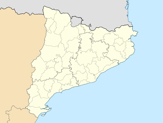 El Perelló Location in Catalonia | |||
| Coordinates: 40°52′36″N 0°42′47″E / 40.87667°N 0.71306°ECoordinates: 40°52′36″N 0°42′47″E / 40.87667°N 0.71306°E | |||
| Country |
| ||
| Community |
| ||
| Province | Tarragona | ||
| Comarca | Baix Ebre | ||
| Government | |||
| • Mayor | Ferran Cid Martí (2015)[1] | ||
| Area[2] | |||
| • Total | 100.7 km2 (38.9 sq mi) | ||
| Elevation | 142 m (466 ft) | ||
| Population (2014)[1] | |||
| • Total | 3,155 | ||
| • Density | 31/km2 (81/sq mi) | ||
| Demonym(s) | Perellonenc, perellonenca | ||
| Website |
www | ||


El Perelló is a municipality in the comarca of the Baix Ebre in Catalonia, Spain. It is situated in the north of the comarca, below the Boix and Cabrafeixet ranges. The N-340 road runs around the town, and connects it with the A-7 autopista at l'Ampolla.
Demography
The municipality of l'Ampolla formed part of el Perelló until 1990: their combined population as of 2007 is 2895. Populations below are for the territory of el Perelló as defined at the date given.
| 1900 | 1930 | 1950 | 1970 | 1986 | 2007 |
|---|---|---|---|---|---|
| 4134 | 4408 | 4149 | 3556 | 3713 | 2895 |
References
- 1 2 "Ajuntament del Perelló". Generalitat of Catalonia. Retrieved 2015-11-13.
- ↑ "El municipi en xifres: El Perelló". Statistical Institute of Catalonia. Retrieved 2015-11-23.
- Panareda Clopés, Josep Maria; Rios Calvet, Jaume; Rabella Vives, Josep Maria (1989). Guia de Catalunya, Barcelona:Caixa de Catalunya. ISBN 84-87135-01-3 (Spanish). ISBN 84-87135-02-1 (Catalan).
External links
![]() Media related to El Perelló at Wikimedia Commons
Media related to El Perelló at Wikimedia Commons
- Official website (Catalan)
- Information - Generalitat de Catalunya (Catalan)
- Statistical information - Institut d'Estadística de Catalunya (Catalan)
 |
Tivenys | Rasquera | Tivissa | |
| Tortosa | |
L'Ametlla de Mar | ||
| ||||
| | ||||
| L'Ampolla | Balearic Sea |
Municipalities of Baix Ebre | ||
|---|---|---|
This article is issued from Wikipedia - version of the 1/25/2016. The text is available under the Creative Commons Attribution/Share Alike but additional terms may apply for the media files.