El Cielo Biosphere
The El Cielo Biosphere (Reserva de la Biosfera El Cielo in Spanish) is located in the southern part of the Mexican state of Tamaulipas. The biosphere protects the northernmost extension of tropical forest and cloud forest in Mexico. It has an area of 144,530 hectares (357,100 acres) (558 square miles) made up mostly of steep mountains rising from about 200 metres (660 ft) to a maximum altitude of more than 2,300 metres (7,500 ft).[1]
The state of Tamaulipas created the biosphere in 1985. In 1987 it was recognized by UNESCO's Man and the Biosphere Programme.[2]

History
The El Cielo area attracted little attention until the 1930s. In 1935, A Canadian farmer and horticulturalist named John William Francis (Frank, Francisco, or Pancho) Harrison established a homestead he named Rancho El Cielo at 1,140 metres (3,740 ft) elevation in the cloud forest. Extensive logging and logging roads penetrated the area in the 1950s. Enthusiastic birdwatchers found their way to Harrison's small ranch and in 1965, to protect the ecosystem, Harrison transferred his land to a non-profit corporation in cooperation with Texas Southmost College and the Gorgas Science Foundation, In 1966, Harrison was murdered in a land dispute with local farmers.[3]
Harrison's farm is now the El Cielo Biological Research Center. In 1983, the Gorgas Science Foundation established Rancho El Cielito by purchasing land along the Sabinas River, just outside the Biosphere, to preserve part of a riparian ecosystem.[4]
Geography
The 144,530 hectares (357,100 acres) biosphere has two core areas in which most human travel and exploitation are prohibited. One of 7,844 hectares (19,380 acres) protects tropical forests; the larger core area of 28,674 hectares (70,850 acres) includes a cross section of the altitudes and climates of the biosphere, especially the cloud forest. The remainder of the biosphere is a buffer zone in which human activities, including limited logging, is permitted. Several communities within the biosphere offer facilities for visitors and are reachable by road.[5] An ecological interpretive center is reached by paved road a few miles west of the town of Gomez Farias. The interpretive center, located at an elevation of 360 metres (1,180 ft) offers good views of the tropical forest and facilities for visitors.[6]
The biosphere occupies portions of four Mexican municipalities in the state of Tamaulipas: Jaumave, Llera de Canales. Gómez Farías, and Ocampo. Within the biosphere are 26 ejidos (hamlets with communal land) and about 8,000 hectares (20,000 acres) of agricultural land used mostly to cultivate corn, beans, and rice.[7] The principal access is a road, initially paved, from the town of Gomez Farias into the interior and higher elevations of the biosphere. The community of Alta Cima (also known as Altas Cimas), at an elevation of 910 metres (2,990 ft) has modest lodging and restaurants for visitors. Camping is allowed.
The highest point in the biosphere is 7,719 feet (2,353 m) located at 23 14N, 99 30W.[8] The lowest elevations are about 200 metres (660 ft) at the eastern, northern, and southern borders of the biosphere. The biosphere is characterized by steep, north-south trending mountain ranges, eastern extensions of the Sierra Madre Oriental, made up of limestone. Typical of karst topography, caves, sinkholes, and rock outcrops are common.[9]
Flora
Several distinct vegetation types are found in the biosphere. Vegetation in the drier northern and western portions of the biosphere up to an elevation of 1,600 metres (5,200 ft) consists of desert and semi-desert shrublands, the montane Tamaulipan matorral and the lowland Tamaulipan mezquital. Shrubs and small trees generally do not exceed 5 metres (16 ft) in height except in riparian locations. Annual precipitation in the shrublands is less than 1,000 millimetres (39 in).[10]
In the eastern part of the biosphere, sub-tropical semi-deciduous forests (Veracruz moist forests) are found at elevations of from 200 metres (660 ft) and 800 metres (2,600 ft) above sea level. The closed canopy forests averages about 20 metres (66 ft) in height. Annual precipitation of this zone is usually from 1,100 millimetres (43 in) to more than 1,800 millimetres (71 in).[11]
The principal reason for the establishment of the Biosphere was the prevalence of Cloud forests, distinguished by heavy precipitation, foggy conditions, and abundant mosses and fungi, at elevations of 800 metres (2,600 ft) to 1,400 metres (4,600 ft). The El Cielo cloud forests receive precipitation of about 2,500 millimetres (98 in) annually. The closed canopy forests reach a height of about 30 metres (98 ft).
Oak forests, (Sierra Madre Oriental pine-oak forests), mixed oak-pine forest, and pine forests are found at elevations of 700 metres (2,300 ft) to the top of highest summits in the biosphere. These forested highland areas are drier than the cloud forests with an average precipitation of 850 millimetres (33 in) annually.[12][13]
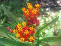
All of the vegetation types have a wet season from May to October and a dry season from November to April. More than 1,000 species of vegetation have been recorded from the cloud forests consisting of 56 percent tropical species, 20 percent temperate, 19 percent cosmopolitan, and 5 percent other. Included among the vegetation are species associated with the temperate climate of the eastern United States such as maple (Acer skutchii), hickory (Carya ovata), hornbeam (Carpinus caroliniana), and redbud (Cercis canadensis).[14]
A botanical garden and arboretum is located in Alta Cima at an elevation of 800 metres (2,600 ft).[15]
Fauna
Six species of cats, none abundant, are found in the biosphere: jaguar, mountain lion, ocelot, margay, jaguarundi, and bobcat. A small population of black bears is present.
At least 255 species of birds are resident in the biosphere preserve and more than 175 migratory species have been recorded. Both birds and mammals are a mixture of temperate and tropical species.[16]
Climate
The climate of Gomez Farias at the eastern entrance to the park is typical of the lower and wetter elevations of the biosphere. Higher elevations are substantially cooler and precipitation declines rapidly on the western slopes of the mountains. The town of Jaumave, Tamaulipas at the northwestern entrance to the biosphere receives only 17.9 inches (450 mm) of precipitation annually and has a semi-arid, near-desert climate. Freezing temperatures are rare at the lower elevations of El Cielo, but common in winter at elevations of more than 1,000 metres (3,300 ft)
| Climate data for Gomez Farias, Tamaulipas. 23 03 N, 99 09W. Elevation: 327 metres (1,073 ft) | |||||||||||||
|---|---|---|---|---|---|---|---|---|---|---|---|---|---|
| Month | Jan | Feb | Mar | Apr | May | Jun | Jul | Aug | Sep | Oct | Nov | Dec | Year |
| Average high °C (°F) | 22.5 (72.5) |
24.7 (76.5) |
28.3 (82.9) |
30.9 (87.6) |
32.2 (90) |
32.2 (90) |
31.7 (89.1) |
32.3 (90.1) |
30.8 (87.4) |
28.7 (83.7) |
25.9 (78.6) |
22.9 (73.2) |
28.6 (83.5) |
| Daily mean °C (°F) | 17.3 (63.1) |
19.1 (66.4) |
22.3 (72.1) |
24.9 (76.8) |
26.7 (80.1) |
27.0 (80.6) |
26.8 (80.2) |
27.1 (80.8) |
26.0 (78.8) |
23.9 (75) |
20.9 (69.6) |
18.9 (66) |
23.3 (73.9) |
| Average low °C (°F) | 12.2 (54) |
13.4 (56.1) |
16.4 (61.5) |
18.9 (66) |
21.3 (70.3) |
21.9 (71.4) |
21.8 (71.2) |
21.9 (71.4) |
21.2 (70.2) |
19.0 (66.2) |
16.0 (60.8) |
13.1 (55.6) |
16.1 (61) |
| Average precipitation mm (inches) | 31 (1.22) |
30 (1.18) |
47 (1.85) |
77 (3.03) |
172 (6.77) |
323 (12.72) |
365 (14.37) |
270 (10.63) |
289 (11.38) |
153 (6.02) |
50 (1.97) |
39 (1.54) |
1,847 (72.72) |
| Source: Weatherbase: Gomez Farias, Tamaulipas.[17] | |||||||||||||
References
- ↑ Comision Nacional para el Conocimiento y Uso de la Biodiversidad, http://www2.inecc.gob.mx/publicaciones/libros/2/cielo.html, accessed 18 Dec 2014
- ↑ "Gomez Farias Region and El Cielo Biosphere Reserve", http://www.botany.si.edu/projects/cpd/ma/ma9.htm, accessed 18 Dec 2014
- ↑ Webster, Fred and Marie S. The Road to El Cielo, Austin: University of Texas Press, 2001, pp. 113-118; "Gomez Farias Region and El Cielo Biosphere Reserve", http://www.botany.si.edu/projects/cpd/ma/ma9.htm, accessed 18 Dec 2014
- ↑ "Rancho El Cielo and Rancho El Cielito", Gorgas Science Foundation http://www.gsfinc.org/focus/mexico, accessed 23 Dec 2014
- ↑ Sosa Florescano, Alejandra, "El Cielo: A Reserve Teeming with Life" http://www.revistascisan.unam.mx/Voices/pdfs/6822.pdf, accessed 18 Dec 2014
- ↑ Google Earth
- ↑ Comision Nacional para el Conocimiento y Uso de la Biodiversidad, http://www2.inecc.gob.mx/publicaciones/libros/2/cielo.html, accessed 18 Dec 2014
- ↑ Google Earth
- ↑ "Gomez Farias Region and El Cielo Biosphere Reserve", http://www.botany.si.edu/projects/cpd/ma/ma9.htm, accessed 18 Dec 2014
- ↑ "Tamaulipan Matorral" http://www.worldwildlife.org/ecoregions/na1311, accessed 18 Dec 2014
- ↑ "Veracruz Moist Forests" http://www.worldwildlife.org/ecoregions/nt0176, accessed 18 Dec 2014
- ↑ Comision Nacional para el Conocimiento y Uso de la Biodiversidad, http://www2.inecc.gob.mx/publicaciones/libros/2/cielo.html, accessed 18 Dec 2014
- ↑ Downey, Patricia J.; Hellgren, Eric C.; Caso, Arturo; Carvajal, Sasha; Frangioso, Kerri (2007). "Hair Snares for Noninvasive Sampling of Felids in North America: Do Gray Foxes Affect Success?". Journal of Wildlife Management. 71 (6): 2090–2094. doi:10.2193/2006-500.
- ↑ "Gomez Farias Region and El Cielo Biosphere Reserve", http://www.botany.si.edu/projects/cpd/ma/ma9.htm, accessed 18 Dec 2014
- ↑ "Botanical Gardens Conservation International" http://www.bgci.org/garden.php?id=3594&ftrCountry=MX&ftrKeyword=&ftrBGCImem=&ftrIAReg=, accessed 22 Dec 2014
- ↑ Comision Nacional para el Conocimiento y Uso de la Biodiversidad, http://www2.inecc.gob.mx/publicaciones/libros/2/cielo.html, accessed 18 Dec 2014
- ↑ http://www.weatherbase.com/weather/weather.php3?s=928136&cityname=G%F3mez-Far%EDas-Tamaulipas-Mexico&units=metric , accessed 18 December 2014
Coordinates: 22°54′00″N 99°09′36″W / 22.9000°N 99.1600°W