Ejeda
| Ejeda | |
|---|---|
 Ejeda Location in Madagascar | |
| Coordinates: 24°21′S 44°31′E / 24.350°S 44.517°E | |
| Country |
|
| Region | Atsimo-Andrefana |
| District | Ampanihy |
| Elevation[1] | 235 m (771 ft) |
| Population (2001)[2] | |
| • Total | 37,000 |
| • Ethnicities | Mahafaly |
| Time zone | EAT (UTC3) |
Ejeda is a town and commune (Malagasy: kaominina) in southwestern Madagascar. It belongs to the district of Ampanihy, which is a part of Atsimo-Andrefana Region.
It is situated at the Route nationale 10 that crosses the Linta River near Ejeda.
The population of the commune was estimated to be approximately 37,000 in 2001 commune census.[2]
Ejeda is served by a local airport. Primary and junior level secondary education are available in town. The town provides access to hospital services to its citizens.[2]
The majority 60% of the population of the commune are farmers, while an additional 35% receives their livelihood from raising livestock. The most important crop is maize, while other important products are peanuts, cassava and chickpea. Services provide employment for 5% of the population.[2]
References and notes
- ↑ Estimated based on DEM data from Shuttle Radar Topography Mission
- 1 2 3 4 "ILO census data". Cornell University. 2002. Retrieved 2008-03-11.
| Ampanihy | 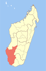 | |
|---|---|---|
| Ankazoabo | ||
| Benenitra | ||
| Beroroha | ||
| Betioky Sud | ||
| Morombe |
| |
| Sakaraha | ||
| Toliara I | ||
| Toliara II | ||
Coordinates: 24°21′S 44°31′E / 24.350°S 44.517°E