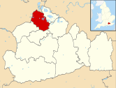
Egham Hythe
| Egham Hythe | |
.jpg) The Swan Inn |
|
 One of the large modern business, storage, industrial and retail premises on The Causeway |
|
 Egham Hythe |
|
| Area | 1.91 km2 (0.74 sq mi) |
|---|---|
| Population | 6,474 (2011. Runnymede Ward)[1] |
| – density | 3,390/km2 (8,800/sq mi) |
| OS grid reference | TQ025705 |
| – London | 17.8 mi (28.6 km) |
| District | Runnymede |
| Shire county | Surrey |
| Region | South East |
| Country | England |
| Sovereign state | United Kingdom |
| Post town | STAINES-UPON-THAMES |
| Postcode district | TW18 |
| Dialling code | 01784 |
| Police | Surrey |
| Fire | Surrey |
| Ambulance | South East Coast |
| EU Parliament | South East England |
| UK Parliament | Runnymede and Weybridge |
Coordinates: 51°25′26″N 0°31′26″W / 51.424°N 0.524°W
Egham Hythe is a ward historically only in Egham, split into two post towns in Surrey, England. It is on the south bank of the River Thames between Runnymede and Thorpe and has a road to junction 13 of the M25, the Causeway, hosting major businesses. Its northern half, as such, has many of the largest businesses of north Surrey and its southern half includes the largely residential locality Pooley Green.
Egham Hythe is west south-west of Charing Cross and has been bypassed by the A30 since the 1950s. Egham Hythe has Staines Boat Club and four pubs. It has a large riverside inn and hotel facing the inn, in a conservation area known as the Hythe, meaning port in Old and Middle English. One end of Staines Bridge, a 'local road' crossing of the river, connects Egham Hythe to Staines and the Thames Path crosses from one bank to the other.
History
The Abbey and the causeway
In the centuries around the time of the Norman Conquest the tything of the Hythe, which belonged to Chertsey Abbey, supported only shepherd's tenements and lowly agriculture dwellings due to flooding quite often by the river Thames. The consistent use of the Hythe in ecclesiastical records, Assize Rolls and feet of fines denotes that Anglo-Saxon speakers ran an inland port here, as hythe means port in Old and Middle English.[2] The other three Egham tythings were:
- Town
- Strode (later also known as Stroude)
- Englefield[3]
A water-mill known as Trumpes Mill on the stream marking with border of Thorpe in about 1500 was granted with the manor of Mylton or Middleton occupying most of the tything that was not common land to the college of Corpus Christi; tithes from it to the value of 21s. 4d (equivalent to £629 in 2015 based on rough 1323 annual rent calculations) remained due to the almoner of Chertsey Abbey until the Dissolution in 1537. The last long lessee of the manor, still somewhat intact, was Priscilla Edgell who married Richard Wyatt in 1766, their surnames giving rise to the current names of streets.[4]
Thomas de Oxenford to protect many fields fields, even Chertsey from common winter deluge and summer flash flooding at his own expense constructed the great Egham Causeway, leading from the town of Egham to the bridge of Staines, in the time of Henry III to be used as a highway and as a dyke (embankment), which prevented the inundation of "all the surrounding country" by the River Thames as caused regularly following prolonged heavy rainfall. In 1350 a royal commission was appointed to find the persons responsible for the repair of the causeway, damaged by flood, but decided that none was so responsible.[3] By 1385 the Sheriff of Surrey was irked by the Causeway's condition and ordered by public proclamation:
...that all persons, ecclesiastical as well as secular, shall each, according to the extent of his holding, cause the same to be repaired with all haste.[3]
Before the century was finished, Chertsey Abbey frequently undertook the repair out of charity and the Abbot found himself in his words of 1395, charged with its repair by "the malevolent instigation of adversaries" and he prayed for a better settlement. Using the large passing trade of Staines Bridge various ordinary people in the 15th century were bound to keep up the Causeway including Thomas Stanes, John Edmed, William Mulso in return for being given the right to levy tolls (grants of pontage).[3] The character of the partly Tudor street has been protected by the designation of a conservation area and the building in the 19th century of Staines Bridge directly upstream of it rather than being its main street as it was before that reconstruction.[5][6]
19th century enclosure of the common
One of the two significant commons of Egham here known as Hythefield, was stated to be in Stevenson's 1809 survey[7] more highly rent-able than most such common of Surrey[3] were it to be made private, was enclosed on 12 June 1817 – to this day two large publicly administered allotments provide fertile soil in the Pooley Green locality for tomato and vegetable growers who wish to hire these, subject to a waiting list.[8]
Industrialisation/commercialisation
A gradual increase in housing and population was boosted by the building of the railway in the 1850s with stations at neighbouring Egham and Staines. The lack of forest and elevated views assisted its subdivision, most of Egham was a flat former flood plain below its western hills – in 1911 six large private Egham estates are listed, all in the west of the parish.[3]
Egham Hythe gained its first school in the 1880s and its own parish church, having separated from Egham's in 1930. Much of the campaigning and financial support for the church came from local resident and entrepreneur Edward Budgen.
Though Egham Hythe suffered a particularly severe flood in 1947, the population increased in the period 1951–1961, forming always approximately a third of the homes of the old civil (secular) parish of Egham disbanded in 1965, the population of which rose from 22,241 to 30,571 however the definition of Egham as a local unit at the time included Thorpe, ant the whole rose from 7,786 acres (3,151 ha) to 9,350 acres (3,780 ha) in the same period, or 37.84 km².[9]
Economy
Industry has played an important role in the northernmost part of Egham Hythe since the 19th century due to the historic prominence of the Causeway as the route out of London for all passing traffic on the WSW axis, since superseded by alternative routes, the A30 and M3. Nonetheless the motorway connection makes the road very well-connected to these and to the M4. Prior to the Second World War the area was home to Lagonda, the motorcar manufacturers. The Lagonda site was later taken over by Petters Limited and is a Sainsbury's supermarket.
In commerce, research and industry the Causeway has the large headquarters of Centrica and their UK operation British Gas as well as a Veolia Water production centre and office headquarters. Current owners and tenants of business park premises include: Fujitsu Siemens, Dataserv, Gartner, Acton Bright Steel (metals for construction), Halfords, Salesforce.com, Future Electronics, Homebase and Cala Homes.
Amenities
.jpg)
Schools
Egham Hythe has two primary schools (Thorpe Lea School and The Hythe School) and the area's academy-status secondary school – The Magna Carta School and a start-of-21st century community centre.
Schools Egham Hythe Primary School, which I believe was built in Victorian times was located opposite St Pauls Church to the right of The Community Centre which was built in 1960 ish, at around the same time that the new Secondary School was built opposite and to the right of St Pauls Church. The old primary school was converted into new housing and apartments in the late 1990s, but the school buildings exterior walls and roof were retained. I started my schooling at Egham Hythe Primary School in 1957 and attended until 1961, when I had to graduate to Stepgates Secondary School in Chertsey.
Religion
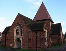
Its churches include High but modern Anglicanism (St Paul's)[10] Methodism (Wendover Road church)[11] and a Pentecostal fellowship. St John of Rochester Roman Catholic church.[12] In Staines a wider range of religions have their own places of community and worship.
Thorpe Hay Meadow
Egham Hythe provides access to Thorpe Hay Meadow, one of the few surviving example of unimproved grassland on Thames Gravel in Surrey.[13] It has been managed by Surrey Wildlife Trust since 1988. This 16-acre (6.5 ha) site contains at least 157 different plant species. It is managed to encourage biodiversity.
Demography
The proportion of households in Egham Hythe who owned their home outright was 11.2% below the regional average. The proportion who owned their home with a loan was 4.1% higher than the regional average; providing overall a greater proportion than average of rented residential property and of social housing, and above to the average in Surrey and Runnymede and slightly higher than the national average; a third, 539 households were rented directly from the local authority in 2011.[1]
| Output area | Population | Households | % Owned outright | % Owned with a loan | hectares[1] |
|---|---|---|---|---|---|
| Egham Hythe (ward) | 6,474 | 1,640 | 21.3 | 39.2 | 191[1] |
Local government
At Surrey County Council, one of the 81 representatives represents the area within the Egham division.[14]
At Runnymede Borough Council all wards of the borough are deemed appropriate to be represented under the current constitution of councillors by three councillors.[15]
| Election | Member[15] |
Ward | |
|---|---|---|---|
| 2010 | Jill Warner | Egham Hythe | |
| 2011 | Yvonna Lay | Egham Hythe | |
| 2012 | Jonathan Wilson | Egham Hythe | |
| Election | Member[16] |
Electoral Division | |
|---|---|---|---|
| 2013 | Yvonna Lay | Egham | |
References
- 1 2 3 4 Key Statistics; Quick Statistics: Population Density United Kingdom Census 2011 Office for National Statistics Retrieved 20 November 2013
- ↑ Hythe (definition at wiktionary)
- 1 2 3 4 5 6 H.E. Malden (editor) (1911). "Parishes: Egham". A History of the County of Surrey: Volume 3. Institute of Historical Research. Retrieved 20 November 2013.
- ↑ Grid square map Ordnance survey website
- ↑ Egham Hythe Conservation Area Runnymede Borough Council
- ↑ OS Map with Listed Buildings and Parks marked
- ↑ Stevenson, View of the Agriculture of Surrey (1809)
- ↑ Runnymede Borough Council
- ↑ A vision of Britain The University of Portsmouth and others. Retrieved 20 November 2013
- ↑ Egham Hythe, St Paul the Church of England Retrieved 20 November 2013
- ↑ Wendover Road Methodist Church Retrieved 20 November 2013
- ↑ Egham Community Churches and Religious Matters Retrieved 20 November 2013
- ↑ Surrey Wildlife Trust
- ↑ Electoral Divisions Surrey County Council. Retrieved 6 November 2013
- 1 2 Your local councillors Runnymede Borough Council . Retrieved 20 November 2013
- ↑ Your Councillor Surrey County Council. Retrieved 6 November 2013
External links
- St Paul's, Egham Hythe (see history page)
- Egham-by-Runnymede Historical Society
- Map of the parish of Egham Hythe
- Map and statistics for the electoral ward of Egham Hythe
| Towns, villages and neighbourhoods |
|  | ||||||||||||||
|---|---|---|---|---|---|---|---|---|---|---|---|---|---|---|---|---|
| Notable parks | ||||||||||||||||
| Churches | ||||||||||||||||
| Education | ||||||||||||||||
| Transport |
| |||||||||||||||
| Buildings and structures | ||||||||||||||||
| Sports |
| |||||||||||||||
Places listed are articles notable as settlements, arranged by post town | ||||||||||||||||