Eenhana
| Eenhana | |
|---|---|
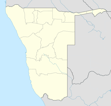 Eenhana Location in Namibia | |
| Coordinates: 17°27′57″S 16°20′13″E / 17.46583°S 16.33694°ECoordinates: 17°27′57″S 16°20′13″E / 17.46583°S 16.33694°E | |
| Country |
|
| Region | Ohangwena Region |
| Government | |
| • Mayor | Julia Shikongo |
| • Town Council CEO | Walde Ndevashiya |
| Population (2011)[1] | |
| • Total | 5,528 |
| Time zone | West Africa Time (UTC+1) |
| Climate | BSh |
Eenhana (IPA: [ɛːˈn̥ana]) is the capital town of the Ohangwena Region, northern Namibia, on the border with Angola. It also used to be a mission station of the Finnish Missionary Society.
Eenhana is situated in a subtropical forest. It is connected to the road network and has a well-developed infrastructure. Due to the proximity of Angola, many businesses are situated here. The town hosts a trade fair every year.
The name of the Eenhana comes from the word calves in Oshikwanyama and is a reference to the calves that used to water at the small water pan where Eenhana is now located.[2]
History
Eenhana was founded around New Year's Day 1930 by the Reverend Paulus Hamutenya (d. 1932). He was one of the first seven Ovambos to be ordained pastors in Oniipa, Ovamboland, in 1925 by the director of the Finnish Missionary Society, Matti Tarkkanen.[3]
Hamutenya had earlier lived in Edundja, where he had built a church. However, the area became crowded, and he decided to found a new settlement for the Oukwanyama people in the woods, 60 km to the east of Engela. Oukwanyamans from Angola had already begun to move in that area. The South West African government made Hamutenya the local head of the tribesmen of Eastern Oukwanyama.
In 1932, Hamutenya built a church in Eenhana, but the same year he died, after a short illness.[4]
The Eenhana mission station was founded by the nurse Linda Helenius in 1936. Eenhana thus became the centre of medical care in Eastern Oukwanyama for several decades. Teacher Suoma Hirvonen soon joined Helenius on this new mission station.[5]
Before Namibian independence it was a military centre of the South African Defence Force without public infrastructure. It was proclaimed a settlement in 1992, and a town in 1999.
Trade
The town attempts to attract businesses to the town through business exhibitions, small and medium enterprises and tourism activities. Eenhana Town Council hosts an annual trade fair since 2008.[6] It is investing into marketing activities directed at investors and is assisting business development by developing open markets and providing business skills.[7]
Education
Eenhana is the home to six schools, three primary, one special school and two secondary:
- Eenhana Primary School
- Paulus Hamuntenya Primary School
- Haimbili Haufiku Senior Secondary School
- Usko Nghaamwa Special School
- Eenhana Junior Secondary School
- Nanhapo Primary School (the most recent of these schools)
Other education institutions include:
- the University of Namibia's Centre for External Studies
- Tate Institute of Technology
- Glowdom Educational Foundation
- NAMCOL Centre
- Eenhana Vocational Training Centre
Politics
Eenhana is governed by a town council that currently has seven seats.[8]
Tourism
Eenhana is the location of at least five mass graves of People's Liberation Army of Namibia (PLAN) guerrillas killed by South African forces during the Namibian War of Independence.[9] In 2008 the government built the Eenhana Memorial Shrine for those people which is situated on the northern part of the town.
The Eenhana Memorial Shrine[10] was opened in 2007 during a ceremony with President Hifikepunye Pohamba. It was built by China State Construction Engineering Corp at a cost of N$ 5 million and commemorates the "women and men who sacrificed their lives for the freedom of the country; who died while liberating Namibia from colonialism".[11] In January 2011, it was called a "white elephant" by the state-run New Era newspaper due to a lack of interest by tourists.[11] The site curator at the site noted that the National Heritage Council of Namibia has done less to advertise the site well.
Eenhana is however connected to one of the prominent tourism route; the extension of the Trans-Caprivi Highway which passes through the town connecting Eenhana to Rundu, Katima Mulilo and Victoria Falls/Livingstone in the east and to Ruacana and Epupa falls on the west via Okalongo Outapi road. Other attractions include the Oukwanyama Kingdom and King Mandume Museum at Omhedi, a Community Conservancy at Omauni in the Okongo District as well as the Ondeshifiilwa Memorial site.
Twin town
.svg.png) Harelbeke, Belgium
Harelbeke, Belgium
References
- ↑ "Table 4.2.2 Urban population by Census years (2001 and 2011)" (PDF). Namibia 2011 - Population and Housing Census Main Report. Namibia Statistics Agency. p. 39. Retrieved 24 August 2016.
- ↑ Eenhama Town Council About us
- ↑ Peltola 1958, p. 212.
- ↑ Peltola 1958, p. 212, 232.
- ↑ Peltola 1958, p. 232.
- ↑ "SBN supports Eenhana Trade and Business Expo". Die Republikein. 8 June 2010.
- ↑ Heita, Desie (8 April 2009). "Eenhana on Massive Marketing Drive". New Era. Retrieved 28 Sep 2010.
- ↑ "Know Your Local Authority". Election Watch (3). Institute for Public Policy Research. 2015. p. 4.
- ↑ Biles, Peter (13 January 2006). "Unearthing the past in Namibia". BBC.
- ↑ "National Heritage Council of Namibia"
- 1 2 Shrine unknown New Era, 24 January 2011