Edgerton Highway
| |
|---|---|
| Route information | |
| Maintained by Alaska DOT&PF | |
| Length: | 34 mi (54 km) |
| Major junctions | |
| West end: |
|
| East end: | McCarthy Road in Chitina |
| Highway system | |

The Edgerton Highway is a minor highway in the U.S. state of Alaska that extends 33 miles (53 km) from the Richardson Highway near Copper Center to the town of Chitina. The McCarthy Road, within the Wrangell-Saint Elias National Park and Preserve, is a 58-mile (93 km) extension from Chitina to McCarthy.[1]
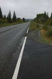
The Edgerton Highway, named for U.S. Army Major General Glen Edgar Edgerton, a member of the Alaska Road Commission, follows an old pack trail along the Copper River, and is paved. The popular dip-net salmon fishery in Chitina causes the highway to be fairly heavily used in summer. It is part of Alaska Route 10.
Route description
The Edgerton Highway begins at its junction with the Richardson Highway at Pippin Lake in the rural community of Kenny Lake. The highway travels east-northeast through rural Kenny Lake before reaching an intersection with the Old Edgerton Highway and turning southeast.[2] The highway continues through several miles of forest along the Copper River, crossing several small affluents.[2] The roadway passes the Chitina Airport, ending at its junction with the McCarthy Road after passing through the ghost town of Chitina.[2]
Major junctions
The entire route is in Valdez-Cordova Borough.
| Location | mi[3] | km | Destinations | Notes | |
|---|---|---|---|---|---|
| Kenny Lake | 0.000 | 0.000 | Western terminus | ||
| 7.252 | 11.671 | Old Edgerton Highway | |||
| Chitina | 33.320 | 53.623 | Copper River Spur | ||
| 34.970 | 56.279 | McCarthy Road | Eastern terminus. Highway continues east as McCarthy Road | ||
| 1.000 mi = 1.609 km; 1.000 km = 0.621 mi | |||||
References
- ↑ "Edgerton Highway (AK 10) & Chitina." alaskajourney.com. Accessed 23 March 2012.
- 1 2 3 Google (May 31, 2012). "Map of Edgerton Highway" (Map). Google Maps. Google. Retrieved May 31, 2012.
- ↑ Birkholz, Ethan (2010). Annual Traffic Volume Report (PDF) (Report) (2008-2009-2010 ed.). Alaska Department of Transportation & Public Facilities. Route Number 210000. Retrieved May 31, 2012.