Eastern Desert
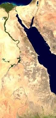
The Nile River and the Eastern Desert.
The Eastern Desert is the section of Sahara Desert east of the Nile River, between the river and the Red Sea.[1][2] It extends from Egypt in the north to Eritrea in the south, and also comprises parts of Sudan and Ethiopia.
Features
The Eastern Desert's main geographic features are the western Red Sea coastline—with the "Red Sea Riviera"—and the Eastern Desert mountain range that runs along the coast, the highest peak of which is Shaiyb al-Banat (2,187 m). Other notable ecological areas are Wadi Gamal National Park and Gebel Elba. The Eastern Desert is a popular setting for safaris and other excursions.
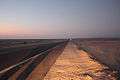
Gallery
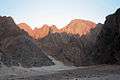
 Early morning with the Eastern Desert mountain range on the horizon
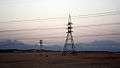
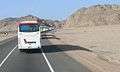 Tourist bus in the Eastern Desert
See also
| Wikimedia Commons has media related to Eastern Desert. |
References
External links
Coordinates: 27°18′N 32°36′E / 27.300°N 32.600°E
This article is issued from Wikipedia - version of the 11/25/2016. The text is available under the Creative Commons Attribution/Share Alike but additional terms may apply for the media files.