East St. Louis, Illinois
| East St. Louis | |
| City | |
| Country | United States |
|---|---|
| State | Illinois |
| County | St. Clair |
| Coordinates | 38°37′N 90°8′W / 38.617°N 90.133°WCoordinates: 38°37′N 90°8′W / 38.617°N 90.133°W |
| Area | 14.37 sq mi (37.22 km2) |
| - land | 13.99 sq mi (36 km2) |
| - water | 0.38 sq mi (1 km2), 2.64% |
| Population | 27,006 (2010) |
| Density | 1,929/sq mi (744.8/km2) |
| Founded | June 6, 1820 |
| - Incorporated | February 16, 1865[1] |
| Government | Council-Manager |
| Mayor | Emeka Jackson-Hicks |
| Timezone | CST (UTC-6) |
| - summer (DST) | CDT (UTC-5) |
| Postal code | 62201–62207 |
| Area code | 618 |
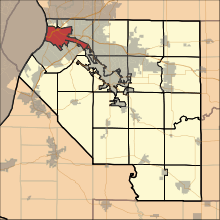
 Location in St. Clair County and the state of Illinois.
| |
.svg.png) Location of Illinois in the United States
| |
| Website: www.cesl.us | |
East St. Louis is a city in St. Clair County, Illinois, United States, directly across the Mississippi River from St. Louis, Missouri, in the Metro-East region of Southern Illinois. As of the 2010 census, the city had a total population of 27,006, less than one-third of its peak of 82,366 in 1950. Like many larger industrial cities, it has been severely affected by loss of jobs in the restructuring of the railroad industry and de-industrialization of the Rust Belt in the second half of the 20th century. In 1950, East St. Louis was the fourth largest city in Illinois.
One of the highlights of the city's waterfront is the Gateway Geyser, the second-tallest fountain in the world. Designed to complement the Gateway Arch across the river in St. Louis, it shoots water to a height of 630 feet (190 m), the same height as the Arch.
History
Native Americans had long inhabited both sides of the Mississippi River. The Mississippian culture rulers organized thousands of workers to construct villages and complex earthwork mounds at what later became St. Louis and East St. Louis, as well as the urban complex of Cahokia to the north of East St. Louis within present-day Collinsville, Illinois. Before the Civil War, settlers reported up to 50 mounds in the area that became East St. Louis, but most were lost to 19th-century development and later roadbuilding.
East St. Louis lies within the American Bottom area of the present day Metro-East area of St. Louis, Missouri. This name was given after the United States acquired the Louisiana Purchase in 1803, and European Americans began to settle in the area. The village was first named "Illinoistown".
East St. Louis was founded in 1797 by Captain James Piggott, a Revolutionary War veteran. In that year Piggott began operating a ferry service across the Mississippi River, connecting Illinoistown with St. Louis. When Piggott died in 1799, his widow sold the ferry business, moved to St. Louis County and remarried. Famed actress Virginia Mayo (Virginia Clara Jones) was a great great granddaughter of Captain Piggott.[2]
The municipality called East St. Louis was established on April 1, 1861. Illinoistown residents voted on a new name that day, and 183 voted to rename the town East St. Louis. Though it started as a small town, East St. Louis soon grew to a larger city at the center of a growing economy in St. Louis, which was the fourth largest city in the United States in 1870.[3]
Great Railroad Strike of 1877
A period of extensive industrial growth followed the American Civil War. Industries located in East St. Louis to make use of the local availability of Illinois coal as fuel. Another early industry was meatpacking and stockyards, concentrated in one area to limit their nuisance to other jurisdictions.
In the expansion, many businessmen became overextended in credit, and a major economic collapse followed the Panic of 1873. This was due to railroad and other manufacturing expansion, land speculation and general business optimism caused by large profits from inflation. The economic recession began in the East and steadily moved west, severely crippling the railroads, the main system of transportation. In response to the difficulties, railroad companies began dramatically lowering workers' wages, forcing employees to work without pay, and cutting jobs and the amount of paid work hours. These wage cuts and additional money-saving tactics used by the industry prompted strikes and unrest on a massive scale.
While most of the strikes in the eastern cities during 1877 were accompanied by violence, the late July 1877 St. Louis strike was marked by a bloodless and quick take-over by dissatisfied workers. By July 22, the St. Louis Commune began to take shape, as representatives from almost all the railroad lines met in East St. Louis. They soon elected an executive committee to command the strike and issued General Order No. 1, halting all railroad traffic other than passenger and mail trains. John Bowman, the mayor of East St. Louis, was appointed arbitrator of the committee. He helped the committee select special police to guard the property of the railroads from damage. The strike and the new de facto workers' government, while given encouragement by the largely German-American Workingmen's Party and the Knights of Labor (two key players in the organization of the Missouri general strike), were run by no organized labor group.
The strike closed packing industry houses surrounding the National Stock Yards. At one plant, workers allowed processing of 125 cattle in return for 500 cans of beef for the workers. Though the East St. Louis strike continued in an orderly fashion, across the river there were isolated incidents of violence. Harry Eastman, the East St. Louis workers' representative, addressed the mass of employees:
"Go home to your different wards and organize your different unions, but don't keep coming up here in great bodies and stirring up excitement. Ask the Mayor, as we did, to close up all the saloons... keep sober and orderly, and when you are organized, apply to the United Workingmen for orders. Don't plunder ... don't interfere with the railroads here ... let us attend to that".[4]
The strikers held the railroads and city for about a week, without the violence that took place in Chicago and other cities. On July 28 US troops took over the Relay Depot, the Commune's command center, and the strike ended peacefully.[5]
The Great Cyclone of 1896
On May 27, 1896, a tornado struck St. Louis and East St. Louis that remains the deadliest event in the area because of the amount of people it injured or killed in such a short time. In approximately twenty minutes, the 1896 St. Louis–East St. Louis tornado killed 137 people in St. Louis and 118 in East St. Louis. The tornado's destruction spanned ten miles, including into the railyards and commercial districts of East St. Louis. During the storm, 311 buildings were destroyed and 7,200 others were severely damaged. The cost of this loss was estimated to be 10 to 12 million dollars. In 1896 this was a considerable amount of money, as a two-story brick home could be purchased at that time for a mere $1,500.[6]
East St. Louis Riots of 1917
East St. Louis in 1917 had a strong industrial economy boosted by World War I, where late 19th and early 20th-century European immigrants worked. Many workers entered the military, and other workers went on strike. As the war prevented immigration from Europe, major companies recruited black workers from the South to work at the Aluminum Ore Company and the American Steel Company. They were available because the US Army initially rejected many black volunteers in the years before an integrated military.[7] This was also the period of the first Great Migration of African Americans leaving poor rural areas of the South to go to the industrial cities and jobs of the North and the Midwest.
Resentment on both sides and the arrival of new workers created fears for job security at a time of union organizing and labor unrest, and raised social tensions. At a white labor meeting on May 28, men traded rumors of fraternizing between black men and white women. Three thousand ethnic white men left the meeting and headed as a mob for the downtown, where they randomly attacked black men on the street. They destroyed buildings and physically attacked people; they "killed a 14-year-old boy and scalped his mother. Before it was over 244 buildings were destroyed.".[8] The governor called in National Guard to prevent further rioting, but rumors continued to circulate about an organized retaliation from the blacks.
On July 1, 1917, a black man attacked a white man. Whites drove by black homes near 17th and Market and fired shots into several of them, shooting in retaliation. When police came to investigate the gathering of a large group of local residents, several in the crowd at 10th and Bond fired on the police, killing two detectives. The next morning, thousands of whites mobbed the black section of town. The rioters burned entire sections of the city and shot blacks as they escaped the flames. They also lynched several blacks.
Although the governor had called in the National Guard to try to control the situation, several accounts reported that they joined in the rioting. The mob included "ten or 15 white women, [who] chased a negro woman at the Relay Depot in broad daylight. The girls were brandishing clubs and calling upon the men to kill the woman."2 The woman was a known prostitute who had white customers.
Though official reports suggested that the East St. Louis race riot resulted in the deaths of 39 African Americans and 9 whites, other estimates put the figure much higher.[9]
W.E.B. DuBois came to investigate the riots personally and Congress also held an investigation.[3]
20th and 21st centuries
East St. Louis was named an All-America City in 1960 and celebrated its centennial in 1961. It was known as the "Pittsburgh of the West."[3] Its population reached a peak of 82,366 residents in the 1950 census. In 1950, it was the fourth largest city in Illinois. Through the 1950s and later, the city's musicians were an integral creative force in blues, rock and roll and jazz. Some left and achieved national recognition, such as Ike & Tina Turner and the jazz great Miles Davis, who was born in nearby Alton and grew up in East St. Louis. The 1999 PBS series River of Song featured these musicians in its coverage of music of cities along the Mississippi River.

The city suffered from the mid-century deindustrialization and railroad restructuring. As a number of local factories began to close because of changes in industry, the railroad and meatpacking industries also were cutting back and moving jobs out of the region. This led to a precipitous loss of working and middle-class jobs. The city's financial conditions deteriorated. Elected in 1951, Mayor Alvin Fields tried funding measures that resulted in raising the city's bonded indebtedness and the property tax rate. More businesses closed as workers left the area to seek jobs in other regions. More established white workers had an easier time gaining jobs in other localities, and the city demographics became increasingly black. Crime increased. "Brownfields" (areas with environmental contamination by heavy industry) have made redevelopment more difficult and expensive.

Street gangs appeared in city neighborhoods. Like other cities with endemic problems by the 1960s, violence added to residential mistrust and adversely affected the downtown retail base and the city's income.
The construction of freeways also contributed to East St. Louis' decline. They were constructed through and broke up functioning neighborhoods and community networks, adding to the social disruption of the period. The freeways made it easier for residents to commute back and forth from suburban homes, so the wealthier people have moved out to newer housing. East St. Louis adopted a number of programs to try to reverse decline: the Model Cities program, the Concentrated Employment Program, and Operation Breakthrough. The programs were not enough to offset the loss of industrial jobs due to national restructuring.
In 1971, James Williams was elected as the city's first black mayor. Faced with the overwhelming economic problems, he was unable to make much of a difference. In 1979, when Carl Officer was elected as mayor (the youngest in the country at that time at age 25), many said the city had nowhere to go but up, yet things grew worse. Middle-class citizens continued to leave the city. People who could get jobs simply left for places with work and a decent quality of life. Lacking sufficient tax revenues, the city cut back on maintenance, sewers failed and garbage pickup ceased. Police cars and radios stopped working. The East St. Louis Fire Department went on strike in the 1970s.
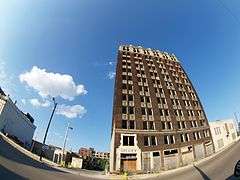
Structure fires had destroyed such a significant number of consecutive blocks that the director of the post-Armageddon film Escape from New York chose this city as a shooting location for his film about a society that had been destroyed. [10][11]
In the 1980s, the state imposed a financial advisory board to manage the city in exchange for a financial bailout. State legislative approval in 1990 of riverboat gambling and the installation of the Casino Queen riverboat casino provided the first new source of income for the city in nearly 30 years. In 1991 Gordon Bush was elected mayor.
Several major industries operating in the area have achieved separate incorporation as jurisdictions of the land where their plants are sited. These communities have virtually no residents, and the shell jurisdictions are outside the tax base of East St. Louis. Residents of the city, however, suffer from contaminated air and other adverse environmental effects of these sites. At the same time, the city's tax base is too poor for it to maintain its infrastructure, including the sanitary sewers, many of which have broken and overflowed in residential neighborhoods and schools.[12]
Since 2000, the city has completed several redevelopment projects: in 2001 it opened a new library and built a new city hall. Public-private partnerships have resulted in a variety of new retail developments, housing initiatives, and the St. Louis MetroLink light rail, which have sparked renewal.
The city, now small in terms of population, has drastic urban blight. Sections of "urban prairie" can be found where vacant buildings have been torn down and whole blocks have become overgrown with vegetation. Much of the territory surrounding the city remains undeveloped, bypassed by developers who chose more affluent suburban areas. Many old, "inner city" neighborhoods abut large swaths of corn and soybean fields or otherwise vacant land. In addition to agricultural uses, a number of truck stops, strip clubs, and semi-rural businesses surround blighted areas in the city.
In 2010, the East St. Louis community gardening movement began to develop plots for "urban farming", as has been done in North St. Louis.[13] Inspired by Detroit's planned use of vacant land for green development, community associations, nonprofits and universities have collaborated to spark green development in East St. Louis.[14]
Archeological remains
In the early 1990s, archeological surveys and excavations prior to construction of Interstate 55/70 revealed evidence of important prehistoric structures in the East St. Louis area. Both sides of the river were reported to have had numerous mounds when Europeans first settled in the area, but most in St. Louis and on the east side were lost to development.
Illinois researchers discovered the remains of several earthwork mounds. In the East St. Louis area, 50 mounds had been mapped before the Civil War, and seven remain visible today. The largest is estimated to have been originally 40 feet high and would have nearly covered a football field. Around the remains of this mound, researchers have discovered burial mounds, a large plaza, a wooden defensive palisade and several other Mississippian structures. These indicate that it was a ritual center. The 500-acre prehistoric site is now called the East St. Louis Mound Center. The state and University of Illinois are trying to develop coordinated projects with East St. Louis and businesses to use the mounds and artifacts as attractions for heritage tourism.[15]
It was built by the Mississippian culture, which reached its peak in the region about AD 1100–1200 at the nearby major center of Cahokia, a designated UNESCO World Heritage Site within the present-day boundaries of Collinsville. It is about five miles from East St. Louis.
In 2012, archeological work prior to construction of the Stan Musial Bridge across the Mississippi discovered artifacts and evidence of a formerly unidentified 900-year-old suburb of Cahokia in present-day East St. Louis. This site had not been mapped in the 19th century, and was unknown. The Mississippian culture site is located in a present industrial wasteland. Researchers found evidence of more than 1,000 dwellings and the base of an earthen pyramidal mound. It would have been one of dozens of mounds when the community was active, based on the size of the residential population of this site. Discovery of the site led scholars to increase their estimates of the total population of the Mississippians at Cahokia and in the area, now thought to have been about 20,000. They did not have the time to excavate the entire area, which is on private land and subject to risk of destruction by development.[16]
Geography
East St. Louis is located at 38°37′N 90°8′W / 38.617°N 90.133°W (38.616,-90.133).
According to the 2010 census, East St. Louis has a total area of 14.37 square miles (37.22 km2), of which 13.99 square miles (36.23 km2) (or 97.36%) is land and 0.38 square miles (0.98 km2) (or 2.64%) is water.[17]
East St. Louis usually experiences cold winters and hot summers. On July 14, 1954 the temperature at East St. Louis reached 117 °F (48 °C), the highest temperature ever recorded in Illinois.
Transportation
East St. Louis is home to four St. Louis MetroLink stations; East Riverfront, 5th & Missouri, Emerson Park, and JJK Center.
Interstate 55, Interstate 64, Interstate 70, and U.S. Route 40 run through East St. Louis and are linked to St. Louis by the Poplar Street Bridge and Stan Musial Bridge. Prior to its decommissioning, the fabled U.S. Route 66 also shared a concurrency with these Interstate highways. In addition, U.S. Route 50 also shared a concurrency prior to its being rerouted to run concurrently with Interstate 255.
Demographics
| Historical population | |||
|---|---|---|---|
| Census | Pop. | %± | |
| 1870 | 5,044 | — | |
| 1880 | 9,185 | 82.1% | |
| 1890 | 15,169 | 65.1% | |
| 1900 | 29,734 | 96.0% | |
| 1910 | 58,540 | 96.9% | |
| 1920 | 66,785 | 14.1% | |
| 1930 | 74,397 | 11.4% | |
| 1940 | 75,603 | 1.6% | |
| 1950 | 82,366 | 8.9% | |
| 1960 | 81,728 | −0.8% | |
| 1970 | 70,029 | −14.3% | |
| 1980 | 55,239 | −21.1% | |
| 1990 | 40,921 | −25.9% | |
| 2000 | 31,542 | −22.9% | |
| 2010 | 27,006 | −14.4% | |
| Est. 2015 | 26,790 | [18] | −0.8% |
As of the census[20] of 2000, there were 31,542 people, 11,178 households, and 7,668 families residing in the city. The population density is 2,242.9 people per square mile (866.2/km²). There are 12,899 housing units at an average density of 917.2 per square mile (354.2/km²). The racial makeup of the city was 97.74% Black or African-American, 1.23% White, 0.19% Native American, 0.08% Asian-American, 0.03% Pacific Islander, 0.19% from other races, and 0.55% from two or more races. Hispanic or Latino of any race were 0.73% of the population.
There were 11,178 households out of which 33.2% had children under the age of 18 living with them, 21.9% were married couples living together, 40.6% had a female householder with no husband present, and 31.4% were non-families. 27.8% of all households were made up of individuals and 10.4% had someone living alone who was 65 years of age or older. The average household size was 3.80 and the average family size was 4.02.
In the city the population was spread out with 32.8% under the age of 18, 9.7% from 18 to 24, 24.6% from 25 to 44, 20.3% from 45 to 64, and 12.5% who were 65 years of age or older. The median age was 31 years. For every 100 females there were 81.5 males. For every 100 females age 18 and over, there were 72.5 males.
The median income for a household in the city was $21,324, and the median income for a family was $24,567. Males had a median income of $27,864 versus $21,850 for females. The per capita income for the city was $11,169. About 31.8% of families and 35.1% of the population were below the poverty line, including 48.6% of those under the age of 18 and 25.2% of those 65 ages and older.
Government and infrastructure
Several social services organizations operate in East St. Louis including Lessie Bates Davis Neighborhood House, Catholic Urban League, Christian Activity Center, and The Delta Childcare Center of Delta Sigma Theta sorority, East Saint Louis Alumnae Chapter.
The Southwestern Illinois Correctional Center, operated by the Illinois Department of Corrections, is near East St. Louis.[21]
Fire department
The city of East St. Louis is protected by the 53 paid, professional firefighters of the city of East St. Louis Fire Department. The East St. Louis Fire Department is divided into 3 divisions of operations: Administration, Firefighting/Hazard Mitigation, and Fire Prevention/Arson Investigation. The department currently operates out of 3 Fire Stations, located throughout the city: Engine 422 located at 17th St. and Lincoln Ave., Engine 425 located at 17th St. and Central Ave., and Engine 426 located at 72nd St. and State St. The current Chief of Department is Jason Blackmon.[22][23]
The East St. Louis Fire Department has been struggling over the past 25 years with budget cuts. Some 22 firefighters were scheduled to be laid off by May 2013. The department had 18 Captains, 18 Lieutenants, and 17 Firefighters. According to a National Fire Report, approximately 49 percent of all emergency calls the East St. Louis Fire Department responds to are structural fires.[22][24]
Education
The city is served by the East St. Louis School District 189 .
All residents are zoned to East St. Louis High School.
Formerly East St. Louis Lincoln High School served portions of the city.
Notable people
Media
One television station is licensed to, but does not operate from, the city; Ion Television affiliate WRBU (Channel 46), which serves the entire St. Louis market. In the past, it served as St. Louis's UPN and MyNetworkTV affiliate. On FM, sports station WXOS (101.1) and non-commercial Contemporary Christian music station WCBW (89.7) are licensed to East St. Louis, along with news/talk station KFTK (1490) on AM.
Crime
East St. Louis is not only one of the most violent cities in the United States, but it continuously ranks among the world's most dangerous cities. According to FBI's data of 2007, the murder rate of East St. Louis hit 101.9 per population of 100,000, surpassing that of cities such as Gary, Indiana (48.3 per pop. 100,000); New Orleans, Louisiana (94.7); Baltimore, Maryland (43.3); and Detroit, Michigan (47.3); as well as that of its neighbor St. Louis (37.2). FBI data shows East St. Louis' rate of rape exceeded 250 per population of 100,000. In 2014 the murder rate of city of East St. Louis was higher than that of Honduras, the country with the highest murder rate in the world, at 90.4 per 100,000 people.[25] In 2016, NeighborhoodScout released rankings indicating that East St. Louis had the highest murder rate of any city in the United States.[26]
The following table shows East St. Louis' crime rate in six categories that Morgan Quitno uses for its calculation for "America's most dangerous cities" ranking, in comparison to the national average:[27] Year: 2006 number of crimes per 100,000.
| Crime | East St. Louis | National average |
|---|---|---|
| Murder | 101.9 | 5.6 |
| Rape | 251.3 | 32.2 |
| Robbery | 1,347.0 | 195.4 |
| Assault | 5,847.3 | 340.1 |
| Burglary | 2,442.8 | 814.5 |
| Automobile theft | 2,067.5 | 526.5 |
References
- ↑ http://www.cesl.us/admin/upload_file/2016%20Budget%20and%20Three-Year%20Financial%20Plan.pdf
- ↑ Meier, Jenee. "Alumnus' book highlights history of East St. Louis". Southern Illinois University at Edwardsville. Retrieved July 25, 2007.
- 1 2 3 Nunes, Bill; Theising, Andrew (2011). East St. Louis. Charleston, South Carolina: Arcadia Publishing.
- ↑ Burbank, David T. (1966). Reign of the Rabble: The St. Louis General Strike of 1877. p. 74.
- ↑ , University of Illinois, Urbana-Champaign
- ↑ Curzon, Julian (1997). The Great Cyclone at St. Louis and East St. Louis, May 27, 1896. SIU Press.
- ↑ "A Chronology of African American Military Service: From WWI through WWII"
- ↑ Jonathan Kozol, Savage Inequalities, p. 22
- ↑ "Race Riot". Eslarp.uiuc.edu. July 2, 1998. Retrieved September 3, 2013.
- ↑ Beeler, Michael. "Escape from N.Y.: Filming the Original". Cinefantastique.
- ↑ Maronie, Samuel J. (May 1981). "From Forbidden Planet to Escape from New York: A candid conversation with SFX & production designer Joe Alves". Starlog. Retrieved March 10, 2007.
- ↑ Jonathan Kozol, "Life on the Mississippi: East St. Louis, Illinois", excerpted from Savage Inequalities, hosted at Third World Traveler, accessed April 2, 2015
- ↑ Eastside Gardens, Official website
- ↑ The Epoch Times
- ↑ William Allen And John G. Carlton, "Much evidence of Mississippian culture has succumbed to bulldozer and plow", St. Louis Post-Dispatch, January 9, 2000, Retrieved October 31 2010
- ↑ Veronique LaCapra, "Ancient suburb near St. Louis could be lost forever", St. Louis Public Radio, June 2, 2012, accessed April 2, 2015
- ↑ "G001 - Geographic Identifiers - 2010 Census Summary File 1". United States Census Bureau. Retrieved 2015-12-27.
- ↑ "Annual Estimates of the Resident Population for Incorporated Places: April 1, 2010 to July 1, 2015". Retrieved July 2, 2016.
- ↑ "Census of Population and Housing". Census.gov. Retrieved June 4, 2015.
- ↑ "American FactFinder". United States Census Bureau. Retrieved January 31, 2008.
- ↑ "Southwestern Illinois Correctional Center." Illinois Department of Corrections. Retrieved July 10, 2010.
- 1 2 ":: Welcome to City of East St.Louis ::". Cesl.us. Retrieved September 3, 2013.
- ↑ http://www.eslfire.com/#!services1/c8az
- ↑ American Military University (March 12, 2013). "Video: East St. Louis Fire Dept. showcases budget cut challenges". Firerescue1.com. Retrieved September 3, 2013.
- ↑ "Honduras, Venezuela have world's highest murder rates: U.N.". April 10, 2014 – via Reuters.
- ↑ "Top 30 Highest Murder Rate Cities in the U.S. 2016 - NeighborhoodScout".
- ↑ "East St. Louis, Illinois (IL 62205) profile: population, maps, real estate, averages, homes, statistics, relocation, travel, jobs, hospitals, schools, crime, moving, houses, news, sex offenders".
- Heaps, Willard Allison. "Target of Prejudice: The Negro". Riots, U.S.A., 1765–1970. New York: The Seabury Press, 1970. 108–117.
- Kozol, Jonathan. "Life on the Mississippi". Savage Inequalities: Children in America's Schools. Crown, 1991. 7–39. ISBN 0-517-58221-X
- "Race Rioters Fire East St. Louis and Shoot or Hang Many Negroes; Dead Estimated at from 20 to 76". The New York Times, July 3, 1917.
External links
| Wikimedia Commons has media related to East St. Louis, Illinois. |
| Wikivoyage has a travel guide for East St. Louis. |
| Counties |  | |
|---|---|---|
| Major Cities (25,000+) | ||
| Cities (5,000-25,000) | ||
| Villages and Towns (1,000-5,000) |
| |
| Interstates in the Metro-East | ||
| Airports/Military Bases | ||
| List of Colleges in the Metro-East | ||
| Sports teams based in the Metro East |
| |
Municipalities and communities of St. Clair County, Illinois, United States | ||
|---|---|---|
| Cities | ||
| Villages | ||
| Townships | ||
| CDPs | ||
| Other unincorporated communities | ||
| Footnotes | ‡This populated place also has portions in an adjacent county or counties | |
| Topics |  | |
|---|---|---|
| Central city | ||
| Largest cities (over 50,000 in 2010) | ||
| Medium-sized cities (over 20,000 in 2010) | ||
| Largest towns and villages (over 10,000 in 2010) |
| |
| Missouri Counties | ||
| Illinois Counties | ||
| Subregions | ||
| Counties | 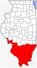 | |
|---|---|---|
| Mid-sized cities (25,000+) | ||
| Small Cities (10,000-25,000) | ||
| Small Cities (5,000-10,000) | ||
| Interstates | ||
| Airports/Military bases |
| |
| Universities | ||
| Colleges | ||
| Sports teams based in the Southern Illinois | ||