Middlebury, Vermont
| Middlebury, Vermont | ||
|---|---|---|
| Town | ||
|
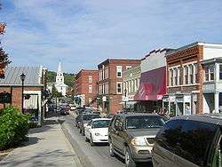
Main Street | ||
| ||
 Middlebury, Vermont | ||
 Middlebury, Vermont Location in the United States | ||
| Coordinates: 44°0′7″N 73°8′44″W / 44.00194°N 73.14556°WCoordinates: 44°0′7″N 73°8′44″W / 44.00194°N 73.14556°W | ||
| Country | United States | |
| State | Vermont | |
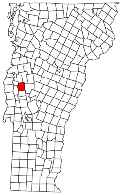
| County | Addison | |
| Chartered | 1761 | |
| Area | ||
| • Total | 39.2 sq mi (101.6 km2) | |
| • Land | 38.8 sq mi (100.6 km2) | |
| • Water | 0.4 sq mi (1.0 km2) | |
| Elevation | 427 ft (130 m) | |
| Population (2010) | ||
| • Total | 8,496 | |
| • Density | 219/sq mi (84.5/km2) | |
| Time zone | Eastern (EST) (UTC-5) | |
| • Summer (DST) | EDT (UTC-4) | |
| ZIP code | 05753 | |
| Area code(s) | 802 | |
| FIPS code | 50-44350[1] | |
| GNIS feature ID | 1462146[2] | |
| Website |
www | |

Middlebury is the shire town[3] (county seat[4]) of Addison County, Vermont, United States. The population was 8,496 at the 2010 census.[5] Middlebury is home to Middlebury College and the Henry Sheldon Museum of Vermont History.
History

One of the New Hampshire Grants, Middlebury was chartered by Colonial Governor Benning Wentworth on November 2, 1761. The name "Middlebury" came from its location between the towns of Salisbury and New Haven.[6] It was awarded to John Evarts and 62 others. The French and Indian Wars ended in 1763, and the first settlers arrived in 1766. John Chipman was the first to clear his land, Lot Seven.[7] During the Revolutionary War, much of the town was burned in Carleton's Raid on November 6, 1778. After the war concluded in 1783, settlers returned to rebuild homes, clear forests and establish farms. Principal crops were grains and hay.
Landowners vied for the lucrative honor of having the village center grow on their properties. A survey dispute with Salisbury led to the forfeiture of Gamaliel Painter's farm to that town, and his transition from farming to developing Middlebury Village near his and Abisha Washburn's mill, together with other mills that surrounded the Otter Creek falls. Industries would include a cotton factory, sawmill, gristmill, pail factory, paper mill, woolen factory, iron foundry, and marble quarry. The Rutland & Burlington Railroad first arrived on September 1, 1849. Around 1830, Middlebury was the second largest town in Vermont.
Middlebury College, one of the United States' elite liberal arts colleges, was founded here in 1800. It is a member of the NESCAC. In the summer, the town plays host to the annual Middlebury College Language Schools, as well as the college's Bread Loaf Writers' Conference, the oldest surviving conference of its kind in the nation.
On October 22, 2007, central Middlebury was evacuated for a short time because of a train derailment; the Middlebury Union Middle School served as the evacuation headquarters.
Today, as the largest town by population in Addison County, Middlebury serves as the commercial and business center for the region. Downtown hosts a three-screen movie theater, the post office, and two historic inns, as well as many shops and restaurants. There is considerable development along U.S. Route 7 heading south of town, including Shaw's and Hannaford supermarkets, two drugstores, most of the town's gas stations, and several fast-food spots. Of note is Middlebury's A&W, Vermont's only remaining car-hop restaurant and a popular spot with both locals and Middlebury College students. Along with A&W, fast food restaurants in Middlebury include a McDonald's, a Dunkin' Donuts, and a Subway.
Geography
Middlebury is located near the center of Addison County in western Vermont. The town is drained by Otter Creek, which flows from south to north along the western edge of the town, with the falls at the center of the village. The Middlebury River flows west to Otter Creek out of the mountains. Chipman Hill, a hill of glacial till, rises 450 feet (140 m) above the village just to the northeast. Foothills of the Green Mountains border the town to the east, with the Champlain Valley to the west.
According to the United States Census Bureau, the town has a total area of 39.2 square miles (101.6 km2), of which 38.8 square miles (100.6 km2) is land and 0.39 square miles (1.0 km2), or 1.00%, is water.[5]
Middlebury is crossed by U.S. Route 7, Vermont Route 23, Vermont Route 30, Vermont Route 116, and Vermont Route 125. It is bordered by the towns of New Haven and Bristol to the north, Ripton to the east, Cornwall and Weybridge to the west, and Salisbury to the south. A new bridge over Otter Creek connecting Cross Street to Bakery Lane opened in November 2010 to serve as a shortcut and alleviate traffic through downtown.[8] The village of East Middlebury is located in the southern part of the town, east of U.S. Route 7.
Climate
This climatic region is typified by large seasonal temperature differences, with warm to hot (and often humid) summers and cold (sometimes severely cold) winters. According to the Köppen Climate Classification system, Middlebury has a humid continental climate, abbreviated "Dfb" on climate maps.[9]
Demographics
| Historical population | |||
|---|---|---|---|
| Census | Pop. | %± | |
| 1790 | 395 | — | |
| 1800 | 1,263 | 219.7% | |
| 1810 | 2,138 | 69.3% | |
| 1820 | 2,535 | 18.6% | |
| 1830 | 3,468 | 36.8% | |
| 1840 | 3,162 | −8.8% | |
| 1850 | 3,517 | 11.2% | |
| 1860 | 2,879 | −18.1% | |
| 1870 | 3,086 | 7.2% | |
| 1880 | 2,993 | −3.0% | |
| 1890 | 2,793 | −6.7% | |
| 1900 | 3,045 | 9.0% | |
| 1910 | 2,848 | −6.5% | |
| 1920 | 2,914 | 2.3% | |
| 1930 | 2,968 | 1.9% | |
| 1940 | 3,175 | 7.0% | |
| 1950 | 4,778 | 50.5% | |
| 1960 | 5,305 | 11.0% | |
| 1970 | 6,532 | 23.1% | |
| 1980 | 7,574 | 16.0% | |
| 1990 | 8,034 | 6.1% | |
| 2000 | 8,183 | 1.9% | |
| 2010 | 8,496 | 3.8% | |
| Est. 2015 | 8,557 | [10] | 0.7% |
| U.S. Decennial Census[11] | |||
As of the census[1] of 2010, there were 8,494 people, 2,860 households, and 1,642 families residing in the town. The population density was 209.7 people per square mile (80.9/km2). There were 2,805 housing units at an average density of 71.9 per square mile (27.7/km2). The racial makeup of the town was 90.3% White, 1.3% Black or African American, 0.2% Native American, 4.3% Asian, 0.02% Pacific Islander, 0.66% from other races, and 3.0% from two or more races. Hispanic or Latino of any race were 3.0% of the population.[12]
There were 2,657 households out of which 27.7% had children under the age of 18 living with them, 44.6% were couples living together and joined in either marriage or civil union, 10.4% had a female householder with no husband present, and 42.3% were non-families. 35.3% of all households were made up of individuals and 14.4% had someone living alone who was 65 years of age or older. The average household size was 2.24 and the average family size was 2.90.

In the town the population was spread out with 17.5% under the age of 18, 31.4% from 18 to 24, 18.6% from 25 to 44, 19.3% from 45 to 64, and 13.3% who were 65 years of age or older. The median age was 27 years. For every 100 females there were 90.7 males. For every 100 females age 18 and over, there were 87.5 males.
The median income for a household in the town was $37,723, and the median income for a family was $46,691. Males had a median income of $32,645 versus $25,994 for females. The per capita income for the town was $17,926. About 5.3% of families and 9.6% of the population were below the poverty line, including 8.2% of those under age 18 and 6.1% of those age 65 or over.
Education
Public
- Mary Hogan Elementary, Grades K–6
- Middlebury Union Middle School, Grades 7–8
- Middlebury Union High School, Grades 9–12
 Middlebury College campus
 - P.A Hannaford Career Center, Regional Technical Center serving grades 9-12 and adults
Private
- The Aurora School (kindergarten and elementary)
- Bridge School (elementary)
- St. Mary's Catholic Elementary School
- The Gailer School – closed 2012
Higher education
- Community College of Vermont – Middlebury campus
- Middlebury College
Transportation
Air
The Middlebury State Airport is located in the town for private aviation. Commercial airlines are available at Burlington International Airport to the north and Rutland Southern Vermont Regional Airport to the south.
Bus

Bus service is provided by Addison County Transit Resources (ACTR). In addition, Premier Coach provides an intercity bus line in a joint venture effort with Greyhound via Vermont Translines on its Albany, NY to Burlington, Vermont route with stops in Rutland and Bennington as well. Service on this route began June 9, 2014.[13][14]
Highway
 U.S. Route 7 is the primary north/south highway through the town. It is known as Court Street south of the village, and North Pleasant Street north of the village.
 Vermont Route 23 is a north/south highway known as Weybridge Street and is located on the west side of town, crossing the college campus.
 Vermont Route 30 is a north/south highway entering the town on the south town line with Cornwall and ends at Route 7. It is known as Main Street within the town.
 Vermont Route 116 is a north/south highway located on the east side of town, ending near the East Middlebury village at Route 7. It is known as Case Street in Middlebury except for a short portion known as Ossie Road within the East Middlebury village.
 Vermont Route 125 is an east/west highway entering the town on the west side through Middlebury College where it is known as College Street. East of Route 7, Route 125 is known as East Main Street up until it exits the town at the Ripton town line.
Medical care

Middlebury and the surrounding area (Addison County) are served by Porter Medical Center.[15]
Notable people
- Julia Alvarez, author
- Robert B. Bates, Speaker of the Vermont House of Representatives[16]
- Joseph Battell, publisher and philanthropist
- Ricardo Chávez Castañeda, author
- Thomas Treadwell Davis, US congressman[17]
- John Deere, inventor and manufacturer
- James Rood Doolittle, US senator from Wisconsin
- Jim Douglas, 80th governor of Vermont
- Ray Fisher, professional baseball pitcher and college coach[17]
- Robert Frost (1874-1963), poet
- Peter J. Hincks, Vermont State Treasurer[18]
- Ronald D. Liebowitz, president of Middlebury College
- Gabriel Mann, actor and former model[17]
- Samuel Mattocks, Vermont State Treasurer and father of Governor John Mattocks
- Tomas Coyne, man child, follower of Cleisthenes.
- John M. McCardell, Jr., president emeritus and professor at Middlebury College
- Bill McKibben, author and environmentalist
- James Meacham, US congressman
- Gamaliel Painter, local politician and town leader
- Edward John Phelps, lawyer and diplomat
- Samuel S. Phelps, US senator
- William H. Porter, banker
- Steven C. Rockefeller, religion professor and son of Nelson Aldrich Rockefeller
- Patricia Ross, cross country skier
- Horatio Seymour, US senator
- Patty Sheehan, golfer[17]
- William Slade, US congressman and 17th Governor of Vermont
- David Allen Smalley, judge
- John Wolcott Stewart, US senator and congressman[17]
- Charles M. Swift, lawyer, businessman, founder of Meralco and several railroads [19]
- Hilary Swift, Photojournalist
- John P. Townsend, financier of the Gilded Age[17]
- Arthur Trudeau, Army general and Ufologist[20]
- James M. Warner, manufacturer and general[17]
- Emma Willard, women's rights advocate and school founder
- Isaac Wilson, US congressman
Points of interest

- Middlebury State Airport
- Otter Creek Brewing
- Emma Willard Memorial
- Middlebury to Her Soldiers (sculpture)
- Woodchuck Hard Cider
- Ilsley Public Library
- TAM – Trail Around Middlebury[21]
In popular culture
- A shot of Middlebury appears as stock footage, standing in for a fictional Pennsylvania town, in the 30 Rock episode "Episode 210".
- Middlebury College was mentioned briefly in the film "American Graffiti".
- The bridge over the waterfall appears in the film Me, Myself & Irene.
- A shot of the Waybury Inn in East Middlebury was used in the opening of the TV series Newhart. In addition, scenes of the town are also occasionally shown in the series.
- Snake Jailbird of The Simpsons is a notable alumnus of Middlebury College, having turned to a life of crime to pay his student loans.
References
- 1 2 "American FactFinder". United States Census Bureau. Retrieved 2008-01-31.
- ↑ "US Board on Geographic Names". United States Geological Survey. 2007-10-25. Retrieved 2008-01-31.
- ↑ Title 24, Part I, Chapter 1, §2, Vermont Statutes. Accessed 2007-11-01.
- ↑ "Find a County". National Association of Counties. Retrieved 2011-06-07.
- 1 2 "Geographic Identifiers: 2010 Demographic Profile Data (G001): Middlebury town, Addison County, Vermont". U.S. Census Bureau, American Factfinder. Retrieved August 29, 2013.
- ↑ "Profile for Middlebury, Vermont, VT". ePodunk. Retrieved June 24, 2014.
- ↑ Glenn M. Andres. "A Walking History of Middlebury".
- ↑ Middlebury Celebrates New Bridge
- ↑ Climate Summary for Middlebury, Vermont
- ↑ "Middlebury town, Addison County, Vermont". United States Census Bureau. Retrieved 11 June 2016.
- ↑ "U.S. Decennial Census". United States Census Bureau. Retrieved May 16, 2015.
- ↑ "Middlebury town, Addison County, Vermont". United States Census Bureau. Retrieved 11 June 2016.
- ↑ New Vermont Bus Service Coming Soon, My Champlain Valley. Retrieved 2014-07-23.
- ↑ Bus Service VT NH NY, Vermont Translines. Retrieved 2014-07-25.
- ↑ Porter Medical Center, Middlebury, VT. Portermedical.org. Retrieved on 2014-04-12.
- ↑ Educational aid society (1915). American College and Private School Directory, Volume 8. Educational aid society. p. 64. Retrieved 25 June 2014.
- 1 2 3 4 5 6 7 "Middlebury, Vermont". City-Data.com. Retrieved June 25, 2014.
- ↑ "Peter Hincks, State Treasurer, Dies at 85". Bennington Banner. Bennington, VT. United Press International. July 8, 1968. p. 14. (subscription required (help)).
- ↑ Albers, Jan. "Museum Offers a Look into the Life of local Jewel, Jessica Swift". Henry Sheldon Museum of Vermont History. Retrieved 18 November 2015.
- ↑ "Middlebury, Vermont". City-Data.com. Retrieved June 25, 2014.
- ↑ "The Trail Around Middlebury & North Country National Scenic Trail". Middlebury Area Land Trust. Retrieved 25 March 2015.
Further reading
- A. J. Coolidge & J. B. Mansfield, A History and Description of New England; Boston, Massachusetts 1859
- Samuel Swift, History of the Town of Middlebury, Vermont; A. H. Copeland, Middlebury, Vermont 1859
External links
- Town of Middlebury official website
- Ilsley Public Library
- Middlebury College
- Middlebury Community Network
- Early Vermont Maps and Atlases – Maps of Middlebury and the region from the 18th and 19th centuries (hosted by Middlebury College)
- City-Data.com
Municipalities and communities of Addison County, Vermont, United States | ||
|---|---|---|
| City | 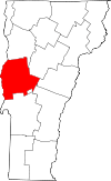 | |
| Towns | ||
| CDPs | ||
| Other communities | ||
Montpelier (capital) | |
| Regions | |
| Counties | |
| Cities | |
| Towns (pop. >5000) | |
| Festivals | |
| Topics |
|
| Society |
|