East Devon Way
Coordinates: 50°42′25″N 3°05′46″W / 50.707°N 3.096°W
| East Devon Way | |
|---|---|
|
The church at Musbury lies near the trail | |
| Length | 38 mi (61 km) |
| Location | South West England |
| Designation | UK National Trail |
| Trailheads |
Exmouth, Devon Lyme Regis, Dorset |
| Use | Hiking |

The East Devon Way is a long distance footpath in England. It runs for 38 miles between Exmouth in East Devon and Lyme Regis in Dorset.[1]
Landscapes seen on the path include; estuary, high open commons, woodlands and river valleys. The route includes some fairly steep climbs but is generally not challenging.
The path runs inland but links with the South West Coast Path at both ends. There is rail access to Exmouth via branch line from Exeter and buses serve both ends of the route.
Landscape features
- The Jurassic Coast, a 95-mile (153 km) long World Heritage Site
- River Axe
- River Coly
- River Exe estuary
- River Otter
- River Sid
- The Cobb breakwater and fossils at Lyme Regis
Places
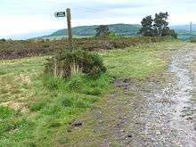
East Devon way and footpath running through the Fire Beacon Hill site
References
- ↑ "East Devon Way". Devon.gov.uk. Retrieved 2012-07-01.
External links
This article is issued from Wikipedia - version of the 7/11/2016. The text is available under the Creative Commons Attribution/Share Alike but additional terms may apply for the media files.