Dytiatky
| Dytiatky Дитятки | |
|---|---|
| Village | |
|
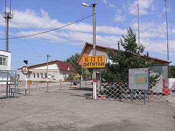
Dytiatky Checkpoint | |
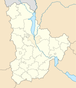 Dytiatky Location of Hornostapil in Ukraine | |
| Coordinates: 51°6′45″N 30°8′43″E / 51.11250°N 30.14528°ECoordinates: 51°6′45″N 30°8′43″E / 51.11250°N 30.14528°E | |
| Country |
|
| Oblast |
|
| Raion |
Chernobyl (1923–1988) Ivankiv (since 1988) |
| Founded | 1864 |
| Area | |
| • Total | 2.1 km2 (0.8 sq mi) |
| Elevation | 126 m (413 ft) |
| Population (2001)[1] | |
| • Total | 571 |
| Postal code | 07220 |
| Area code(s) | +380 4591 |
Dytiatky (Ukrainian: Дитятки, Russian: Дитятки, also spelled Dytyatky or Dityatki) is a Ukrainian village in the Ivankiv Raion, Kiev Oblast. As of 2001, it had a population of 571.[1]
History
The village was first mentioned in 1864. On 25 August 1941, it was occupied by Nazi German troops, and the population that left the occupied area, resisted to them. 154 villagers of those who fought on the Soviet side, were awarded with Soviet orders and medals.
Part of the former Chernobyl Raion until 1988, when it was disestablished after the 1986 nuclear accident, it is one of the few villages of this former district outside the Chernobyl Exclusion Zone.[2]
Geography
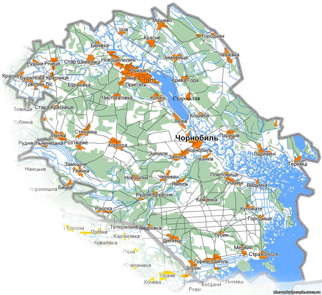
Dytiatky is located between Ivankiv (32 km) and Chernobyl (23 km), on a branch of the P02 road. It is the seat of one of the busiest checkpoints (Ukrainian: КПП Дитятки - KPP Dytyatky) to the Chernobyl Exclusion Zone, being on the main tourist route to the area and the Chernobyl Nuclear Power Plant (40 km).[3]
The village is 10 km far from Hornostaipil, 41 from Pripyat and 115 from Kiev. It is the seat of the homonym rural council, that includes the villages of Fruzynivka and Zoryn, has an area of 38 km² and a population of 1,011.[4]
Gallery
|

See also
References
- 1 2 (Ukrainian) Dytiatky on Verkhovna Rada website
- ↑ "Map of the Chernobyl Raion" (in Ukrainian). Chernobyl & Chernobylyane. Retrieved 3 December 2015.
- ↑ "Securing the Chornobyl exclusion zone against illegal movement of radioactive materials" (IRPA)
- ↑ (Ukrainian) Dytiatky Rural Council on Verkhovna Rada website
External links
![]() Media related to Dytiatky at Wikimedia Commons
Media related to Dytiatky at Wikimedia Commons
| Raions | |||||||
|---|---|---|---|---|---|---|---|
| Cities |
| ||||||
| |||||||
| People | |||||||||||
|---|---|---|---|---|---|---|---|---|---|---|---|
| Places |
| ||||||||||
| Works | |||||||||||
| Organisations | |||||||||||
| Related articles | |||||||||||
| |||||||||||