Duzduzan
| Duzduzan دوزدوزان | |
|---|---|
| town | |
 Duzduzan | |
| Coordinates: 37°56′59″N 47°07′12″E / 37.94972°N 47.12000°ECoordinates: 37°56′59″N 47°07′12″E / 37.94972°N 47.12000°E | |
| Country |
|
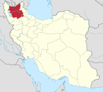
| Province | East Azerbaijan |
| County | Sarab |
| Bakhsh | Mehraban |
| Elevation | 1,687 m (5,535 ft) |
| Population (2006) | |
| • Total | 3,557 |
| Time zone | IRST (UTC+3:30) |
| • Summer (DST) | IRDT (UTC+4:30) |
| Postal code | 54911 |
| Calling code | 0432722 |
| Website | http://www.duzduzan.com/ |
Duzduzan (Persian: دوزدوزان; also Romanized as Dūzdūzān)[1] is a town in Mehraban District, Sarab County, East Azerbaijan Province, Iran. At the 2006 census, its population was 3,557, in 664 families.[2]
Geography
Duzduzan is located in the mountains of Arasbaran in north-western Iran on the highway between Ardabil and Tabriz. Although not on the river it is within the drainage basin of the Aji Chay. Because of its high elevation it has a climate that is generally cold and rainy. The town is 15 km by road east of the village of Kurdkandi and 32 km by road east of Bostanabad. Duzduzan is 37 km by road west of the city of Sarab, the county seat.
Earthquakes
The area is earthquake prone as it lies on the Duzduzan Fault, in the North Tabriz fault system,[3][4] just north of the plate boundary where the Arabian Plate is pushing against the Eurasian Plate. The town was heavily shaken in:[4]
- 1721 by the Shebli earthquake (7.3 MW)
- 1780 by the Tabriz earthquake (7.4 MW)
- 1786 by the Marand-Mishu earthquake (6.3 MW)
- 1807 by a quake on the Tasujreverse fault (5.5 MW)
- 1879 by a quake on the South Bozqush reverse fault (6.7 MW)
Economy
The people in the area depend mostly upon subsistence agriculture and livestock production, with some production of handicrafts.
References
- ↑ Duzduzan can be found at GEOnet Names Server, at this link, by opening the Advanced Search box, entering "-3061898" in the "Unique Feature Id" form, and clicking on "Search Database".
- ↑ "Census of the Islamic Republic of Iran, 1385 (2006)". Islamic Republic of Iran. Archived from the original (Excel) on 2011-11-11.
- ↑ Azad, Solaymani (2009). Seismic Hazard Assessement for Tehran, Tabriz and Zandjan Cities (Nw Iran) Based on Morphotectonics And Paleoseismology (PDF). Doctoral dissertation (in French). Montpellier, France: Montpellier 2 University. p. 61, figure 2. Archived (PDF) from the original on 24 January 2013.
- 1 2 Berberian, Manuel; Yeats, Robert S. (1999). "Patterns of historical earthquake rupture in the Iranian Plateau" (PDF). Bulletin of the Seismological Society of America. 89 (1): 120–139. Archived from the original (PDF) on 10 August 2013.
| Capital | |||||||||||||||||||||||||||||||||||||||||||||||||||
|---|---|---|---|---|---|---|---|---|---|---|---|---|---|---|---|---|---|---|---|---|---|---|---|---|---|---|---|---|---|---|---|---|---|---|---|---|---|---|---|---|---|---|---|---|---|---|---|---|---|---|---|
| Districts |
| ||||||||||||||||||||||||||||||||||||||||||||||||||