Dutton Park Place busway station
Dutton Park Place | |||||||||||
|---|---|---|---|---|---|---|---|---|---|---|---|
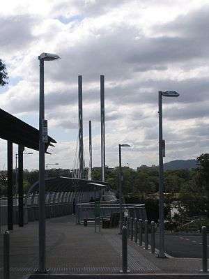 Eleanor Schonell Bridge, as viewed from Dutton Park Place, facing UQ Lakes. | |||||||||||
| Location | Eleanor Schonell Bridge, near TJ Doyle Memorial Park Drive, Dutton Park, Queensland | ||||||||||
| Coordinates | 27°29′53″S 153°01′29″E / 27.497988°S 153.024770°ECoordinates: 27°29′53″S 153°01′29″E / 27.497988°S 153.024770°E | ||||||||||
| Owned by | TransLink | ||||||||||
| Bus routes | 6[1] | ||||||||||
| Construction | |||||||||||
| Disabled access | Yes[2] | ||||||||||
| Other information | |||||||||||
| Fare zone | 2[1] | ||||||||||
| Services | |||||||||||
| |||||||||||
The Dutton Park Place busway station is a bus station in Brisbane, Queensland, and the penultimate westbound stop on TransLink's Eastern Busway.[3] Situated on the eastern bank of the Brisbane River in the suburb of Dutton Park, it forms part of the Eleanor Schonell Bridge, and connects the Busway to the University of Queensland via its busway station opposite the river. Passengers can access the station from TJ Doyle Memorial Park Drive, near the South Brisbane Cemetery, while buses can enter and exit the station independently of the Busway at the Annerley Road-Gladstone Road intersection.[4]
History
Although the Bridge was constructed in 2006, the bus stop on its eastern end at Dutton Park Place was only opened in 2009, as part of the Boggo Road Busway connecting UQ Lakes to Buranda.[5] Before opening, the proximity of the Dutton Park bus station construction works to the South Brisbane Cemetery was somewhat controversial,[6] prompting concern from Prime Minister Kevin Rudd.[7]
The bus stop acts as an important component of the environmentally friendly nature of the attached "Green Bridge".[8] It provides busway access to pedestrians and cyclists, and connects to Brisbane's lengthy bikeway network.[2]
Routes
Dutton Park Place is serviced by six TransLink routes, all of which terminate at the adjacent UQ Lakes busway station.[1] Three of these routes travel to/from Brisbane City further north, via either the Woolloongabba busway station, the RBWH busway station, or Highgate Hill and West End - the latter route is the only one to enter/exit the Eastern Busway at Dutton Park Place, rather than continuing to/from Boggo Road busway station.[4]
The other three routes reach outer Brisbane, travelling either to/from the easterly Carindale bus station, or the southerly Eight Mile Plains busway station or Sunnybank Hills.[1]
References
- 1 2 3 4 "Dutton Park Place, Dutton Park". TransLink. Retrieved 2015-09-29.
- 1 2 "Major Infrastructure: Eleanor Schonell Pedestrian/Cycling Map" (PDF). Brisbane City Council. Retrieved 2015-09-29.
- ↑ "Eastern Busway network map" (PDF). TransLink. 2013-10-14. Retrieved 2015-09-29.
- 1 2 "New turn on route 192". UQ News. 2012-05-22. Retrieved 2015-09-29.
- ↑ "Busways Project Info: Eastern Busway". Queensland Government Department of Transport and Main Roads. Retrieved 2015-09-29.
- ↑ Tony Moore (2008-05-23). "Infamous resident in grave danger". Brisbane News. Retrieved 2015-09-29.
- ↑ Tony Moore (2008-03-20). "PM intervenes in grave dispute". Brisbane News. Retrieved 2015-09-29.
- ↑ Penny McLintock (2007-05-18). "Green Bridge use 'discriminatory', spinal injuries group says". ABC News. Retrieved 2015-09-29.