Regional Municipality of Durham
| Durham Region | ||
|---|---|---|
| Regional municipality (upper-tier) | ||
| Regional Municipality of Durham | ||
| ||
| Motto: "A Great Place to Grow" | ||
 Map showing Durham Region's location in Ontario | ||
| Coordinates: 43°55′N 78°56′W / 43.917°N 78.933°WCoordinates: 43°55′N 78°56′W / 43.917°N 78.933°W | ||
| Country |
| |
| Province |
| |
| Established | 1792 (County) | |
| Established | January 1, 1974 (Regional Municipality) | |
| Seat | Whitby | |
| Government | ||
| • Chair Governing Body |
Roger Anderson Durham Regional Council | |
| Area[1] | ||
| • Land | 2,523.62 km2 (974.38 sq mi) | |
| Elevation | 91.3 m (299.5 ft) | |
| Population (2011)[1] | ||
| • Total | 608,124 | |
| • Density | 241.0/km2 (624/sq mi) | |
| Time zone | Eastern (EST) (UTC-5) | |
| • Summer (DST) | Eastern (EDT) (UTC-4) | |
| Website | www.durham.ca | |

The Regional Municipality of Durham, informally referred to as Durham Region, is a regional municipality located in Southern Ontario east of Toronto and the Regional Municipality of York, forming the east end of the Greater Toronto metropolitan area. It has an area of approximately 2,500 square kilometres. The regional government is headquartered in Whitby.
The southern portion of the region, on Lake Ontario is primarily suburban in nature, forming the eastern end of the 905 belt of suburbs around Toronto. The northern area comprises rural areas and small towns. The city of Pickering, town of Ajax and the township of Uxbridge are considerd to be part of Toronto's Census Metropolitan Area, while the communities of Oshawa, Whitby, and Clarington are part of the Oshawa's Census Metropolitan Area.
Subdivisions
Durham Region consists of the following municipalities:
- Town of Ajax
- Township of Brock
- Municipality of Clarington
- City of Oshawa
- City of Pickering
- Township of Scugog
- Township of Uxbridge
- Town of Whitby
It also contains one First Nations reserve: Mississaugas of Scugog Island First Nation.
Local government
History
The Region of Durham was established in 1974 as one of several new regional governments in the Province of Ontario, primarily in fast-growing urban and suburban areas. It encompasses areas that had been part of Ontario County and the United Counties of Northumberland and Durham, and was the culmination of a series of studies into municipal governance in the "Oshawa-Centred Region" that had begun in the late 1960s. The boundaries of the region were different than had been anticipated and from those announced in late 1972; for example, it was widely expected that Pickering would be annexed to Metropolitan Toronto, which residents had expressed preference for in a ballot question. In addition, the region was proposed to extend further east to include Hope Township and the town of Port Hope, and did not include the northern townships of Scott, Brock and Thorah.
Climate
Under the Köppen climate classification, the Durham Region has a humid continental climate (Köppen Dfb).
| Climate data for Bowmanville (Clarington) (1981−2010) | |||||||||||||
|---|---|---|---|---|---|---|---|---|---|---|---|---|---|
| Month | Jan | Feb | Mar | Apr | May | Jun | Jul | Aug | Sep | Oct | Nov | Dec | Year |
| Record high °C (°F) | 13.0 (55.4) |
12.5 (54.5) |
21.5 (70.7) |
29.0 (84.2) |
33.0 (91.4) |
33.5 (92.3) |
36.0 (96.8) |
35.0 (95) |
32.2 (90) |
26.0 (78.8) |
21.1 (70) |
17.5 (63.5) |
36.0 (96.8) |
| Average high °C (°F) | −1.4 (29.5) |
0.0 (32) |
4.3 (39.7) |
11.3 (52.3) |
18.0 (64.4) |
23.1 (73.6) |
25.8 (78.4) |
24.8 (76.6) |
20.4 (68.7) |
13.7 (56.7) |
7.2 (45) |
1.6 (34.9) |
12.4 (54.3) |
| Daily mean °C (°F) | −5.6 (21.9) |
−4.4 (24.1) |
−0.2 (31.6) |
6.4 (43.5) |
12.4 (54.3) |
17.5 (63.5) |
20.0 (68) |
19.2 (66.6) |
15.0 (59) |
8.7 (47.7) |
3.4 (38.1) |
−2.2 (28) |
7.5 (45.5) |
| Average low °C (°F) | −9.9 (14.2) |
−8.8 (16.2) |
−4.6 (23.7) |
1.5 (34.7) |
6.8 (44.2) |
11.8 (53.2) |
14.3 (57.7) |
13.5 (56.3) |
9.5 (49.1) |
3.6 (38.5) |
−0.4 (31.3) |
−6.0 (21.2) |
2.6 (36.7) |
| Record low °C (°F) | −34.0 (−29.2) |
−30.0 (−22) |
−26.0 (−14.8) |
−14.4 (6.1) |
−5.0 (23) |
−1.0 (30.2) |
2.8 (37) |
−0.5 (31.1) |
−3.3 (26.1) |
−8.3 (17.1) |
−17.8 (0) |
−34.5 (−30.1) |
−34.5 (−30.1) |
| Average precipitation mm (inches) | 63.1 (2.484) |
50.5 (1.988) |
55.0 (2.165) |
70.6 (2.78) |
75.9 (2.988) |
83.8 (3.299) |
63.2 (2.488) |
78.1 (3.075) |
98.7 (3.886) |
70.8 (2.787) |
88.6 (3.488) |
68.1 (2.681) |
866.5 (34.114) |
| Average rainfall mm (inches) | 32.2 (1.268) |
32.8 (1.291) |
41.0 (1.614) |
68.0 (2.677) |
75.9 (2.988) |
83.8 (3.299) |
63.2 (2.488) |
78.1 (3.075) |
98.7 (3.886) |
70.6 (2.78) |
83.1 (3.272) |
46.1 (1.815) |
773.3 (30.445) |
| Average snowfall cm (inches) | 31.0 (12.2) |
17.7 (6.97) |
14.1 (5.55) |
2.6 (1.02) |
0.0 (0) |
0.0 (0) |
0.0 (0) |
0.0 (0) |
0.0 (0) |
0.1 (0.04) |
5.6 (2.2) |
22.0 (8.66) |
93.1 (36.65) |
| Average precipitation days (≥ 0.2 mm) | 12.5 | 10.8 | 11.2 | 12.5 | 12.2 | 12.0 | 10.4 | 11.5 | 13.0 | 13.0 | 14.3 | 13.0 | 146.4 |
| Average rainy days (≥ 0.2 mm) | 5.5 | 5.3 | 8.0 | 11.8 | 12.2 | 12.0 | 10.4 | 11.5 | 13.0 | 13.0 | 12.7 | 7.4 | 122.7 |
| Average snowy days (≥ 0.2 cm) | 7.8 | 6.3 | 4.0 | 1.1 | 0.0 | 0.0 | 0.0 | 0.0 | 0.0 | 0.1 | 2.1 | 6.5 | 27.9 |
| Source: Environment Canada[2] | |||||||||||||
| Climate data for Oshawa (1981−2010) | |||||||||||||
|---|---|---|---|---|---|---|---|---|---|---|---|---|---|
| Month | Jan | Feb | Mar | Apr | May | Jun | Jul | Aug | Sep | Oct | Nov | Dec | Year |
| Record high °C (°F) | 14.0 (57.2) |
11.5 (52.7) |
23.5 (74.3) |
29.5 (85.1) |
32.0 (89.6) |
34.5 (94.1) |
36.5 (97.7) |
36.0 (96.8) |
31.5 (88.7) |
24.4 (75.9) |
21.1 (70) |
16.5 (61.7) |
36.5 (97.7) |
| Average high °C (°F) | −1.1 (30) |
0.1 (32.2) |
4.2 (39.6) |
10.8 (51.4) |
16.9 (62.4) |
22.3 (72.1) |
25.1 (77.2) |
24.3 (75.7) |
20.2 (68.4) |
13.3 (55.9) |
7.4 (45.3) |
2.1 (35.8) |
12.1 (53.8) |
| Daily mean °C (°F) | −4.8 (23.4) |
−3.6 (25.5) |
0.4 (32.7) |
6.6 (43.9) |
12.3 (54.1) |
17.6 (63.7) |
20.6 (69.1) |
20.0 (68) |
15.9 (60.6) |
9.5 (49.1) |
4.2 (39.6) |
−1.2 (29.8) |
8.1 (46.6) |
| Average low °C (°F) | −8.5 (16.7) |
−7.3 (18.9) |
−3.5 (25.7) |
2.5 (36.5) |
7.7 (45.9) |
12.9 (55.2) |
15.9 (60.6) |
15.6 (60.1) |
11.7 (53.1) |
5.6 (42.1) |
1.0 (33.8) |
−4.4 (24.1) |
4.1 (39.4) |
| Record low °C (°F) | −30.5 (−22.9) |
−27 (−17) |
−24 (−11) |
−13.3 (8.1) |
−2.8 (27) |
1.1 (34) |
6.0 (42.8) |
3.0 (37.4) |
−0.6 (30.9) |
−7.8 (18) |
−13 (9) |
−29 (−20) |
−30.5 (−22.9) |
| Average precipitation mm (inches) | 65.6 (2.583) |
56.6 (2.228) |
54.2 (2.134) |
72.7 (2.862) |
78.9 (3.106) |
73.9 (2.909) |
73.1 (2.878) |
77.4 (3.047) |
94.0 (3.701) |
70.1 (2.76) |
84.8 (3.339) |
70.7 (2.783) |
871.9 (34.327) |
| Average rainfall mm (inches) | 30.0 (1.181) |
31.7 (1.248) |
40.7 (1.602) |
70.6 (2.78) |
78.9 (3.106) |
73.9 (2.909) |
73.1 (2.878) |
77.4 (3.047) |
94.0 (3.701) |
70.0 (2.756) |
80.0 (3.15) |
45.8 (1.803) |
766.1 (30.161) |
| Average snowfall cm (inches) | 35.6 (14.02) |
24.9 (9.8) |
13.5 (5.31) |
2.0 (0.79) |
0.0 (0) |
0.0 (0) |
0.0 (0) |
0.0 (0) |
0.0 (0) |
0.1 (0.04) |
4.7 (1.85) |
24.9 (9.8) |
105.8 (41.65) |
| Average precipitation days (≥ 0.2 mm) | 13.6 | 10.4 | 11.0 | 12.8 | 12.8 | 10.8 | 10.6 | 11.2 | 12.1 | 13.5 | 14.4 | 12.6 | 145.7 |
| Average rainy days (≥ 0.2 mm) | 5.7 | 5.0 | 7.9 | 12.4 | 12.8 | 10.8 | 10.6 | 11.2 | 12.1 | 13.4 | 13.3 | 7.5 | 122.7 |
| Average snowy days (≥ 0.2 cm) | 8.7 | 6.3 | 3.8 | 0.85 | 0.0 | 0.0 | 0.0 | 0.0 | 0.0 | 0.08 | 1.8 | 5.9 | 27.5 |
| Source: Environment Canada[3] | |||||||||||||
Demographics
| Canada census – Regional Municipality of Durham community profile | |||
|---|---|---|---|
| 2011 | 2006 | 2001 | |
| Population: | 608,124 (8.4% from 2006) | 561,258 (10.7% from 2001) | 506,901 (10.5% from 1996) |
| Land area: | 2,523.62 km2 (974.38 sq mi) | 2,523.15 km2 (974.19 sq mi) | 2,523.48 km2 (974.32 sq mi) |
| Population density: | 241.0/km2 (624/sq mi) | 222.4/km2 (576/sq mi) | 200.9/km2 (520/sq mi) |
| Median age: | 37.7 (M: 36.8, F: 38.5) | 35.9 (M: 35.3, F: 36.4) | |
| Total private dwellings: | 220,598 | 202,155 | 175,738 |
| Median household income: | |||
| References: 2011[1] 2006[4] 2001[5] | |||
| Historical populations | ||
|---|---|---|
| Year | Pop. | ±% |
| 1991 | 409,070 | — |
| 1996 | 458,616 | +12.1% |
| 2001 | 506,901 | +10.5% |
| 2006 | 561,258 | +10.7% |
| 2011 | 608,124 | +8.4% |
| [5] | ||
| Racial makeup | |||
|---|---|---|---|
| Canada 2006 Census | Population | % of Total Population | |
| Visible minority group Source:[6] | South Asian | 24,110 | 4.3 |
| Chinese | 7,560 | 1.4 | |
| Black | 33,300 | 6 | |
| Filipino | 7,650 | 1.4 | |
| Latin American | 3,100 | 0.6 | |
| Southeast Asian | 1,410 | 0.3 | |
| Arab | 3,050 | 0.5 | |
| West Asian | 2,605 | 0.5 | |
| Korean | 1,165 | 0.2 | |
| Japanese | 1,535 | 0.3 | |
| Mixed visible minority | 4,505 | 0.8 | |
| Other visible minority | 3,420 | 0.6 | |
| Total visible minority population | 93,420 | 16.8 | |
| Aboriginal group Source:[7][8][9][10][11][12][13][14][15][16] | First Nations | 3,960 | 0.7 |
| Métis | 2,160 | 0.4 | |
| Inuit | 145 | 0 | |
| Total Aboriginal population | 6,565 | 1.2 | |
| White | 457,340 | 82.1 | |
| Total population | 557,330 | 100 | |
Services
The regional government, within its geographic area, has sole responsibility for the following:
- Durham Regional Police Service provides local policing for all municipalities.
- The Ontario Provincial Police patrol provincial highways
- Durham Region Transit provides public transit service
- Main roads, traffic lights and controls
- Strategic land use planning
- Subdivision and condominium approval
- Water supply and distribution
- Sewage collection and treatment
- Collection of recyclable materials
- Waste collection, except in Whitby and Oshawa
- Waste disposal
- Public health and social services
The region also provides services in:
- Economic development
- Tourism
Local municipalities have responsibility for:
- Local planning
- Local streets and sidewalks
- Fire protection
- Parks and recreation
- Tax collection
- Building inspection and permits
- Public libraries
- Licensing
- Waste collection in Whitby and Oshawa
Economy
Youth unemployment is a major issue in the region: at 23% by the Durham Workforce Authority in 2013, it is 17% higher than the provincial average.
Major employers include General Motors of Canada, Ontario Power Generation, Lakeridge Health, Durham District School Board, Durham College, University of Ontario Institute of Technology, and many smaller component and transportation firms supplying the automotive industry.
Automobile and other industries
Durham Region is a major centre of the Canadian automobile industry. Oshawa is the Canadian headquarters of General Motors and home of GM's largest plant in North America. In addition, the Canadian headquarters of Volkswagen is located in the region, BMW was located in the region until moving to Richmond Hill in 2010. The worldwide recession and spike in oil prices resulted in large-scale layoffs at GM beginning in 2008, along with the closure of the Oshawa Truck plant in 2009. This dramatically reduced employment levels at GM, and also resulted in significant employment losses and closures in the auto parts industry. While a number of models are currently produced in Oshawa, concerns remain about GM's long-term future as a manufacturer in Canada as no production is currently slated for Oshawa beyond 2016.
Ontario Power Generation (OPG) is also a major employer in the region. OPG is Canada's largest owner of nuclear power plants with responsibility for operating the Pickering A, Pickering B, and Darlington nuclear generating stations, all of which are located in Durham Region.
Shopping
Major shopping centres located in Durham Region include:
- First Pickering Place (Pickering)
- Oshawa Power Centre (Oshawa)
- Oshawa Centre (Oshawa)
- Pickering Town Centre (Pickering)
- Thickson Centre (Whitby)
- Rio-Can Durham Centre (Ajax)
- The Bowmanville Mall (Bowmanville)
Transportation
400-series freeways
 Highway 401 traverses the region from west to east, entering in the Rouge Valley and exiting east of Newtonville.
  Highway 407, a privately-owned toll freeway, enters the region south of Highway 7 and travels east to Durham Regional Road 1 (Brock Road) before transitioning to a provincially-owned highway, Highway 407E. This route travels generally parallel to Highway 7, ending at Durham Regional Road 33 (Harmony Road).
 Highway 412, part of the Highway 407E project, connects south to Highway 401 parallel and east of Durham Regional Road 23 (Lakeridge Road).
 Highway 418, a future freeway, will travel between Durham Regionl Road 34 (Courtice Road) and Road 57 (Waverley Road) from Highway 401, southwest of Bowmanville, north to near Hampton (north of Durham Regional Road 4 (Taunton Road)), connecting with the future extension of Highway 407.
- By 2020 Highway 407 will run all the way to Highway 35/115 in the east.
Other highways
-
 Highway 7
 -
 Highway 7A
 -
 Highway 12
 -
 Highway 35
 -
 Highway 48
 -
 Highway 115
 -
 Highway 2 (now Durham Highway 2)
 -
 Highway 47 (now Durham Highway 47)
Note: This is the only region of the Greater Toronto Area where the Trans Canada Highway passes through. The TC's Central Ontario Route enters from the northeast at Manilla along Highway 7, makes an abrupt turn near Sunderland onto Highway 12 heading north towards Beaverton and the northern regional boundary.
Public transportation
Public transit in the Region is operated by Durham Region Transit, which was formed in January 2006 when the five preexisting municipal public transit systems in the region were merged under the Region's administration.
In addition, GO Transit provides the following services within the Region:
- Lakeshore East GO Trains serve Pickering, Ajax, Whitby, and Oshawa GO Stations, providing connections to Toronto's Union Station
- Morning Highway 401 peak hour service to Finch Bus Terminal from Oshawa GO Station via Whitby GO Station, Ajax GO Station and Scarborough Town Centre, with reverse service in the afternoon
- From September to April, weekday express service to UOIT and Durham College from Scarborough Centre Bus Terminal and additional peak-hour services to and from York University via Brooklin, Brougham, Unionville, and Richmond Hill
- Durham Highway 2/Kingston Road (the former provincial Highway 2) between Pickering and Oshawa is served by buses providing connections to the Toronto Transit Commission at Scarborough Town Centre, York Mills, and Yorkdale Shopping Centre
- Clarington is served by buses connecting with Lakeshore East GO Trains at Oshawa GO Station
- Port Perry in Scugog Township is served by buses from Whitby GO Station
- Uxbridge is served by buses from the Stouffville Corridor
Air Travel
Although small airports such as Oshawa Airport exist in Durham Region, the main airport serving the region is Toronto Pearson International Airport.
Education
The Durham District School Board operates all English-language secular public schools within Durham Region, except for those schools within Clarington, which are part of the Kawartha Pine Ridge District School Board. This is a holdover from the pre-1974 structure in which the area now forming Clarington was part of Durham County, while the other municipalities were part of Ontario County.
The Durham Catholic District School Board operates the separate English-language public Catholic school system within Durham Region, again with the exception of schools in Clarington, which are part of the Peterborough Victoria Northumberland and Clarington Catholic District School Board.
Neither school board is an operating division of the regional government. Instead, as is true of all school boards in Ontario, they are separate entities with distinct but overlapped service areas. Elected public trustees responsible for their operation.
French-language school boards serving the municipality include the Conseil scolaire Viamonde and the Conseil scolaire de district catholique Centre-Sud.
Durham Secondary Academy and Middle School offers private elementary and secondary education for students in the Region of Durham.
The region also is home to the University of Ontario Institute of Technology (UOIT), Ontario's fastest growing university, Durham College, and Trent University Durham (Trent University's main campus is in Peterborough). The UOIT and Durham College main campuses are located in North Oshawa. Durham College also has a satellite campus in Whitby, and UOIT has one in Downtown Oshawa.
Travel region
Durham Region lies within the Central Counties of Ontario, a tourism-related association.
See also
- List of municipalities in Ontario
- Durham Regional Police Service
- Durham Region Transit
- Proposal for the Province of Toronto
- List of townships in Ontario
References
- 1 2 3 "(Code 3518) Census Profile". 2011 census. Statistics Canada. 2012. Retrieved 2012-03-01.
- ↑ "Bowmanville Mostert". Canadian Climate Normals 1981-2010 Station Data. Environment Canada. Retrieved 2016-05-12.
- ↑ "Oshawa WPCP". Canadian Climate Normals 1981–2010. Environment Canada. Retrieved 2014-04-12.
- ↑ "2006 Community Profiles". Canada 2006 Census. Statistics Canada. March 30, 2011. Retrieved 2012-03-23.
- 1 2 "2001 Community Profiles". Canada 2001 Census. Statistics Canada. February 17, 2012. Retrieved 2012-03-23.
- ↑ , Community Profiles from the 2006 Census, Statistics Canada - Census Division
- ↑ , Aboriginal Peoples - Data table
- ↑ , Aboriginal Peoples - Data table
- ↑ , Aboriginal Peoples - Data table
- ↑ , Aboriginal Peoples - Data table
- ↑ , Aboriginal Peoples - Data table
- ↑ , Aboriginal Peoples - Data table
- ↑ , Aboriginal Peoples - Data table
- ↑ , Aboriginal Peoples - Data table
- ↑ , Aboriginal Peoples - Data table
- ↑ , Aboriginal Peoples - Data table
External links
| Wikimedia Commons has media related to Regional Municipality of Durham. |
- Durham Region Durham Region official site.
- Durham Region's Official List of Businesses and Organizations
 |
Simcoe County | Kawartha Lakes (single-tier city) | | |
| York Regional Municipality | |
Peterborough County Northumberland County | ||
| ||||
| | ||||
| Toronto (single-tier city) | Lake Ontario |
Largest city: Toronto | ||
| Regions | 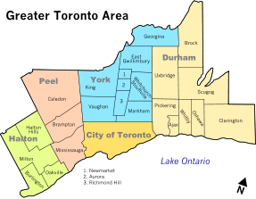 | |
| Cities | ||
| Towns | ||
| Townships and municipalities | ||
| Regions | |
|---|---|
| Counties | |
| Districts | |
| Regional municipalities | |
| Single-tier municipalities | |
| Separated municipalities | |
| |
Central Counties of Ontario Tourism Region | |
|---|---|
| York Region Tourism | |
| Durham Region Tourism | |
| Hills of the Headwaters Tourism Association | |
| |