Durham, New Hampshire
| Durham, New Hampshire | ||
|---|---|---|
| Town | ||
|
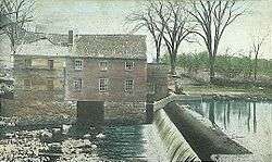
Old Mill and Dam, Durham c. 1908 | ||
| ||
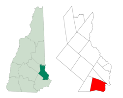 Location within Strafford County, New Hampshire | ||
| Coordinates: 43°08′02″N 70°55′35″W / 43.13389°N 70.92639°WCoordinates: 43°08′02″N 70°55′35″W / 43.13389°N 70.92639°W | ||
| Country | United States | |
| State | New Hampshire | |
| County | Strafford | |
| Settled | 1635 | |
| Incorporated | 1732 | |
| Government | ||
| • Town Council |
Katherine "Kitty" Marple Firoze Katrak Wayne Burton James Lawson Katherine Bubar Allan Howland Diana Carroll Alan Bennett | |
| • Town Administrator | Todd I. Selig | |
| Area | ||
| • Total | 24.8 sq mi (64.1 km2) | |
| • Land | 22.4 sq mi (58.0 km2) | |
| • Water | 2.4 sq mi (6.1 km2) 9.57% | |
| Elevation | 50 ft (15 m) | |
| Population (2010) | ||
| • Total | 14,638 | |
| • Density | 590/sq mi (230/km2) | |
| Time zone | EST (UTC-5) | |
| • Summer (DST) | EDT (UTC-4) | |
| ZIP code | 03824 | |
| Area code(s) | 603 | |
| FIPS code | 33-19700 | |
| GNIS feature ID | 0873584 | |
| Website |
www | |

Durham is a town in Strafford County, New Hampshire, United States. The population was 14,638 at the 2010 census.[1] Durham is home to the University of New Hampshire.
The primary settlement in the town, where 10,345 people resided at the 2010 census,[1] is defined by the U.S. Census Bureau as the Durham census-designated place (CDP) and includes the densely populated portion of the town centered on the intersection of New Hampshire Route 108 and Main Street and including the university which dominates the town.
History

Situated beside Great Bay at the mouth of the Oyster River, Durham was originally called Oyster River Plantation. It was settled in 1635 by pioneers who traveled up the Piscataqua River and across Little Bay to settle at the falls of the Oyster River.
At the time, the land that is now New Hampshire belonged to Massachusetts; not until 1692 did the New Hampshire colony finally gain full and permanent independence from its southern neighbor. Most of the coastal area was divided among four townships, and for its first century, Durham was part of Dover. The village location was ideal for its fresh water, natural meadows for livestock, and the transportation opportunities afforded by the waterways leading to the Atlantic Ocean. The land along the river was quickly settled, and nearby dense forests provided the timber necessary to construct homes as well as boats. Oyster River Plantation took the form of a small agricultural village, and the first generation of residents worked to clear and shape the land for planting.[2]
The town name "Durham" was suggested by the Rev. Hugh Adams, as claimed by him in an address to the General Assembly in 1738.[3][4] Two of the earliest settlers of Dover were William and Edward Hilton, the direct descendants of Sir William de Hilton, Lord of Hilton Castle in County Durham, England, but there is nothing to prove that Durham was named in their honor.
During King William's War, on July 18, 1694, the English settlement was attacked in the Raid on Oyster River by French career soldier Claude-Sébastien de Villieu with about 250 Abenaki from Norridgewock under command of their sagamore Bomazeen (or Bomoseen). In all, 104 inhabitants were killed and 27 taken captive,[5] with half the dwellings, including the garrisons, pillaged and burned to the ground.
The community would rebuild, however, and by 1716 Durham was a separate parish. Incorporated in 1732, Durham once included portions of the present-day towns of Madbury, Lee and Newmarket. Because of its arable land, the town would develop as a farming community.
Benjamin Thompson, a descendant of an early settler, bequeathed his assets and family estate, Warner Farm, to the state for the establishment of an agricultural college. Originally founded in 1866 in Hanover, the New Hampshire College of Agriculture and the Mechanic Arts moved to Durham in 1893 and became the University of New Hampshire in 1923. Thompson Hall, built in 1892 with an iconic clock tower, is named in his honor. Designed in the Romanesque Revival style by the Concord architectural firm of Dow & Randlett, it was listed on the National Register of Historic Places in 1996.
Libraries
Over the years the people of Durham have created several libraries:
Durham Social Library (1815-1857): This library was incorporated by act of the New Hampshire Legislature in 1815. The library contained several hundred books and had a membership numbering nearly 50.
Durham Agricultural Library (1862-1881): Formed Feb. 3, 1862, with Benjamin Thompson as president, this library was small (approximately 72 books) and vocationally-based.
Durham Social Library (1881-1892): Organized March 9, 1881, the library had a membership of 80 and several hundred books. In 1883 the Richardson house was purchased to house the library. It eventually merged with the Durham Public Library.
Durham Public Library (1892-1906): Established in 1892 through the provisions of a New Hampshire state act, this was the town's first "public" library. It contained more than 3,500 books and eventually merged with the library of the New Hampshire College of Agriculture and the Mechanic Arts.
Library of the New Hampshire College of Agriculture and the Mechanic Arts (1893- ): Came to Durham with the arrival of the College in 1893. Initially, the College housed the library in a single room in Thompson Hall. In 1900 Hamilton Smith gave the University $10,000 to construct a library, another $20,000 was obtained from Andrew Carnegie. In 1907 – a year after the town and the college agreed to merge their collective library resources – the building (Hamilton Smith Hall) was completed.[6]
In March 1997 by a margin of 2-1, Durham voters passed a charter amendment to establish a Board of Trustees and allow plans for a new library to go forward. In July 1997 a temporary space was found for the new Public Library in a storefront between the dollar store and a pizzeria. Under the guidance of the Trustees and a newly formed Friends of the Library group, many volunteer townspeople come forward to sheetrock, paint, assemble shelves, and unpack and shelve 719 boxes of books. On July 21, 1997 a dedication ceremony was held for the new library, with Governor Jeanne Shaheen as the keynote speaker. It was the first new public library to be established in New Hampshire in almost a century. In July 2013 a new public library building was completed on Madbury Road.
Police department
A police force of some manner has served Durham since at least 1848.[7] Durham Police Department is made up of 20 full-time and part-time officers and provides service 24-hours a day.[8]
The Police Department's Adopt-A-Cop program was instituted in 1999 to improve relationships between University of New Hampshire fraternities. Each fraternity is assigned a police officer who attends house meetings and events and acts a liaison between the fraternity and the community.[9]
Fire department and EMS
The first fire department organization in Durham was organized in 1927 and the first salaried firefighter was employed in 1934.[10]
The Durham Fire Department is one of the few fire departments in the country that is funded by both a municipality and a university.[10]
In addition, McGregor Memorial EMS is a regional, non-profit organization delivering emergency medical services and education to the New Hampshire Seacoast area since 1968.
Geography and transportation
According to the United States Census Bureau, the town has a total area of 24.8 square miles (64 km2), of which 22.4 sq mi (58 km2) is land and 2.4 sq mi (6.2 km2) is water, comprising 9.57% of the town. The town is drained by the Oyster River. The highest point in Durham is Beech Hill, at 291 feet (89 m) above sea level, located on the town's northern border.[11] Durham lies fully within the Piscataqua River (coastal) watershed.[12]
The village area of the town, defined as a census-designated place (CDP), has a total area of 2.7 sq mi (7.0 km2), of which 0.1 sq mi (0.26 km2) (1.85%) is water.
Amtrak's Downeaster train stops at Durham–UNH station with service to the Portland Transportation Center and Boston's North Station.
Demographics
| Historical population | |||
|---|---|---|---|
| Census | Pop. | %± | |
| 1790 | 1,247 | — | |
| 1800 | 1,126 | −9.7% | |
| 1810 | 1,449 | 28.7% | |
| 1820 | 1,538 | 6.1% | |
| 1830 | 1,606 | 4.4% | |
| 1840 | 1,498 | −6.7% | |
| 1850 | 1,497 | −0.1% | |
| 1860 | 1,534 | 2.5% | |
| 1870 | 1,298 | −15.4% | |
| 1880 | 962 | −25.9% | |
| 1890 | 871 | −9.5% | |
| 1900 | 996 | 14.4% | |
| 1910 | 823 | −17.4% | |
| 1920 | 749 | −9.0% | |
| 1930 | 1,217 | 62.5% | |
| 1940 | 1,533 | 26.0% | |
| 1950 | 4,770 | 211.2% | |
| 1960 | 5,504 | 15.4% | |
| 1970 | 8,869 | 61.1% | |
| 1980 | 10,652 | 20.1% | |
| 1990 | 11,818 | 10.9% | |
| 2000 | 12,664 | 7.2% | |
| 2010 | 14,638 | 15.6% | |
| Est. 2015 | 16,645 | [13] | 13.7% |
As of the census of 2000, there were 12,664 people, 2,882 households, and 1,582 families residing in the town. The population density was 565.5 people per square mile (218.4/km²). There were 2,923 housing units at an average density of 130.5 per square mile (50.4/km²). The racial makeup of the town was 94.55% White, 0.77% African American, 0.21% Native American, 3.10% Asian, 0.13% Pacific Islander, 0.27% from other races, and 0.97% from two or more races. 1.24% of the population were Hispanic or Latino of any race.
There were 2,882 households out of which 28.3% had children under the age of 18 living with them, 48.3% were married couples living together, 4.8% have a woman whose husband does not live with her, and 45.1% were non-families. 20.2% of all households were made up of individuals and 6.6% had someone living alone who was 65 years of age or older. The average household size was 2.79 and the average family size was 3.03.
The age distribution, heavily influenced by the presence of UNH, is: 12.0% under the age of 18, 56.5% from 18 to 24, 13.3% from 25 to 44, 12.1% from 45 to 64, and 6.1% who were 65 years of age or older. The median age was 21 years, which is also typical for a college town. For every 100 females there are 82.3 males. For every 100 females age 18 and over, there were 79.9 males.
The median income for a household in the town was $51,697, and the median income for a family was $83,609. Males had a median income of $54,519 versus $31,548 for females. The per capita income for the town was $17,210. 27.7% of the population and 2.8% of families were below the poverty line. Out of the total people living in poverty, 5.5% are under the age of 18 and 1.1% are 65 or older.
Town center
As of the census of 2000, there were 9,024 people, 1,703 households, and 727 families residing in the town center, or CDP. The population density was 3,398.7 people per square mile (1,309.8/km²). There were 1,718 housing units at an average density of 249.4 persons/km² (647.1 persons/sq mi). The racial makeup of the town was 93.27% White, 0.83% African American, 0.29% Native American, 3.96% Asian, 0.18% Pacific Islander, 0.32% from other races, and 1.15% from two or more races. 1.31% of the population were Hispanic or Latino of any race.
There were 1,703 households out of which 20.9% had children under the age of 18 living with them, 37.2% were married couples living together, 4.2% have a woman whose husband does not live with her, and 57.3% were non-families. 25.2% of all households were made up of individuals and 8.8% had someone living alone who was 65 years of age or older. The average household size was 2.59 and the average family size was 2.91.
The age distribution of the village area is: 6.8% under the age of 18, 71.5% from 18 to 24, 9.4% from 25 to 44, 7.1% from 45 to 64, and 5.2% who were 65 years of age or older. The median age was 21 years. The distribution and median age are both typical for university towns. For every 100 females there are 79.0 males. For every 100 females age 18 and over, there were 77.1 males.
The median income for a household is $30,040, and the median income for a family was $70,066. Males had a median income of $48,155 versus $26,250 for females. The per capita income for the town was $12,088. 39.9% of the population and 5.9% of families were below the poverty line. Out of the total people living in poverty, 12.3% are under the age of 18 and 1.8% are 65 or older. However, much of the population "living in poverty" consists of students, many of whom are still partially supported by their parents.
Notable people
- Dudley Dudley, political activisit
- Jack Edwards,[15] play-by-play announcer for the Boston Bruins
- Daniel Ford, writer
- Sam Fuld, outfielder with the Chicago Cubs and Tampa Bay Rays, currently with the Oakland Athletics.
- Manuela Lutze, four-time Olympic rower, two-time Olympic gold medalist
- Joyce Maynard, writer
- Hercules Mooney, lieutenant colonel in the U.S. Revolutionary War
- Don Murray, journalist
- Deron Quint, defenseman with six NHL teams
- Alexander Scammel, colonel of the 3rd New Hampshire Regiment
- Daniel C. Stillson (1830–1899), inventor of the Stillson pipe wrench
- John Sullivan, Revolutionary War general
- Ben Sulsky, professional poker player
- Benjamin Thompson, farmer, businessman & benefactor of U.N.H.
Sites of interest
- Durham Historic Association & Museum[16]
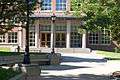
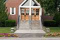
Gallery
-
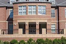
Pettee Hall
-
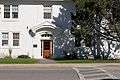
Taylor Hall
-
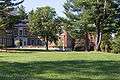
Murkland Hall
-
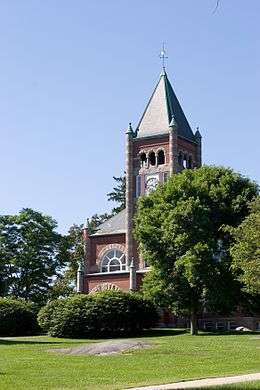
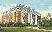
Thompson Hall
-
Dimond Library
-
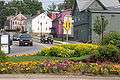
Downtown at Madbury Road and Main Street
-
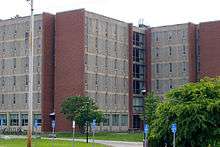
Babcock Hall
See also
References
- 1 2 United States Census Bureau, American FactFinder, 2010 Census figures. Retrieved March 23, 2011.
- ↑ "Durham, NH". The Great American Stations. Retrieved Sep 5, 2014.
- ↑ N.H. Province Papers, Vol. V, page 35
- ↑ Mary P. Thompson, [https://books.google.com/books?id=QarkVaNCBvEC&pg=PA282&lpg=PA282&dq=Mary+P.+Thompson%27s+Landmarks+in+Ancient+Dover,+p.+67.&source=bl&ots=rXTLCrmIF1&sig=hfGsgNxRcAnY_TGtBdJBaaH1IzA&hl=en&sa=X&ved=0ahUKEwjLtPrQx97JAhVFzIMKHcSdAPcQ6AEIKTAC#v=onepage&q=Rev%2C%20HUgh%20Adams&f=falseMary P. Thompson's Landmarks in Ancient Dover, p. 67 Landmarks in Ancient Dover], p. 67
- ↑ Webster, John Clarence. Acadia at the End of the Seventeenth Century. Saint John, NB, New Brunswick Museum, 1979. p. 65
- ↑ "Durham Town Records, New Hampshire". University of New Hampshire Library. Retrieved February 3, 2014.
- ↑ "Police Dept. History". Town of Durham, NH. Retrieved December 16, 2010.
- ↑ "A Welcome from the Chief of Police". Town of Durham, NH. Retrieved December 16, 2010.
- ↑ "Durham PD Programs". Town of Durham, NH. Retrieved December 16, 2010.
- 1 2 "Durham Fire Department History". Town of Durham, NH. Retrieved December 16, 2010.
- ↑ U.S. Geological Survey. Dover Quadrangle, New Hampshire-Maine map. 1:62,500. 15 Minute Series (Topographic). Washington D.C.: USGS, 1956. Available from University of New Hampshire Dimond Library Documents Department & Data Center, http://docs.unh.edu/NH/dovr56sw.jpg accessed 2009-03-17.
- ↑ Foster, Debra H.; Batorfalvy, Tatianna N.; Medalie, Laura (1995). Water Use in New Hampshire: An Activities Guide for Teachers. U.S. Department of the Interior and U.S. Geological Survey.
- ↑ "Annual Estimates of the Resident Population for Incorporated Places: April 1, 2010 to July 1, 2015". Retrieved July 2, 2016.
- ↑ "Census of Population and Housing". Census.gov. Retrieved June 4, 2016.
- ↑ Doyle, Bill. "NESN's Jack Edwards calls on his dramatic heritage". Worcester Telegram.
- ↑ Durham Historic Association & Museum
External links
- Town of Durham official website
- New Hampshire Economic and Labor Market Information Bureau Profile
- University of New Hampshire
- History of the Oyster River Massacre
Municipalities and communities of Strafford County, New Hampshire, United States | ||
|---|---|---|
| Cities | 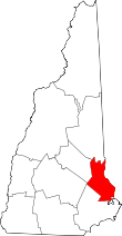 | |
| Towns | ||
| CDPs | ||
| Other villages | ||