Dunnellon/Marion County Airport
| Dunnellon/Marion County Airport & Park of Commerce | |||||||||||||||
|---|---|---|---|---|---|---|---|---|---|---|---|---|---|---|---|
| IATA: none – ICAO: none – FAA LID: X35 | |||||||||||||||
| Summary | |||||||||||||||
| Airport type | Public | ||||||||||||||
| Owner | Dunnellon Airport Authority | ||||||||||||||
| Serves | Dunnellon, Florida | ||||||||||||||
| Location | 15070 SW 111th St. | ||||||||||||||
| Elevation AMSL | 65 ft / 20 m | ||||||||||||||
| Coordinates | 29°03′42″N 082°22′36″W / 29.06167°N 82.37667°W | ||||||||||||||
| Map | |||||||||||||||
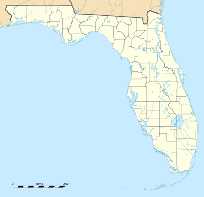 X35 Location of Dunnellon/Marion County Airport | |||||||||||||||
| Runways | |||||||||||||||
| |||||||||||||||
| Statistics (2014) | |||||||||||||||
| |||||||||||||||
Dunnellon/Marion County Airport and Park of Commerce (FAA LID: X35) is a county-owned public airport located in the City of Dunnellon, in Marion County, Florida, United States. In 2014, the general aviation airport averaged 105 flights per day. The complex features two lighted runways with no control tower. During World War II, the airport was used by the United States Army Air Forces for training and was then known as the Dunnellon Army Air Field.
Overview
The Dunnellon/Marion County Airport is also known as the Dunnellon Airport or the Marion County Airport. It is owned by Marion County and managed by the county's Dunnellon Airport Authority.[2] The airport is located in the City of Dunnellon about four nautical miles (4.6 mi; 7.4 km) east of its central business district. From Interstate 75, it is situated 13 miles (21 km) west of the highway.[3]
The airport and commerce complex encompasses 792 acres (3.21 km2) of land. With new security fencing, electrical gates, a snack bar and additional T-hangars, the airport is not projected to require major expansion through 2020. The facility is located 38 miles (61 km) south of Gainesville Regional Airport. Services available include 24-hour aviation fuel, minor airframe and minor power plant servicing.[1]
Facilities and aircraft
Dunnellon/Marion Co. & Park of Commerce Airport covers an area of 792 acres (321 ha) at an elevation of 65 feet (20 m) above mean sea level. It has two asphalt paved runways: 5/23 is 5,000 by 100 feet (1,524 by 30 m) and 10/28 is 4,702 by 60 feet (1,433 by 18 m).[1]
For the 12-month period ending September 25, 2014, the airport had 38,603 general aviation aircraft operations, an average of 105 per day. At that time there were 107 aircraft based at this airport: 96 single-engine, 4 multi-engine, 1 jet, 1 helicopter and 5 ultralights.[1][4]
The airport also has a full service privately-owned flight school, Whiskey Bravo Air.
History

Originally set on 500 acres (2.0 km2) that was purchased in 1942 by Marion County, it was opened in August 1942 by the United States Army Air Forces. Known as Dunnellon Army Air Field,[5] it was used as a training airfield with three runways. Control was deeded to Marion County following the end of the war.
On July 1, 1981, Marion County created the Dunnellon Airport Authority to manage the operation, maintenance and improvement of the airport.[2]
In the 1990s, one runway (designated as 14/32) was closed reducing the airport to its current two - 5/23 and 10/28 (formerly 9/27).
References
- 1 2 3 4 FAA Airport Master Record for X35 (Form 5010 PDF). Federal Aviation Administration. Effective 31 March 2016. Retrieved on 15 May 2016
- 1 2 Dunnellon Airport Authority. Marion County Florida Official Website. Retrieved on 15 May 2016.
- ↑ Land-leasing at the airport. Marion County Florida Official Website. Retrieved on 15 May 2016.
- ↑ Marion County Airport (Dunnellon, FL) X35 Overview. Flightaware.com. Retrieved on 15 May 2016.
- ↑ Air Force History Index. Retrieved 15 May 2016.
External links
- Marion County Airport at Marion County web site
- Aerial image as of 5 January 1999 from USGS The National Map
- FAA Terminal Procedures for X35, effective November 10, 2016
- Resources for this airport:
- FAA airport information for X35
- AirNav airport information for X35
- FlightAware airport information and live flight tracker
- SkyVector aeronautical chart for X35