Drummond/North Elmsley
| Drummond/North Elmsley | |
|---|---|
| Township (lower-tier) | |
| Township of Drummond/North Elmsley | |
|
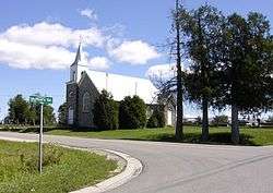
St. Augustine's Anglican Church in Richardson. | |
 Drummond/North Elmsley within Lanark County. | |
 Drummond/North Elmsley Drummond/North Elmsley within Lanark County. | |
| Coordinates: 44°58′N 76°12′W / 44.967°N 76.200°WCoordinates: 44°58′N 76°12′W / 44.967°N 76.200°W | |
| Country |
|
| Province |
|
| County | Lanark |
| Incorporated | January 1, 1998 |
| Government | |
| • Type | Township |
| • Reeve | Aubrey Churchill |
| • Governing Body | Drummond/North Elmsley Township Council |
| • MP | Scott Reid (CPC) |
| • MPP | Randy Hillier (OPC) |
| Area[1] | |
| • Land | 366.03 km2 (141.32 sq mi) |
| Population (2011)[1] | |
| • Total | 7,487 |
| • Density | 20.5/km2 (53/sq mi) |
| Time zone | EST (UTC-5) |
| • Summer (DST) | EDT (UTC-4) |
| Postal code FSA | K7H |
| Area code(s) | 613 |
| Website | http://www.dnetownship.ca |
Drummond/North Elmsley is a township in eastern Ontario, Canada in Lanark County. It is situated on the north shore of the Rideau River between the town of Perth and the town of Smiths Falls. It is a predominantly rural municipality.
The township, covering 366.03 km², was formed on January 1, 1998, through the merger of Drummond Township and North Elmsley Township.
Geography and ecology
The most common landscape is gently rolling Canadian shield, predominantly gneiss. The valleys often have clay or sand deposits from events near the end of the last ice age. At one point near the end of the last ice age, the Champlain Sea flooded the Ottawa valley as far inland as what is now the town of Perth.[2] West of Perth along Highway 7 one can see a remnant of this clay plain. An old shoreline of the Champlain Sea crosses Highway 7 near Ramsay Concession 2 before winding south into Drummond/North Elmsley. North of Perth, this clay plain is occupied by the huge Blueberry Marsh.[3]
The hard rock and thin soil produced distinctive deciduous forests dominated by maple, oak, beech, ash and pine. Southern trees like hickory and butternut are less common. Wetter areas have elm, silver maple and white cedar. Hemlock was much more common in the past, but logging for bark used in tanning has much depleted this species.[4] Only a few large hemlock stands remain, although there are many scatted trees through the remaining forests. Natural forest fires from lightning created some fire barrens in the southern parts of the township.[5] Generally speaking, settlers cleared the deeper pockets of soil, and the clay plains. This produced the distinctive landscape with fields surrounded by forested uplands. The stone piles along the edge of the field illustrate the labour involved in creating agricultural land here. The many outcrops of Canadian shield in fields are also a reminder of just how close to the surface bed rock remains.
The Mississippi River and the Rideau River have extensive areas of wetland. The less flooded areas tend to have silver maple swamp, while lower on the shoreline are marshes and aquatic plants. One of the largest wetlands is the Innisville wetland, a provincially significant wetland that formed upstream from Mississippi Lake. Other familiar wetlands include the Tay Marsh (south of Perth) and The Swale (near Smiths Falls). Both rivers are popular with canoeists and naturalists. Smaller wetlands occur throughout the county; many are produced by beavers. Beaver ponds are an important as they provide habitat for a great many kinds of species, including frogs, turtles, otters, muskrats and migratory waterfowl. Beaver ponds provide a cycle of flooding, from shallow water through to wet meadow, and most phases of pond ecology can be seen driving the township roads.[6]
Owing to its location—the combination of two large rivers, wetlands and forests—the county has a rich array of wildlife, and wildlife viewing is a popular activity. Significant animal species include the black rat snake (now officially renamed the Gray Ratsnake by experts on this species) and the Blanding's turtle.
Communities
The township comprises the communities of Armstrong Corners, Balderson, Beveridge Locks, Cook's Shore, Craig Shore, Drummond Centre, Ebbs Shore, Elmgrove, Ferguson Falls, Glenview, Innisville, McCreary's Shore, McCulloughs Landing, McNaughton Shore, Port Elmsley, Prestonvale, Richardson, Rideau Ferry, Robertson's Shore and Wayside.
Demographics
| Canada census – Drummond/North Elmsley community profile | |||
|---|---|---|---|
| 2011 | 2006 | 2001 | |
| Population: | 7487 (5.2% from 2006) | 7118 (6.7% from 2001) | 6670 (7.8% from 1996) |
| Land area: | 366.03 km2 (141.32 sq mi) | 364.78 km2 (140.84 sq mi) | 364.84 km2 (140.87 sq mi) |
| Population density: | 20.5/km2 (53/sq mi) | 19.5/km2 (51/sq mi) | 18.3/km2 (47/sq mi) |
| Median age: | 43.6 (M: 43.5, F: 43.6) | 40.1 (M: 39.9, F: 40.3) | |
| Total private dwellings: | 3478 | 3237 | 3072 |
| Median household income: | $60,371 | $55,424 | |
| References: 2011[7] 2006[8] 2001[9] | |||
See also
References
- 1 2 "Drummond/North Elmsley census profile". 2011 Census of Population. Statistics Canada. Retrieved 2012-02-14.
- ↑ Chapman, L.J. and D.F. Putnam. 1951. The Physiography of Southern Ontario. University of Toronto Press, Toronto. 284 p. plus map in four sections.
- ↑ Keddy, P.A. 2008. Earth, Water, Fire. An Ecological Profile of Lanark County. General Store Publishing House, Refrew, Ontario. Map 14.
- ↑ Keddy, C.J. 1993. Forest History of Eastern Ontario. A report prepared for the Eastern Ontario Forest Group.
- ↑ Catling, Paul M and Vivian R. Brownell. 1999. The flora and ecology of southern Ontario granite barrens. Pages 392-405 in Anderson, R.C., J.S. Fralish, and J.M. Baskin (eds). Savannas, Barrens, and Rock Outcrop Plant Communities of North America. Cambridge University Press, Cambridge.
- ↑ Keddy, P.A. 2008. Earth, Water, Fire. An Ecological Profile of Lanark County. General Store Publishing House, Refrew, Ontario. Figure 2.
- ↑ "2011 Community Profiles". Canada 2011 Census. Statistics Canada. July 5, 2013. Retrieved 2012-02-14.
- ↑ "2006 Community Profiles". Canada 2006 Census. Statistics Canada. March 30, 2011. Retrieved 2012-02-14.
- ↑ "2001 Community Profiles". Canada 2001 Census. Statistics Canada. February 17, 2012. Retrieved 2012-02-14.
External links
 |
Lanark Highlands | Mississippi Mills | Beckwith | |
| |
Montague Smiths Falls | |||
| ||||
| | ||||
| Tay Valley, Perth | Rideau Lakes |