Dray Sáp
| Dray Sáp | |
|---|---|
| Commune | |
|
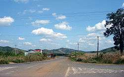
A highland village in the commune of Dray Sáp. | |
 Dray Sáp | |
| Coordinates: 12°7′16″N 108°32′38″E / 12.12111°N 108.54389°ECoordinates: 12°7′16″N 108°32′38″E / 12.12111°N 108.54389°E | |
| Country |
|
| Region | Central Highlands |
| Province | Đắk Lắk |
| District | Krông Ana District |
| Time zone | Indochina Time (UTC+07:00) |
Dray Sáp is a commune (xã) in Krông Ana District, Đắk Lắk Province, Vietnam.
Economy
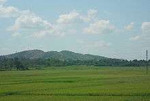
Rice fields
An agricultural commune, it produces rice, coffee and pepper. The Buon Kuop hydropower plant in the commune has a capacity of 280MW. There are two waterfalls that flow through the commune, including the Gia Long and Dray Sap waterfalls which attract tourists.[1]
References
- ↑ "Dray Sap and Gia Long Waterfalls". Frommer's. Retrieved June 19, 2010.
This article is issued from Wikipedia - version of the 11/13/2013. The text is available under the Creative Commons Attribution/Share Alike but additional terms may apply for the media files.