Dracut, Massachusetts
| Town of Dracut | ||
|---|---|---|
| Town | ||
|
Dracut Town Office (demolished 2015) | ||
| ||
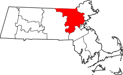
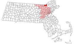 Location in Middlesex County in Massachusetts | ||
| Coordinates: 42°40′N 71°18′W / 42.667°N 71.300°WCoordinates: 42°40′N 71°18′W / 42.667°N 71.300°W | ||
| Country | United States | |
| State | Massachusetts | |
| County | Middlesex | |
| Settled | 1653 | |
| Incorporated | 1701 | |
| Government | ||
| • Type | Open Town Meeting | |
| Area | ||
| • Total | 21.36 sq mi (55.32 km2) | |
| • Land | 20.9 sq mi (54.1 km2) | |
| • Water | 0.5 sq mi (1.2 km2) | |
| Elevation | ~156 ft (~48 m) | |
| Population (2010) | ||
| • Total | 31,079 (2,014 estimate) | |
| • Density | 1,379.07/sq mi (532.46/km2) | |
| Time zone | Eastern (UTC-5) | |
| • Summer (DST) | Eastern (UTC-4) | |
| ZIP code | 01826 | |
| Area code(s) | 978 | |
| FIPS code | 25-17475 | |
| GNIS feature ID | 0618221 | |
| Website | http://www.dracut-ma.us/ | |


Dracut /ˈdreɪkət/ is a town in Middlesex County. The town's population is 31,079.
History
Prior to the area's European settlements in the mid-17th century, Dracut and the surrounding area was known as "Augumtoocooke," and was the site of important Pennacook Indian settlements, due to the fishing grounds at Pawtucket Falls on the Merrimack River and the abundant hunting game in the surrounding marsh areas.[1] From the late 16th to mid 17th centuries, the legendary sachem Passaconaway and his family spent much of their lives on this land.
Europeans began to settle in the "Augumtoocooke" area around 1653, and established the town of Chelmsford, incorporated in 1655, on the opposite side of the Merrimack River from modern Dracut. Ten years later, in October 1665, Bess, wife of Nobb How and daughter of Passaconaway, sold the land called Augumtoocooke to Captain John Evered, also known as Webb of Draucutt of Norfolk County (the Webb family is associated closely with the town of Dreycott Folliott in Wiltshire, England,[2] for the sum of four yards of Duffill and one pound of tobacco. Webb then turned around and sold tracts of land to the Richard Shatswell and Samuel Varnum.[1] Before owning it himself, Webb had already sold 11,000 acres (45 km2) of the land months earlier to Samuel Varnum, as the deed for "Drawcutt upon Mirrimack" was dated 1664, for 400£ (Four Hundred Pounds).[3] Richard Shatswell then took his Dracut land and exchanged it with Edward Colburn (also spelled "Coburn" or "Colborne") for his home and land in Ipswich, Massachusetts. Edward Colburn and his family were probably the first settlers in Dracut who owned land with the intention of permanently living on it (since the owners of the Webb farm had bought it as an investment, rather than to settle, and Samuel Varnum lived on the Chelmsford side of the Merrimack River).[4][5][6]
Even though this area, now known to the new settlers as Dracut (Draucutt), was across the Merrimack River from the Chelmsford town center, they agreed to pay taxes and relied on Chelmsford for protection, as 1667 Middlesex Court documents so declared.[7] By the summer of 1669, however, protection became too costly and difficult, so the Chelmsford Mayor Henchman declared:
"Wherefore, Honorable and Worshipful, I judge it highly needful and necessary that we have relief, and that speedily of about twenty men or more for the repulsing of the enemy and guarding some outplaces, which are considerable on each side of the Merrimac, as Messrs. Howard, Varnum, Coburn & company who must otherwise come in to us, and leave what they have to the enemy, or be exposed to the merciless cruelty of bloody and barbarous men.
"
On the morning of March 18, 1676, the Wamesit Indians burned down four of Edward Colburne's buildings, then attacked Samuel Varnum and family as they crossed the river to milk the cows grazing in the Dracut pastures. The Indians fired upon their boat, killing Samuel's two sons, and one died in his daughter's arms as she sat behind him. The accompanying soldiers and Samuel fired back, but the Indians fled.[3]
By the late 17th century the Varnum, Coburn, Richardson, and the other families of the Dracut section of Chelmsford, dissatisfied with the protection provided, began to petition to the General Court to layout their own township.
"To the Hon. Council & Representatives of his Majesty's Province of the Massachusetts Bay in New England in General Court assembled February 1701.
"The petition of Samuel Sewall Esq., Benjamin Walker, John Hunt & Jonathan Belcher, proprietors of part of the Tract of Land called Dracut beyond Chelmsford in the County of Middlesex on the North Side of Merrimack River and of Samuel Varnum, ..., Thomas Colburne, ..., James Richardson, ..., Ezra Colburn,... Inhabitants and Proprietors of the said Tract of Land called Dracut, ... lyes very commodious for a Township & hath about twenty families already settled thereupon in which are about Eighty Souls & Forasmuch as the making said place a Township will not only be a great Encouragement to the Inhabitants thereof & be the means for a settlement of the Ministry among them (for the benefit of which they are now obliged to go to Chelmsford, which is a great difficulty & eamiot be attended by their children & several others by reason of the distance thereof) but will also be of considerable benefit to the Publick, and be a great strengthening of the Frontier parts by reason of the people which will be desirous to settle at said place when made a Township because of the convenient positionship thereof.
Your Petitioners humbly pray that by the grant of this Honorable Court, the Tract of land aforesaid may be made a Township, and that the Inhabitants, which are or shall settle thereupon, may have and enjoy all Libertys, Privileges & Immunities as the Inhabitants of other Towns within this Province have & do enjoy. And ... the Tract of Land therein described be made a Township & called by the name of Dracut, ...Sent up by concurrence Nehemiah Jewett, Speaker.
"
Dracut was granted separation from Chelmsford, and was officially incorporated as a town on February 26, 1701.
Parts of the community were part of the Wamiset Praying Town, one of the preserves set aside by the colonists for Christianized Indians. The town has several large ponds, bogs and swamps, and numerous brooks (most notably Beaver Brook). Dracut's early economy relied on fishing, lumbering and milling, which led in turn to the 19th century industries of paper making and cotton textile manufacturing, including the Beaver Brook Mill. These mills attracted Irish and French-Canadian immigrants.
There has been intense modern development in Dracut with suburban residential pressures from Lowell. Twice in the 19th century, Lowell annexed large sections of Dracut into its borders. However, some rural landscapes remain intact, as do some handsome historic houses. One of the better known is the 290-year-old Colburn/Cutter House, with its massive beams, huge center chimney and fireplaces. The building, dating back from about 1717, has served as the site of the annual Dracut Craft Fair. In addition, Dracut holds an annual Old Home Day every September starting in 2001 . As of 2010, it is also the only town in the world with the name "Dracut".
Geography
According to the United States Census Bureau, the town has a total area of 21.4 square miles (55 km2), of which 20.9 square miles (54 km2) is land and 0.5 square miles (1.3 km2) (2.15%) is water.
Dracut is located in the Merrimack Valley of Massachusetts, 30 miles (48 km) northwest of the state capital, Boston.
The southern end of Dracut is on the Merrimack River, and the town is bisected by Beaver Brook.
Dracut is sometimes referred to by its sections. They are:
- Collinsville
- East Dracut
- Dracut Center
- Kenwood
- Navy Yard
Adjacent towns
Dracut is bordered by Tyngsboro to the west and the city of Lowell to the south and west in Middlesex County, Methuen to the east in Essex County, and Pelham, New Hampshire, to the north in Hillsborough County, New Hampshire. Tewksbury (Middlesex County) and Andover (Essex County) border the town to the south over the Merrimack River. However, there are no crossings of the river in Dracut's town limits, and thus Tewksbury and Andover are inaccessible across the river directly, and one must instead cross the Merrimack via either several crossings in Lowell or via I-93 in Methuen, in which the Andover line is on the bridge.
Demographics
| Historical population | ||
|---|---|---|
| Year | Pop. | ±% |
| 1850 | 3,503 | — |
| 1860 | 1,881 | −46.3% |
| 1870 | 2,078 | +10.5% |
| 1880 | 1,595 | −23.2% |
| 1890 | 1,996 | +25.1% |
| 1900 | 3,253 | +63.0% |
| 1910 | 3,461 | +6.4% |
| 1920 | 5,280 | +52.6% |
| 1930 | 6,912 | +30.9% |
| 1940 | 7,339 | +6.2% |
| 1950 | 8,666 | +18.1% |
| 1960 | 13,674 | +57.8% |
| 1970 | 18,214 | +33.2% |
| 1980 | 21,249 | +16.7% |
| 1990 | 25,594 | +20.4% |
| 2000 | 28,562 | +11.6% |
| 2010 | 29,457 | +3.1% |
| * = population estimate. Source: United States Census records and Population Estimates Program data.[8][9][10][11][12][13][14][15][16][17] | ||
The earliest census data shows the town of Dracut having a population of 1,173 residents in 1765.[7]
As of the census[18] of 2010, there were 29,457 people, 10,451 households, and 7,733 families residing in the town. The population density was 1,366.7 people per square mile (527.6/km²). There were 10,643 housing units at an average density of 509.3 per square mile (196.6/km²).
The racial makeup of the town was:
- 88.1% White (U.S. Average: 75.1%)
- 4.0% Asian (U.S. Average: 3.6%)
- 2.3% African American (U.S. Average: 12.3%)
- 0.09% Native American (U.S. Average: 0.1%)
- 0.03% Pacific Islander (U.S. Average: 0.1%)
- 0.43% from other races (U.S. Average: 5.5%)
- 0.96% from two or more races (U.S. Average: 2.4%)
Hispanic or Latino of any race were 1.55% of the population (U.S. Average: 12.5%).
There were 10,939 households with the average household size was 2.69 and the average family size was 3.17.
- 35.3% had children under the age of 18 living with them (U.S. Average: 32.8%).
- 55.4% were married couples living together (U.S. Average: 51.7%).
- 12.9% had a female householder with no husband present (U.S. Average: 12.2%).
- 28.2% were non-families (U.S. Average: 31.9%).
- 20.9% of all households were made up of individuals (U.S. Average: 25.8%).
- 8.0% had someone living alone who was 65 years of age or older (U.S. Average: 9.2%).
In the town the population had a median age was 41.1 years (U.S. Average: 35.3).
- 25.5% under the age of 18
- 7.3% from 18 to 24
- 33.5% from 25 to 44
- 22.2% from 45 to 64
- 11.6% who were 65 years of age or older.
For every 100 females there were 96.2 males. For every 100 females age 18 and over, there were 92.4 males.
The median income for a household in the town was $57,676 (U.S. Average: $41,994), and the median income for a family was $65,633 (U.S. Average: $50,046). Males had a median income of $41,873 versus $31,396 for females. The per capita income for the town was $23,750. About 2.7% (U.S. Average: 9.2%) of families and 3.7% (U.S. Average: 12.4%) of the population were below the poverty line, including 3.2% of those under age 18 and 8.3% of those age 65 or over.
Government


Dracut is one of the largest towns in Massachusetts to still be governed by Open Town Meeting, whereby every registered voter is entitled to gather at stated times to conduct the business of the Town. There is an elected Board of Selectmen and School Committee with five members each elected for three-year staggered terms. The voters also elect a Town Moderator, Library Trustees, and some members of the Housing Authority. Those who live in the Dracut Water Supply District also elect a District Moderator and Water Commissioners. The Board of Selectmen, School Committee, and Library Trustees hire a Town Manager, Superintendent of Schools, and Library Director respectively to execute their various duties. More information about the government of the Town of Dracut can be found on the town's official website, www.dracut-ma.us.
Public Safety
Police Department
The town of Dracut has its own full-time police department which employs approximately 37 police officers who utilize approximately 15-20 various types of vehicles to perform their duties. As of January 2014, the Dracut PD now has a K9 unit. The Dracut Police Department's state of the art headquarters is located at 110 Loon Hill Road in the East Dracut section of the town. The town of Dracut is also secondarily protected by the Massachusetts State Police and is patrolled by troopers from the A-1 barracks in Andover.
Fire Department
The Dracut Fire Department is a 24/7 career fire department, with approximately 40 firefighters, that serves the town of Dracut from three fire stations located throughout the town.
Station 1-Headquarters-488 Pleasant Street
- Engine 1
- Engine 4
- Engine 5
- Forestry 1
- Ladder 1
- Rescue 1
- Service 1
- Car 1 (Chief)
- Car 2 (Deputy Chief)
Station 2-15 Jones Avenue
- Engine 2
- Forestry 2
- Truck 4
- State Hazmat ORU 62
Station 3-1998 Lakeview Avenue
- Engine 3
- Forestry 3
Education
Public schools
The Dracut School Department consists of six public schools: one high school, one middle school (grades 6-8), and four elementary schools (grades K-5) They are1:
- Dracut Senior High School (950 students)
- Richardson Middle School (900 students)
- Englesby Elementary School (600 students)
- Brookside Elementary School (500 students)
- Campbell Elementary School (500 students)
- Greenmont Elementary School (280 students)
The school department also uses the former Parker Elementary School for a small portion of its special education activities. There are about 45 public school students attending out of district SPED programs and approximately 120 public school students attending out of town charter schools, as of FY14. In addition, about 440 Dracut students attend the Greater Lowell Vocational High School.
Transportation
Dracut is in proximity to many major area highways. Interstate 93, Interstate 495, and U.S. Route 3 are among the largest. Interstate 95 is not far from Dracut either (roughly 15 to 20 miles (24 to 32 km) to the south), and the Massachusetts Turnpike (Interstate 90) is only 30 to 35 miles (48 to 56 km) to the south in Boston. Massachusetts Route 38, Route 110, and Route 113 run directly through the town.
The LRTA 10 bus connects to the Lowell train station on the MBTA Commuter Rail Lowell Line.
The Maritimes & Northeast Pipeline terminates in Dracut, connecting to the North American natural gas pipeline grid. The Portland Natural Gas Transmission System (PNGTS)), Tennessee Gas and the TransQuebec interconnect here.
Notable residents

- Wendell Corey, actor
- Jeremy Fuller, bareknuckle vale tudo/nhb fighter
- Scott Grimes, actor
- Rick Hawn, pro mma fighter
- Dan Laderoute, artist
- Harry Lew, pro basketball player
- Lucy Lew, early African American rights leader
- Kevin Marcucci, vale tudo fighter
- John Ogonowski (1949-2001), airline pilot who was piloting American Airlines Flight 11 on 9/11 before Flight 11 was hijacked
- James Mitchell Varnum, lawyer
- Joseph Bradley Varnum, politician
See also
References
- 1 2 History of Dracut, Massachusetts, called by the Indians Augumtoocooke and before incorporation, the wildernesse north of the Merrimac. First permanment settlement in 1669 and incorporated as a town in 1701, by Silas Roger Coburn (1922)
- ↑ Richmond alias Webb of Wiltshire, England, and Taunton, Plymouth, Massachusetts. http://www.geneajourney.com/rchmnd.html.)(OGBOURNE ST. GEORGE. British History Online. http://www.british-history.ac.uk/report.aspx?compid=66524#n73.)
- 1 2 "The Varnums of Dracutt," by John Marchall Varnum, 1907
- ↑ Stager, Helen and Stager, Evelyn. A Family Odyssey, p. 235, Nicollet Press, Inc., Pipestone, Minnesota, 1983.
- ↑ Gordon, George A. and Coburn, Silas R. Genealogy of the Descendants of Edward Colburn/Coburn, Lowell, Massachusetts, 1913.
- ↑ Coburn, Silas Roger. History of Dracut, Massachusetts, pp. 67, 75-6, Press of the Courier-Citizen Co., Lowell, Massachusetts, 1922.
- 1 2 https://archive.org/stream/historyofdracutm00cobu/historyofdracutm00cobu_djvu.txt
- ↑ "TOTAL POPULATION (P1), 2010 Census Summary File 1". American FactFinder, All County Subdivisions within Massachusetts. United States Census Bureau. 2010.
- ↑ "Massachusetts by Place and County Subdivision - GCT-T1. Population Estimates". United States Census Bureau. Retrieved July 12, 2011.
- ↑ "1990 Census of Population, General Population Characteristics: Massachusetts" (PDF). US Census Bureau. December 1990. Table 76: General Characteristics of Persons, Households, and Families: 1990. 1990 CP-1-23. Retrieved July 12, 2011.
- ↑ "1980 Census of the Population, Number of Inhabitants: Massachusetts" (PDF). US Census Bureau. December 1981. Table 4. Populations of County Subdivisions: 1960 to 1980. PC80-1-A23. Retrieved July 12, 2011.
- ↑ "1950 Census of Population" (PDF). Bureau of the Census. 1952. Section 6, Pages 21-10 and 21-11, Massachusetts Table 6. Population of Counties by Minor Civil Divisions: 1930 to 1950. Retrieved July 12, 2011.
- ↑ "1920 Census of Population" (PDF). Bureau of the Census. Number of Inhabitants, by Counties and Minor Civil Divisions. Pages 21-5 through 21-7. Massachusetts Table 2. Population of Counties by Minor Civil Divisions: 1920, 1910, and 1920. Retrieved July 12, 2011.
- ↑ "1890 Census of the Population" (PDF). Department of the Interior, Census Office. Pages 179 through 182. Massachusetts Table 5. Population of States and Territories by Minor Civil Divisions: 1880 and 1890. Retrieved July 12, 2011.
- ↑ "1870 Census of the Population" (PDF). Department of the Interior, Census Office. 1872. Pages 217 through 220. Table IX. Population of Minor Civil Divisions, &c. Massachusetts. Retrieved July 12, 2011.
- ↑ "1860 Census" (PDF). Department of the Interior, Census Office. 1864. Pages 220 through 226. State of Massachusetts Table No. 3. Populations of Cities, Towns, &c. Retrieved July 12, 2011.
- ↑ "1850 Census" (PDF). Department of the Interior, Census Office. 1854. Pages 338 through 393. Populations of Cities, Towns, &c. Retrieved July 12, 2011.
- ↑ "American FactFinder". United States Census Bureau. Retrieved 2008-01-31.
Further reading
- 1871 Atlas of Massachusetts. by Wall & Gray. Map of Massachusetts. Map of Middlesex County.
- History of Middlesex County, Massachusetts, Volume 1 (A-H), Volume 2 (L-W) compiled by Samuel Adams Drake, published 1879-1880. 572 and 505 pages. Dracut article by Rev. Elias Nason in volume 1 pages 406-416.
External links
| Wikimedia Commons has media related to Dracut, Massachusetts. |
- Town of Dracut official website
- Dracut Public Library (Moses Greeley Parker Memorial Library)
- Dracut Fire Department
- Dracut Police Department
- Dracut Public Schools
- The Valley Dispatch (Dracut's Newspaper)
- Saint Francis Parish
- Ste. Marguerite d'Youville Parish