Dovje
| Dovje | |
|---|---|
| Village | |
|
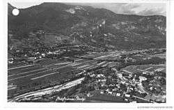
Postcard of Dovje | |
 Dovje Location in Slovenia | |
| Coordinates: 46°28′46.46″N 13°56′13.94″E / 46.4795722°N 13.9372056°ECoordinates: 46°28′46.46″N 13°56′13.94″E / 46.4795722°N 13.9372056°E | |
| Country |
|
| Traditional region | Upper Carniola |
| Statistical region | Upper Carniola |
| Municipality | Kranjska Gora |
| Elevation | 703 m (2,306 ft) |
| Population (2002) | |
| • Total | 609 |
| • Density | 22/km2 (60/sq mi) |
| Area code(s) | 04 (4 if calling from abroad) |
| [1] | |
Dovje (pronounced [ˈdoːu̯jɛ]; German: Lengenfeld) is a village in the Municipality of Kranjska Gora in the Upper Carniola region of Slovenia, located on the southern slopes of the Karawanks at an elevation of 703 m. It has a rich history and rural tradition and is known as one of the sunniest villages in Slovenia. Its location is ideal for farming and this has been the main occupation of its inhabitants for many centuries.
The village itself has preserved a number of elements typical of alpine architecture. The most interesting of these are the arched front doors of the old houses.
The view towards the Julian Alps from the village has made the cemetery next to St. Michael's Church an appropriate final resting place for many hikers that lost their lives on Mount Triglav and the surrounding mountains.
Notable people
Notable people that were born or lived in Dovje include:
- Jakob Aljaž (1847–1927), poet, composer, and mountain enthusiast
- Franjo Jeglič (1856–1935), beekeeper[2]
References
- ↑ Statistical Office of the Republic of Slovenia
- ↑ Bokal, Ljudmila, ed. 2008. Čebelarski terminološki slovar. Ljubljana: Založba ZRC, ZRC SAZU and Lukovica: Čebelarska zveza Slovenije, p. 254.
External links
![]() Media related to Dovje at Wikimedia Commons
Media related to Dovje at Wikimedia Commons
| Settlements | Administrative centre: Kranjska Gora
|  | ||||||
|---|---|---|---|---|---|---|---|---|
| Landmarks |
| |||||||
| Notable people | ||||||||