Dosso, Niger
| Dosso | |
|---|---|
|
Officials at the opening of the regional maternity hospital, 2008 | |
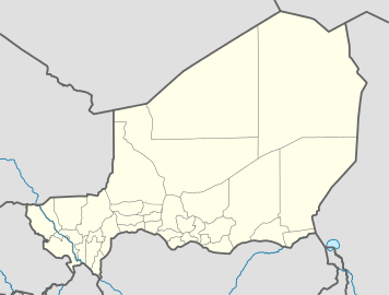 Dosso Location in Niger | |
| Coordinates: 13°02′40″N 3°11′41″E / 13.04444°N 3.19472°ECoordinates: 13°02′40″N 3°11′41″E / 13.04444°N 3.19472°E | |
| Country | Niger |
| Region | Dosso Region |
| Department | Dosso Department |
| Urban Commune | Dosso |
| Elevation | 227 m (748 ft) |
| Population (2011) | |
| • Total | 91,488 |
| [1] | |

Dosso is a city in the south-west corner of Niger. It lies 130–140 kilometres (81–87 mi)[2][3] south-east of the capital Niamey at the junction of the main routes to Zinder and Benin. The seventh-most populous town in Niger and the largest in Dosso Region, it had an official population during the 2001 census of 43,561.[4] It is the capital of its region—which covers five departments in the southwestern corner of the nation, as well as of its own department: Dosso Department. The city itself lies at the centre of its own Urban Commune.[5]
History
Dosso is the seat of the Dosso kingdom, a Zarma chieftaincy which rose to dominate the entire Zarma region in Niger in pre-colonial Niger. The traditional ruler is called Zarmakoy or Djermakoy of Dosso, an autochthonous title meaning literally "King of Djermas" where koy means "king" in Zarma (or Djerma) language.
Sites
Attractions in the town include the Djermakoy's palace and museum, nominated as a UNESCO World Heritage Site in 2006.[6]
Transport
The city of Dosso is a critical commercial hub through which transit import-export products from the Cotonou port. Due to this and its proximity to Niamey, Dosso is transportation hub. Dosso has an interim terminus of the Niamey–Cotonou railway presently under construction.[7] An extension to the capital, Niamey, would be a later stage.
In addition, there is a plan for the construction of a dry commercial port.
Notable residents
- Rabiou Guero Gao – Olympic long-distance runner for Niger
- Zakari Gourouza – first Nigerien Olympic judoka
References
- ↑ Dosso, Niger Page. Falling Rain Genomics, Inc. 1996–2004. Accessed 2 June 2009
- ↑ Dosso, britannica.com.
- ↑ Niger anti-referendum protests turn violent. Adboulaye Massalatchi, Reuters. 1 June 2009.
- ↑ Population figures from citypopulation.de, citing (2001) Institut National de la Statistique du Niger.
- ↑ Loi n° 2002-014 du 11 JUIN 2002 portant création des communes et fixant le nom de leurs chefs-lieux. Includes list of 213 communes rurales and seats, 52 Communes urbaines and seats
- ↑ Palais du Zarmakoye de Dosso, 26 May 2006.
- ↑ "EXTENDING FROM BENIN TO NIGER". Railways Africa. Retrieved 17 October 2010.
Sources
- James Decalo. Historical Dictionary of Niger. Scarecrow Press, Metuchen. NJ – London (1979) ISBN 0-8108-1229-0