Dorćol

Dorćol (Serbian Cyrillic: Дорћол, Serbo-Croatian pronunciation: [dɔ̝̌rt͡ɕɔ̝l]) is an urban neighborhood of Belgrade, the capital of Serbia. It is located in Belgrade's municipality of Stari Grad.
Location
Dorćol begins already some 700 meters north of Terazije, the central square of Belgrade. It roughly can be divided in two sections, Gornji (or Upper) Dorćol, which covers the area from Akademski park to the Cara Dušana street, and Donji (or Lower) Dorćol which occupies the area between the Cara Dušana and Bulevar despota Stefana streets and the right bank of the Danube. The Lower Dorćol used to be known as Jalija (Turkish yali, strand, bank). It borders (and largely overlaps) the neighborhoods of Stari Grad and Jevremovac (east and south) and the fortress of Kalemegdan (west), which is sometimes considered as part of Dorćol as well. The population of the neighborhood in the widest sense was 22,707 in 2002.
History
.jpg)
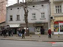
The name of the neighborhood comes from Turkish words dört (four) and yol (road), literally meaning "four roads" or colloquially "intersection (of four roads)", "crossroads". There is a town in Anatolian section of modern Turkey with the same name (Dörtyol). During the Turkish occupation of Belgrade, Dorćol was a well known trading centre, with many markets and traders of different nationalities, among others it was a center of Belgrade's Jewish community, remnant of which is the modern Jevrejska ("Jewish") street in Dorćol. After Belgrade became a capital of independent Serbia, Dorćol kept its multinational character for a long time. During the temporary Austrian occupation of northern Serbia 1717-1739, Jalija (Lower Dorćol) was the seat of the Prince Eugene of Savoy's court. Eventually the old low houses and narrow streets were changed into modern buildings. Still, some parts, though vanishing one by one, resemble the old look.
Economy
Western and northern sections of Dorćol are mainly residential, but eastern and riverside regions are heavily industrialized: depots and workshops of "GSP" (Belgrade City's transportation company), Belgrade City's Waterworks and Sewage company, heat plant "Dunav", Belgrade power station,"Žitomlin", "Jugošped", "Kopaonik", "Kompresor", numerous depots and hangars, etc. On the opposite, clothing company "Beko" is located in the westernmost section of Dorćol.
Traffic facilities include the railway which circles around the fortress of Kalemegdan, from the main railway station of Belgrade, through Dorćol, and over the Pančevo Bridge further into Vojvodina. Small marina is projected to be in the future one of the most modern and expensive parts of the neighborhood. The western part of the Port of Belgrade "Dunav" also belongs to Dorćol.
The area is known for its promenade on the Danube bank, which is well developed with a long bicycle path for recreation and many night clubs on water. The promenade is called Obala majora Gavrilovića ("the riverbank of major Gavrilović") after Dragutin Gavrilović, a Serbian officer who took part in defense of Belgrade in World War I from the Austrian army on this place.
Characteristics
Being one of the original settlements outside the Kalemegdan fortress, Dorćol is a location of some of the oldest city buildings.
Belgrade's only mosque, Bajrakli Mosque, is located in the southernmost part of the neighborhood, in the Gospodar Jevremova street. Originally built from 1660 to 1688 as Çohaci mosque, it was turned into a Roman Catholic church during the Austrian rule in central Serbia in 1717-1739, then a mosque again. Renamed Bajrakli mosque (Turkish: bayrak, flag) in the 18th century, it has been demolished and rebuilt several times.
The oldest surviving private house in downtown Belgrade that is still used as a residence is located in the Cara Dušana Street number 10. Not much is known about its history except that it was built in 1790. The house has an arched ceiling and until recently was used as a bakery.
Church of Alexander Nevsky was originally built by the Russian monks in 1876. Original stone church was demolished in 1891 due to the urban expansion of Dorćol. The foundation stone for the new church was laid down by the Serbian heir apparent Aleksandar Karađorđević in 1912 but the Balkan Wars and World War I prevented to completion of the church until 1930 with the Royal family of Karađorđević being the largest donors. The church is built in the medieval Serbian Moravian style.
Since the late 1990s, Strahinjića Bana street became a "café-street", with dozens of bars, restaurants and cafés. Since then, it became favorite entertainment place of the emerging classes of Belgrade's nouveau riche and gold diggers, and the street has been sarcastically nicknamed "Silicone Valley" because it is frequent by many trophy women (allegedly sporting surgical implants) and their wealthy bushinessmen.[1][2][3]
Culture and sports
The Museum of Vuk and Dositej in Gospodar Jevremova street was officially opened in 1949 and dedicated to Dositej Obradović, a novelist, major Serbian enlightener and first minister of education, and Vuk Karadžić, the most important Serbian language reformer. The building itself is older and it was the seat of the former Belgrade Higher School, which became the University of Belgrade.
Galerija fresaka (Gallery of the Frescoes) was opened in 1973. It hosts the reproduction of the most important frescoes from the Serbian medieval monasteries (11th-15th century, many of them located today in Montenegro and Macedonia), including the famed White Angel from Mileševa. The gallery is part of the National Museum of Serbia.
Other important features are the avant-garde BITEF Theater on the Square of Mira Trailović, the monument to the Greek national hero Rigas Feraios (who was killed by the Turks in the nearby Kalemedan), Ethnographic museum, Jewish museum, Pedagogical museum, Museum of the Theatrical Arts and the Academic park with the PMF, The faculty for the natural sciences and mathematics.
Leading Serbian female novelist Svetlana Velmar-Janković wrote a book named "Dorćol", which is composed from short stories, each named after a street in Dorćol.
Neglected for many years, the sports and recreational complex of "Milan Gale Muškatirović" (formerly and better known as "25. maj") is also located on the riverside. The clay tennis courts have been restored in 2009 to host the Serbia Open, held for the first time from 4–10 May 2009. Bank around the complex is, with the altitude of 75.3 meters above sea level, one of the lowest parts of Belgrade urban area.[4]
Dorćol Rugby league Club won eleven consecutive Serbian Rugby League Championship titles (2002–2013) and are current "double crown" (domestic championship and Cup) holders (See Rugby league in Serbia). Dorćol RLC is the most decorated sports club in the neighbourhood and alongside Handball Club, Wrestling Club is founder of Dorćol Sport Association. Association Football Club and Boxing Club are likely to join the association.
Based on the kind request of the members of the Dorćol Rugby League Club, Dorćol rapper Škabo alongside DJ Ape and beatmaker Šonsi Ras made the song named "Dorćol" - both: the anthem of the club and dedication to the neighbourhood - and published it on his album Remek delo in 2008. Also there is a KUD "Nikola Tesla" established in 1926 ... Nikola Tesla sent a flag from New York .. which is now preserved in the Museum of Belgrade ...
See also
- Marina Dorćol
References
- ↑ Politika, April 25, 2008, p. 25
- ↑ Laurence Mitchell (2013). Serbia. Bradt Travel Guides. p. 135. ISBN 978-1-84162-463-1.
The street is affectionately known as 'Silicone Valley' to locals, which refers to the supposed cosmetic surgery utilised by the glamorous women who haunt its pavements, often as the trophy girlfriend of a wealthy 'businessman'.
- ↑ Ivana Kronja, "New Urban Trends in Serbia, 1990–2004: From Urban Life to Popular Culture and Vice Versa", Ethnologia Balkanica 10/2006, pp. 263-278
- ↑ Politika, April 20, 2008, front page
External links
Coordinates: 44°49′24″N 20°27′38″E / 44.82333°N 20.46056°E
| Wikimedia Commons has media related to Dorćol. |