Doornkop
| Doornkop | |
|---|---|
 Doornkop  Doornkop  Doornkop
| |
|
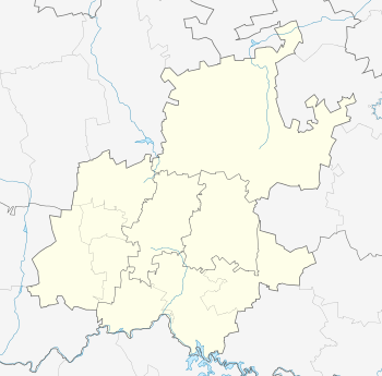
Location within Greater Johannesburg 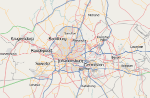 Doornkop | |
| Coordinates: 26°13′58″S 27°47′0″E / 26.23278°S 27.78333°ECoordinates: 26°13′58″S 27°47′0″E / 26.23278°S 27.78333°E | |
| Country | South Africa |
| Province | Gauteng |
| Municipality | City of Johannesburg |
| Area[1] | |
| • Total | 1.25 km2 (0.48 sq mi) |
| Population (2001)[1] | |
| • Total | 8,740 |
| • Density | 7,000/km2 (18,000/sq mi) |
| PO box | 1821 |
Doornkop (literally "thorn hill") is a ridge and locality southwest of Johannesburg, close to Krugersdorp, in Gauteng Province, South Africa.
Battles
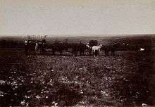
It is the spot where Dr Leander Starr Jameson was defeated on January 2, 1896 following the Jameson Raid. The area is also linked in popular history to the third day of the Battle of Johannesburg that took place nearby from May 27 to 29, 1900 during the Second Boer War. The ridge was taken by cavalry under command of Lt Gen John French while a nearby ridge, now covered by several Soweto suburbs, was taken by seven infantry battalions, including the City Imperial Volunteers and Gordon Highlanders of Lt Gen Ian Hamilton.
Present day
The area is currently being submerged by the westward expansion of Soweto and the eastward growth of Krugersdorp's Kagiso township. Suburbs include Tshepisong, Leratong Village, Bambayi and Thulani.
There is another place named Doornkop, a community 15 km north of Middelburg in the Steve Tshwete Local Municipality (http://www.stevetshwetelm.gov.za/) in Mpumalanga.
References
- 1 2 "Sub Place Doornkop". Census 2001.