Dolní Němčí
| Dolní Němčí | |
|---|---|
| Municipality | |
 Dolní Němčí | |
| Coordinates: 48°58′7″N 17°35′3″E / 48.96861°N 17.58417°ECoordinates: 48°58′7″N 17°35′3″E / 48.96861°N 17.58417°E | |
| Country |
|
| Region | Zlín |
| District | Uherské Hradiště |
| Area | |
| • Total | 9.91 km2 (3.83 sq mi) |
| Elevation | 256 m (840 ft) |
| Population (2006) | |
| • Total | 2,968 |
| • Density | 300/km2 (780/sq mi) |
| Postal code | 687 62 |
Dolní Němčí is a village and municipality (obec) in Uherské Hradiště District in the Zlín Region of the Czech Republic. The municipality covers an area of 9.91 square kilometres (3.83 sq mi), and has a population of 3,014 (as at 28 December 12, 2011).
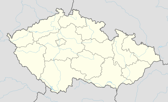
Dolní Němčí lies approximately 15 kilometres (9 mi) south-east of Uherské Hradiště, 30 km (19 mi) south of Zlín, and 290 km (180 mi) south-east of Prague. Although, it is quite a small village, the cultural and sport life is very rich. There are many ensembles including foklor group NK Dolněmčan and football clubs designated for all age groups ranging from small children up to adults. Gamekeeping also has a long tradition in the whole Zlín Region.
References
External links
- Official website (in Czech)
- Wiki Page (in Czech)
| Wikimedia Commons has media related to Dolní Němčí. |
This article is issued from Wikipedia - version of the 4/7/2016. The text is available under the Creative Commons Attribution/Share Alike but additional terms may apply for the media files.