Djoemoe Airstrip
| Djoemoe Airstrip Djumu-Djomoe Airstrip | |||||||||||
|---|---|---|---|---|---|---|---|---|---|---|---|
| IATA: DOE – ICAO: SMDJ | |||||||||||
| Summary | |||||||||||
| Airport type | Public | ||||||||||
| Operator | Luchtvaartdienst Suriname | ||||||||||
| Location | Djoemoe, Suriname | ||||||||||
| Elevation AMSL | 290 ft / 88 m | ||||||||||
| Coordinates | 4°00′25″N 55°28′50″W / 4.00694°N 55.48056°WCoordinates: 4°00′25″N 55°28′50″W / 4.00694°N 55.48056°W | ||||||||||
| Map | |||||||||||
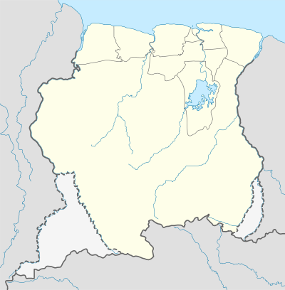 DOE Location in Suriname | |||||||||||
| Runways | |||||||||||
| |||||||||||
|
Sources: GCM[1] | |||||||||||
Djoemoe Airstrip (IATA: DOE, ICAO: SMDJ), (also called Djumu-Djomoe Airstrip) is an airstrip serving Djoemoe, Suriname.
Airlines and destinations
Airlines serving this airport are:
| Airlines | Destinations |
|---|---|
| Blue Wing Airlines | Paramaribo, Zorg en Hoop Airport[2] |
| Caricom Airways | Paramaribo, Zorg en Hoop Airport[3] |
| Gum Air | Paramaribo, Zorg en Hoop Airport[4] |
| Hi-Jet Helicopter Services | Paramaribo, Zorg en Hoop Airport |
| Suriname Air Force / Surinaamse Luchtmacht | Paramaribo, Zorg en Hoop Airport |
See also
 Suriname portal
 Aviation portal
- List of airports in Suriname
- Transport in Suriname
Accidents and incidents
- On 29 October 1987 a Cessna U206F (PZ-NAU) was hijacked at the Djoemoe airstrip, Suriname, by members of the rebellion “Jungle Commando” of Ronnie Brunswijk. The pilot Dan Rogers returned to Paramaribo via French-Guyana after his release. In June 1988 the aircraft was returned to the MAF (Mission Aviation Fellowship) Suriname after mediation of MAF Headquarters in California, USA and French Guyana. [5]
References
- ↑ Airport information for DOE at Great Circle Mapper.
- ↑ Blue Wing destinations
- ↑ Caricom Airways destinations Archived March 15, 2013, at the Wayback Machine.
- ↑ Gum Air destinations
- ↑ Aviation Safety Network Archived May 30, 2015, at the Wayback Machine.
External links
This article is issued from Wikipedia - version of the 12/4/2016. The text is available under the Creative Commons Attribution/Share Alike but additional terms may apply for the media files.