Djambala
| Djambala | |
|---|---|
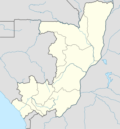 Djambala Location in the Republic of the Congo | |
| Coordinates: 2°32′41″S 14°45′12″E / 2.54472°S 14.75333°E | |
| Country |
|
| Region | Plateaux Region |
| District | Djambala District |
| Elevation | 622 m (2,041 ft) |
| Population (2007 census) | |
| • Total | 17,265 |
Djambala is the main town of Djambala District and the Plateaux Region of the Republic of Congo. It lies north of Brazzaville and lies near the Léfini Faunal Reserve.
Climate
| Climate data for Djambala (extremes 1941–present) | |||||||||||||
|---|---|---|---|---|---|---|---|---|---|---|---|---|---|
| Month | Jan | Feb | Mar | Apr | May | Jun | Jul | Aug | Sep | Oct | Nov | Dec | Year |
| Record high °C (°F) | 31.5 (88.7) |
32.7 (90.9) |
33.0 (91.4) |
33.7 (92.7) |
39.6 (103.3) |
30.8 (87.4) |
37.2 (99) |
35.4 (95.7) |
33.6 (92.5) |
35.0 (95) |
37.1 (98.8) |
31.5 (88.7) |
39.6 (103.3) |
| Average high °C (°F) | 27.6 (81.7) |
27.8 (82) |
28.4 (83.1) |
28.5 (83.3) |
27.6 (81.7) |
26.9 (80.4) |
26.2 (79.2) |
27.0 (80.6) |
27.0 (80.6) |
26.6 (79.9) |
27.1 (80.8) |
27.1 (80.8) |
27.3 (81.1) |
| Daily mean °C (°F) | 23.3 (73.9) |
23.2 (73.8) |
23.6 (74.5) |
23.8 (74.8) |
23.3 (73.9) |
22.2 (72) |
21.2 (70.2) |
22.0 (71.6) |
22.6 (72.7) |
22.7 (72.9) |
22.8 (73) |
22.8 (73) |
22.8 (73) |
| Average low °C (°F) | 19.2 (66.6) |
19.2 (66.6) |
19.3 (66.7) |
19.6 (67.3) |
19.5 (67.1) |
17.9 (64.2) |
16.8 (62.2) |
17.0 (62.6) |
18.3 (64.9) |
18.9 (66) |
19.0 (66.2) |
19.1 (66.4) |
18.6 (65.5) |
| Record low °C (°F) | 15.0 (59) |
12.8 (55) |
14.9 (58.8) |
16.0 (60.8) |
15.3 (59.5) |
12.5 (54.5) |
12.1 (53.8) |
12.6 (54.7) |
15.1 (59.2) |
15.4 (59.7) |
14.8 (58.6) |
12.8 (55) |
12.1 (53.8) |
| Average precipitation mm (inches) | 211 (8.31) |
190 (7.48) |
265 (10.43) |
252 (9.92) |
200 (7.87) |
27 (1.06) |
11 (0.43) |
37 (1.46) |
144 (5.67) |
277 (10.91) |
264 (10.39) |
244 (9.61) |
2,122 (83.54) |
| Average precipitation days (≥ 0.1 mm) | 17 | 15 | 19 | 19 | 15 | 3 | 1 | 4 | 11 | 20 | 21 | 19 | 164 |
| Average relative humidity (%) | 80 | 83 | 83 | 83 | 84 | 82 | 80 | 76 | 80 | 85 | 86 | 86 | 82 |
| Mean monthly sunshine hours | 151.9 | 146.9 | 158.1 | 156.0 | 167.4 | 168.0 | 158.1 | 151.9 | 129.0 | 130.2 | 129.0 | 139.5 | 1,786 |
| Mean daily sunshine hours | 4.9 | 5.2 | 5.1 | 5.2 | 5.4 | 5.6 | 5.1 | 4.9 | 4.3 | 4.2 | 4.3 | 4.5 | 4.9 |
| Source #1: Deutscher Wetterdienst[1] | |||||||||||||
| Source #2: Meteo Climat (record highs and lows)[2] | |||||||||||||
Transport
In April 2007, a deal was signed with a Korean consortium to build a railway mainly for timber traffic from the main port to Djambala.[3][4]
Djambala is also served by Djambala Airport.
See also
References
- ↑ "Klimatafel von Djambala / Kongo" (PDF). Baseline climate means (1961-1990) from stations all over the world (in German). Deutscher Wetterdienst. Retrieved 24 October 2016.
- ↑ "Station Djambala" (in French). Meteo Climat. Retrieved 24 October 2016.
- ↑ Djambala railway
- ↑ AfricaNews
Coordinates: 02°33′S 14°45′E / 2.550°S 14.750°E
This article is issued from Wikipedia - version of the 10/24/2016. The text is available under the Creative Commons Attribution/Share Alike but additional terms may apply for the media files.