Division of Dunkley
| Dunkley Australian House of Representatives Division | |
|---|---|
|
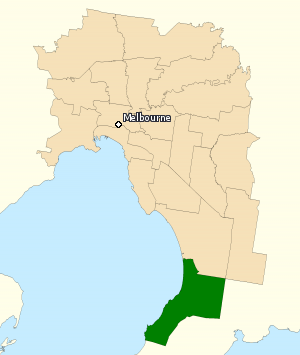
Division of Dunkley in Victoria, as of the 2016 federal election. | |
| Created | 1984 |
| MP | Chris Crewther |
| Party | Liberal |
| Namesake | Louisa Margaret Dunkley |
| Electors | 104,967 (2016) |
| Area | 140 km2 (54.1 sq mi) |
| Demographic | Outer Metropolitan |
The Division of Dunkley is an Australian electoral division in the state of Victoria. The division was created in 1984 and is named for Louisa Margaret Dunkley, a trade unionist and campaigner for equal pay for women.
The division is located south-east of Melbourne. It covers an area of approximately 140 square kilometres (54 sq mi) from Seaford in the north to Mornington in the south. The suburbs and towns in Dunkley are Frankston, Frankston North, Frankston South, Langwarrin, Langwarrin South, Mount Eliza, Mornington, Seaford and parts of Carrum Downs, Baxter and Skye.[1]
Members
| Member | Party | Term | |
|---|---|---|---|
| Bob Chynoweth | Labor | 1984–1990 | |
| Frank Ford | Liberal | 1990–1993 | |
| Bob Chynoweth | Labor | 1993–1996 | |
| Bruce Billson | Liberal | 1996–2016 | |
| Chris Crewther | Liberal | 2016–present | |
Election results
Main article: Electoral results for the Division of Dunkley
| Party | Candidate | Votes | % | ± | |
|---|---|---|---|---|---|
| Liberal | Chris Crewther | 38,158 | 42.73 | −6.02 | |
| Labor | Peta Murphy | 29,620 | 33.17 | +2.29 | |
| Greens | Jeanette Swain | 8,616 | 9.65 | +0.33 | |
| Justice | Ruth Stanfield | 5,510 | 6.17 | +6.17 | |
| Animal Justice | Tyson Jack | 1,926 | 2.16 | +2.16 | |
| Family First | Michael Rathbone | 1,393 | 1.56 | −0.35 | |
| Independent | Joseph Toscano | 1,132 | 1.27 | +1.27 | |
| Liberal Democrats | Tim Wilms | 1,037 | 1.16 | +1.16 | |
| Rise Up Australia | Lin Tregenza | 682 | 0.76 | +0.22 | |
| Christians | Jeff Reaney | 677 | 0.76 | +0.76 | |
| Arts | Sally Baillieu | 542 | 0.61 | +0.61 | |
| Total formal votes | 89,293 | 93.56 | −1.65 | ||
| Informal votes | 6,151 | 6.44 | +1.65 | ||
| Turnout | 95,444 | 90.93 | −2.36 | ||
| Two-party-preferred result | |||||
| Liberal | Chris Crewther | 45,925 | 51.43 | −4.14 | |
| Labor | Peta Murphy | 43,368 | 48.57 | +4.14 | |
| Liberal hold | Swing | −4.14 | |||
References
- ↑ "Profile of the electoral division of Dunkley (Vic)". Current federal electoral divisions. Australian Electoral Commission. 23 September 2013. Retrieved 3 December 2013.
- ↑ Dunkley, VIC, Virtual Tally Room 2016, Australian Electoral Commission.
External links
Coordinates: 38°10′12″S 145°08′17″E / 38.170°S 145.138°E
This article is issued from Wikipedia - version of the 11/29/2016. The text is available under the Creative Commons Attribution/Share Alike but additional terms may apply for the media files.