List of districts of Arunachal Pradesh
History
Original districts
On December 1, 1965 the erstwhile North-East Frontier Agency was divided into five districts:
- Kameng district
- Subansiri district
- Siang district
- Lohit district
- Tirap district
Timeline
- On May 13, 1980, Subansiri district was bifurcated into two districts: Lower Subansiri district and Upper Subansiri district. Upper Subansiri district comprised the area occupied by the erstwhile Daporijo sub-division and Lower Subansiri district comprised the rest of the area occupied by the erstwhile Subansiri district.
- On June 1, 1980, the erstwhile Lohit district was divided into two districts: Lohit district and Dibang Valley district. On the same day, Siang district was bifurcated into two districts: East Siang district and West Siang district. And Sepla and Bomdila sub-divisions of the Kameng district were transformed into East Kameng district and West Kameng district, respectively.
- On October 6, 1984, Tawang district was separated from East Kameng district.
- In 1987, the ersthwile Tirap district was divided into two districts: Tirap district and Changlang district.
- On September 22, 1992, the erstwhile Lower Subansiri district was again bufurcated into Lower Subansiri district and Papum Pare district.
- In 1999, Upper Siang district was split from East Siang district.
- In June 2000, Kurung Kumey district was carved out from the erstwhile Lower Subansiri district.
- On December 16, 2001, Dibang Valley district was bifurcated into Upper Dibang Valley district and Lower Dibang Valley district.
- On February 16, 2004, Anjaw district was carved out from the erstwhile Lohit district.
- On March 19, 2012, Longding district was carved out from the erstwhile Tirap district.
- On November 17, 2014, Namsai district was carved out from the erstwhile Lohit district.
- On February 8, 2015, Kra Daadi district was carved out from the erstwhile Kurung Kumey district.
- On November 27, 2015, a new Siang district was carved out from parts of East Siang and West Siang districts.
Administrative set-up
The districts of Arunachal Pradesh state are administrative geographical units, each headed by a deputy commissioner, an officer belonging to the Indian Administrative Service and a superintendent of police, an officer belonging to the Indian Police Service.
Districts
As of 2015, Arunachal Pradesh comprises 19 districts. Most of them are inhabited by various tribal groups. These are:[1]
| Code | District | Headquarters | Population (2011)[2] | Area (km²) | Density (/km²) | Map |
| AJ | Anjaw | Hawai | 21,089 | 6,190 | 3 |  |
| CH | Changlang | Changlang | 147,951 | 4,662 | 27 |  |
| EK | East Kameng | Seppa | 78,413 | 4,134 | 14 |  |
| ES | East Siang | Pasighat | 99,019 | 4,005 | 22 |  |
| EL | Lohit | Tezu | 145,538 | 2,402 | 13 |  |
| LD | Longding | Longding | [3] | [3] | [3] | [3] |
| LB | Lower Subansiri | Ziro | 82,839 | 3,460 | 24 | 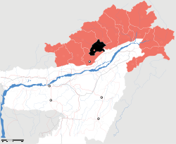 |
| PA | Papum Pare | Yupia | 176,385 | 2,875 | 42 |  |
| TA | Tawang | Tawang Town | 49,950 | 2,085 | 19 |  |
| TI | Tirap | Khonsa | 111,997 | 2,362 | 42 | 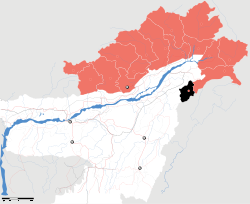 |
| UD | Lower Dibang Valley | Roing | 53,986 | 3,900 | 14 | 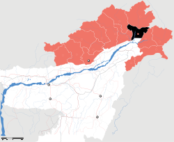 |
| US | Upper Siang | Yingkiong | 33,146 | 6,188 | 5 | 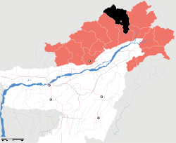 |
| UB | Upper Subansiri | Daporijo | 83,205 | 7,032 | 8 | 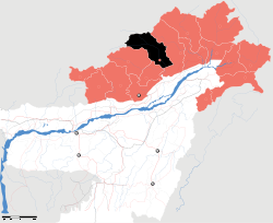 |
| WK | West Kameng | Bomdila | 87,013 | 7,422 | 10 |  |
| WS | West Siang | Along | 112,272 | 8,325 | 12 | 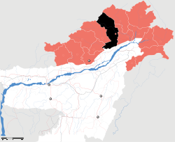 |
| Upper Dibang Valley | Anini | 7,948 | 9,129 | 1 | 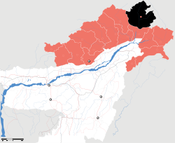 | |
| Kurung Kumey | Koloriang | 89,717 | 8,818 | 10 |  | |
| Namsai | Namsai | |||||
| Kra Daadi | Jamin | |||||
| Siang |
Notes
- ↑ "At a glance". Government of Arunachal Pradesh website.
- ↑ "District Census 2011". Census2011.co.in.
- 1 2 3 4 Longding is included as part of Tirap
| States | ||
|---|---|---|
| Union Territories | ||
| Related topics | ||
This article is issued from Wikipedia - version of the 11/16/2016. The text is available under the Creative Commons Attribution/Share Alike but additional terms may apply for the media files.