Várkerület
| Várkerület Castle District | |||
|---|---|---|---|
| District of Budapest | |||
| District I | |||
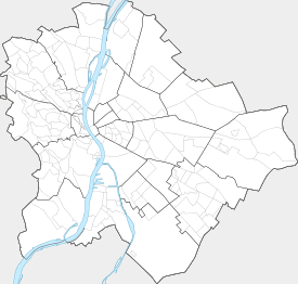
| |||
 Várkerület | |||
| Coordinates: 47°29′51″N 19°02′17″E / 47.49750°N 19.03806°E | |||
| Country | Hungary | ||
| City | Budapest | ||
| District | District I | ||
| Established | 1873 | ||
| Government | |||
| • Type | mayor | ||
| • Mayor | Gábor Tamás Nagy | ||
| Population (2015) | |||
| • Total | 24,933 | ||
| ZIP Code prefix | 1011 ... 1016 | ||
| Website | |||


Várkerület is the historical part of the Buda side of Budapest and consists of the Buda Castle Hill and some other neighbourhoods around it, like Tabán, Krisztinaváros and parts of Gellért Hill.
Location
The Castle District is situated on the banks of the Danube, in the Buda side.
Neighbours of District I are (clockwise from north):
- river Danube
- District XI: Újbuda ("New Buda"), which is most known of the universities and student life
- District XII: Hegyvidék ("Highlands")
- District II
Landmarks
- Buda Castle
- Matthias Church
- Hungarian National Gallery
- Castle Hill Funicular
- Sándor Palace
- Fisherman's Bastion
- Labyrinth of Buda Castle
- Gellért Hill
Twin towns
-
 District I of Vienna, Austria
 -
 Capestrano, Italy
 -
 Carouge, Switzerland
 -
 Lendava, Slovenia
 -
 Marlow, England
 -
 District I of Prague, Czech Republic
 -
 District I of Bratislava, Slovakia
 -
 Regensburg, Germany
 -
 Székelyudvarhely, Romania
 -
 Zenta, Serbia[1]
References
- ↑ "Testvérvárosaink" (in Hungarian). Budavári Önkormányzat. Retrieved 2012-10-24.
External links
 District I, Budapest travel guide from Wikivoyage
|  | |
This article is issued from Wikipedia - version of the 6/11/2016. The text is available under the Creative Commons Attribution/Share Alike but additional terms may apply for the media files.