Discovery Harbour, Hawaii
| Discovery Harbour, Hawaii | |
|---|---|
| Census-designated place | |
 Discovery Harbour, Hawaii | |
| Coordinates: 19°02′34″N 155°37′49″W / 19.04278°N 155.63028°WCoordinates: 19°02′34″N 155°37′49″W / 19.04278°N 155.63028°W | |
| Country | United States |
| State | Hawaii |
| County | Hawaii |
| Area[1] | |
| • Total | 3.559 sq mi (9.22 km2) |
| • Land | 3.559 sq mi (9.22 km2) |
| • Water | 0 sq mi (0 km2) |
| Elevation | 1,142 ft (348 m) |
| Population (2010)[1] | |
| • Total | 949 |
| • Density | 270/sq mi (100/km2) |
| Time zone | Hawaii-Aleutian (UTC-10) |
| Area code(s) | 808 |
| GNIS feature ID | 2631653[2] |
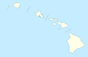
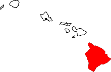
Discovery Harbour is an unincorporated community and census-designated place on the island of Hawaii in Hawaii County, Hawaii, United States. Its population was 949 as of the 2010 census.[1] The community is located near the island's southern tip, south of Hawaii Route 11.
Geography
Discovery Harbour is located at 19°02′34″N 155°37′49″W / 19.0428930°N 155.6303920°W. According to the U.S. Census Bureau, the community has an area of 3.559 square miles (9.22 km2), all of it land.[1]
References
- 1 2 3 4 "2010 Census Gazetteer Files - Places: Hawaii". U.S. Census Bureau. Retrieved April 23, 2016.
- ↑ "Discovery Harbour". Geographic Names Information System. United States Geological Survey.
This article is issued from Wikipedia - version of the 4/24/2016. The text is available under the Creative Commons Attribution/Share Alike but additional terms may apply for the media files.