Dillon County, South Carolina
| Dillon County, South Carolina | |
|---|---|
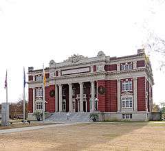 Dillon County Courthouse | |
 Location in the U.S. state of South Carolina | |
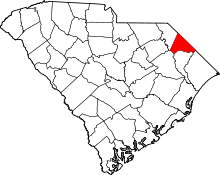
 South Carolina's location in the U.S. | |
| Founded | 1910 |
| Named for | James W. Dillon |
| Seat | Dillon |
| Largest city | Dillon |
| Area | |
| • Total | 407 sq mi (1,054 km2) |
| • Land | 405 sq mi (1,049 km2) |
| • Water | 1.7 sq mi (4 km2), 0.4% |
| Population (est.) | |
| • (2015) | 31,234 |
| • Density | 79/sq mi (31/km²) |
| Congressional district | 7th |
| Time zone | Eastern: UTC-5/-4 |
| Website |
dilloncounty |
Dillon County is a county located in the U.S. state of South Carolina. As of the 2010 census, the county's population was 32,062.[1] The county seat is Dillon.[2] Founded in 1910 from a portion of Marion County, both Dillon County and the city of Dillon were named for prosperous local citizen James W. Dillon (1826-1913), an Irishman who settled there and led a campaign to bring the railroad into the community. The result of this effort was the construction of the Wilson Short Cut Railroad, which later became part of the Atlantic Coast Line Railroad, and which brought greater prosperity to the area by directly linking Dillon County to the national network of railroads.[3]
Geography
According to the U.S. Census Bureau, the county has a total area of 407 square miles (1,050 km2), of which 405 square miles (1,050 km2) is land and 1.7 square miles (4.4 km2) (0.4%) is water.[4] It is the fifth-smallest county in South Carolina by area.
Adjacent counties
- Robeson County, North Carolina - north
- Columbus County, North Carolina - north
- Horry County - east
- Marion County - south
- Florence County - southwest
- Marlboro County - west
Major highways
Demographics
| Historical population | |||
|---|---|---|---|
| Census | Pop. | %± | |
| 1910 | 22,615 | — | |
| 1920 | 25,278 | 11.8% | |
| 1930 | 25,733 | 1.8% | |
| 1940 | 29,625 | 15.1% | |
| 1950 | 30,930 | 4.4% | |
| 1960 | 30,584 | −1.1% | |
| 1970 | 28,838 | −5.7% | |
| 1980 | 31,083 | 7.8% | |
| 1990 | 29,114 | −6.3% | |
| 2000 | 30,722 | 5.5% | |
| 2010 | 32,062 | 4.4% | |
| Est. 2015 | 31,234 | [5] | −2.6% |
| U.S. Decennial Census[6] 1790-1960[7] 1900-1990[8] 1990-2000[9] 2010-2013[1] | |||
2000 census
As of the census[10] of 2000, there were 30,722 people, 11,199 households, and 8,063 families residing in the county. The population density was 76 people per square mile (29/km²). There were 12,679 housing units at an average density of 31 per square mile (12/km²). The racial makeup of the county was 47% White, 49% Black or African American, 2.21% Native American, 0.34% Asian, 0.03% Pacific Islander, 0.99% from other races, and 0.70% from two or more races. 1.75% of the population were Hispanic or Latino of any race.
There were 11,199 households out of which 34.60% had children under the age of 18 living with them, 44.80% were married couples living together, 22.30% had a female householder with no husband present, and 28.00% were non-families. 25.10% of all households were made up of individuals and 9.90% had someone living alone who was 65 years of age or older. The average household size was 2.71 and the average family size was 3.24.
In the county, the population was spread out with 29.10% under the age of 18, 9.50% from 18 to 24, 27.50% from 25 to 44, 22.40% from 45 to 64, and 11.50% who were 65 years of age or older. The median age was 34 years. For every 100 females there were 87.40 males. For every 100 females age 18 and over, there were 81.60 males.
The median income for a household in the county was $26,630, and the median income for a family was $32,690. Males had a median income of $26,908 versus $18,007 for females. The per capita income for the county was $13,272. About 19.40% of families and 24.20% of the population were below the poverty line, including 33.30% of those under age 18 and 26.60% of those age 65 or over.
2010 census
As of the 2010 United States Census, there were 32,062 people, 11,923 households, and 8,342 families residing in the county.[11] The population density was 79.2 inhabitants per square mile (30.6/km2). There were 13,742 housing units at an average density of 33.9 per square mile (13.1/km2).[12] The racial makeup of the county was 48.0% white, 46.1% black or African American, 2.5% American Indian, 0.2% Asian, 1.5% from other races, and 1.6% from two or more races. Those of Hispanic or Latino origin made up 2.6% of the population.[11] In terms of ancestry, 13.5% were American, 6.5% were English, and 5.4% were Irish.[13]
Of the 11,923 households, 36.5% had children under the age of 18 living with them, 40.2% were married couples living together, 23.9% had a female householder with no husband present, 30.0% were non-families, and 26.5% of all households were made up of individuals. The average household size was 2.65 and the average family size was 3.20. The median age was 36.7 years.[11]
The median income for a household in the county was $26,818 and the median income for a family was $34,693. Males had a median income of $31,973 versus $22,100 for females. The per capita income for the county was $14,684. About 26.2% of families and 30.5% of the population were below the poverty line, including 43.8% of those under age 18 and 23.7% of those age 65 or over.[14]
Communities
Cities
- Dillon (county seat)
Town
Unincorporated communities
See also
References
- 1 2 "State & County QuickFacts". United States Census Bureau. Retrieved November 23, 2013.
- ↑ "Find a County". National Association of Counties. Retrieved 2011-06-07.
- ↑ http://www.dilloncounty.sc.gov/history
- ↑ "2010 Census Gazetteer Files". United States Census Bureau. August 22, 2012. Retrieved March 17, 2015.
- ↑ "County Totals Dataset: Population, Population Change and Estimated Components of Population Change: April 1, 2010 to July 1, 2015". Retrieved July 2, 2016.
- ↑ "U.S. Decennial Census". United States Census Bureau. Retrieved March 17, 2015.
- ↑ "Historical Census Browser". University of Virginia Library. Retrieved March 17, 2015.
- ↑ Forstall, Richard L., ed. (March 27, 1995). "Population of Counties by Decennial Census: 1900 to 1990". United States Census Bureau. Retrieved March 17, 2015.
- ↑ "Census 2000 PHC-T-4. Ranking Tables for Counties: 1990 and 2000" (PDF). United States Census Bureau. April 2, 2001. Retrieved March 17, 2015.
- ↑ "American FactFinder". United States Census Bureau. Retrieved 2011-05-14.
- 1 2 3 "DP-1 Profile of General Population and Housing Characteristics: 2010 Demographic Profile Data". United States Census Bureau. Retrieved 2016-03-09.
- ↑ "Population, Housing Units, Area, and Density: 2010 - County". United States Census Bureau. Retrieved 2016-03-09.
- ↑ "DP02 SELECTED SOCIAL CHARACTERISTICS IN THE UNITED STATES – 2006-2010 American Community Survey 5-Year Estimates". United States Census Bureau. Retrieved 2016-03-09.
- ↑ "DP03 SELECTED ECONOMIC CHARACTERISTICS – 2006-2010 American Community Survey 5-Year Estimates". United States Census Bureau. Retrieved 2016-03-09.
External links
- Dillon County Official Website
- 1905 Reprint of Bishop Gregg's History of the Old Cheraws with additional material as an appendix. (Google Book pdf)
 |
| |||
| Marlboro County | |
Robeson County, North Carolina | ||
| ||||
| | ||||
| Florence County | Marion County | Columbus County, North Carolina and Horry County |
Municipalities and communities of Dillon County, South Carolina, United States | ||
|---|---|---|
| City | | |
| Towns | ||
| Unincorporated communities | ||
Coordinates: 34°23′N 79°23′W / 34.39°N 79.38°W